Żyrardów elevation
Żyrardów (Mazovia, Powiat żyrardowski), Poland elevation is 118 meters and Żyrardów elevation in feet is 387 ft above sea level [src 1]. Żyrardów is a seat of a second-order administrative division (feature code) with elevation that is 73 meters (240 ft) smaller than average city elevation in Poland.
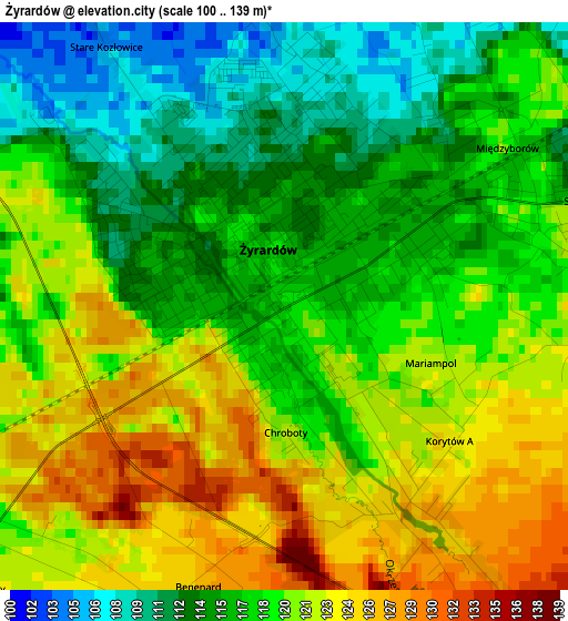
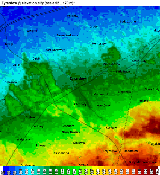
Below is the Elevation map of Żyrardów, which displays elevation range with different colors. Scale of the first map is from 100 to 139 m (328 to 456 ft) with average elevation of 118.4 meters (=388 ft) [note 1]
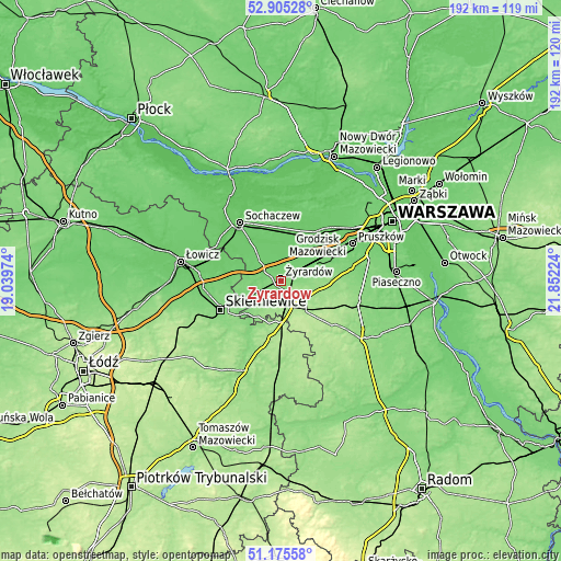
These maps also provides idea of topography and contour of this city, they are displayed at different zoom levels. More info about maps, scale and edge coordinates you can find below images.
| \ | Map #1 | Map #2 | Topo.Map |
| Scale [m] | 100..139 m | 92..170 m | × |
| Scale [ft] | 328..456 ft | 302..558 ft | × |
| Average | 118.4 m = 388 ft | 119.3 m = 391 ft | × |
| Width | 6.01 km = 3.7 mi | 12.02 km = 7.5 mi | 192.3 km = 119.5 mi |
| Height | 6.01 km = 3.7 mi | 12.02 km = 7.5 mi | 192.3 km = 119.5 mi |
| ↑Max Latitude | 52.075818° | 52.102819° | 52.90528° |
| Latitude at center | 52.0488° | 52.0488° | 52.0488° |
| ↓Min Latitude | 52.021766° | 51.994715° | 51.17558° |
| ← Min Longitude | 20.402045° | 20.358099° | 19.03974° |
| Longitude center | 20.44599° | 20.44599° | 20.44599° |
| →Max Longitude | 20.489935° | 20.533881° | 21.85224° |
Nearby cities:
Cities around Żyrardów sort by population:
• Grodzisk Mazowiecki elevation 103 m
14.2 km,  64°
64°
• Milanówek 102 m
17.3 km, 63°
• Mszczonów 165 m
9.8 km,  148°
148°
• Teresin 87 m
16.8 km,  353°
353°
• Mrozy 119 m
6.3 km,  239°
239°
• Paprotnia 89 m
17.5 km, 354°
• Wiskitki 100 m
6 km,  317°
317°
• Żabia Wola 148 m
16.9 km,  96°
96°
• Bieniewice 91 m
16.9 km,  28°
28°
• Guzów 99 m
10.6 km, 315°
• Radziejowice 143 m
8.3 km,  122°
122°
• Puszcza Mariańska 137 m
10.2 km,  220°
220°
Multilingual:
 En español:
Żyrardów elevación 118 m.
 En France:
Żyrardów élévation 118 m.
 Auf Deutsch:
Żyrardów höhe über dem Meeresspiegel ist 118 m.

Sources and notes:
- [note 1] Map square and city borders are not equal. Map elevation data is calculated only from area inside that square.
- [src 1] Elevation data from geonames database provided with same terms of usage.
- [src 2] The elevation map of Żyrardów is generated using elevation data from NASA's 3 arcsec (90m) resolution SRTM data.
- [src 3] Base (background) map © OpenStreetMap contributors tiles are generated by Geofabrik and OpenTopoMap.
Copyright & License:
This Żyrardów Elevation Map is licensed under CC BY-SA. You may reuse any part from this page, if you give a proper credit by linking to this URL:
 More info on terms of use page.