Bęczarka elevation
Bęczarka (Lesser Poland, Powiat myślenicki), Poland elevation is 321 meters and Bęczarka elevation in feet is 1053 ft above sea level [src 1]. Bęczarka is a populated place (feature code) with elevation that is 130 meters (427 ft) bigger than average city elevation in Poland.
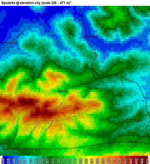
Below is the Elevation map of Bęczarka, which displays elevation range with different colors. Scale of the first map is from 226 to 471 m (741 to 1545 ft) with average elevation of 311.5 meters (=1022 ft) [note 1]
These maps also provides idea of topography and contour of this city, they are displayed at different zoom levels. More info about maps, scale and edge coordinates you can find below images.
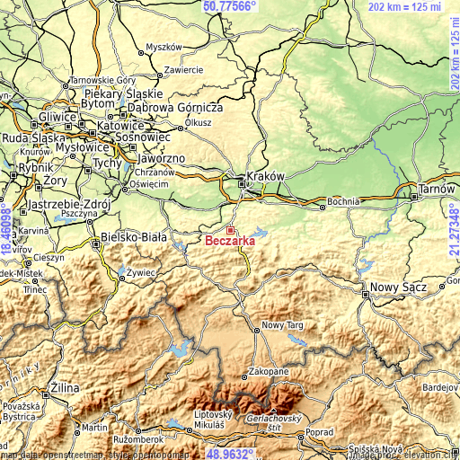
| \ | Map #1 | Topo.Map |
| Scale [m] | 226..471 m | × |
| Scale [ft] | 741..1545 ft | × |
| Average | 311.5 m = 1022 ft | × |
| Width | 6.3 km = 3.9 mi | 201.5 km = 125.2 mi |
| Height | 6.3 km = 3.9 mi | 201.5 km = 125.2 mi |
| ↑Max Latitude | 49.906241° | 50.77566° |
| Latitude at center | 49.87793° | 49.87793° |
| ↓Min Latitude | 49.849603° | 48.9632° |
| ← Min Longitude | 19.823285° | 18.46098° |
| Longitude center | 19.86723° | 19.86723° |
| →Max Longitude | 19.911175° | 21.27348° |
Nearby cities:
Cities around Bęczarka sort by population:
• Myślenice elevation 304 m
7.1 km,  133°
133°
• Sułkowice 290 m
6.3 km,  228°
228°
• Jawornik 309 m
3.1 km,  142°
142°
• Radziszów 220 m
7.4 km,  329°
329°
• Głogoczów 237 m
1.9 km,  14°
14°
• Rudnik 327 m
3.2 km,  206°
206°
• Mogilany 358 m
7 km, 13°
• Wola Radziszowska 229 m
6.4 km,  298°
298°
• Izdebnik 258 m
7.1 km,  264°
264°
• Krzyszkowice 251 m
4 km,  81°
81°
• Jasienica 360 m
6.4 km,  196°
196°
• Krzywaczka 250 m
3.1 km, 304°
Multilingual:
 En español:
Bęczarka elevación 321 m.
 En France:
Bęczarka élévation 321 m.
 Auf Deutsch:
Bęczarka höhe über dem Meeresspiegel ist 321 m.

Sources and notes:
- [note 1] Map square and city borders are not equal. Map elevation data is calculated only from area inside that square.
- [src 1] Elevation data from geonames database provided with same terms of usage.
- [src 2] The elevation map of Bęczarka is generated using elevation data from NASA's 3 arcsec (90m) resolution SRTM data.
- [src 3] Base (background) map © OpenStreetMap contributors tiles are generated by Geofabrik and OpenTopoMap.
Copyright & License:
This Bęczarka Elevation Map is licensed under CC BY-SA. You may reuse any part from this page, if you give a proper credit by linking to this URL:
 More info on terms of use page.