Deszczno elevation
Deszczno (Lubusz, Powiat gorzowski), Poland elevation is 20 meters and Deszczno elevation in feet is 66 ft above sea level [src 1]. Deszczno is a seat of a third-order administrative division (feature code) with elevation that is 171 meters (561 ft) smaller than average city elevation in Poland.
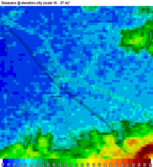
Below is the Elevation map of Deszczno, which displays elevation range with different colors. Scale of the first map is from 16 to 57 m (52 to 187 ft) with average elevation of 23.3 meters (=76 ft) [note 1]
These maps also provides idea of topography and contour of this city, they are displayed at different zoom levels. More info about maps, scale and edge coordinates you can find below images.
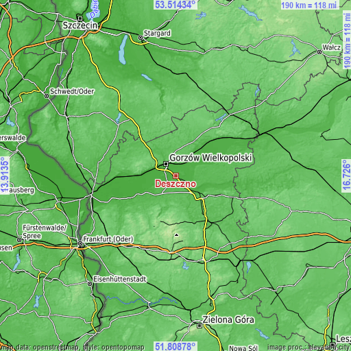
| \ | Map #1 | Topo.Map |
| Scale [m] | 16..57 m | × |
| Scale [ft] | 52..187 ft | × |
| Average | 23.3 m = 76 ft | × |
| Width | 5.93 km = 3.7 mi | 189.6 km = 117.8 mi |
| Height | 5.93 km = 3.7 mi | 189.6 km = 117.8 mi |
| ↑Max Latitude | 52.696521° | 53.51434° |
| Latitude at center | 52.66988° | 52.66988° |
| ↓Min Latitude | 52.643223° | 51.80878° |
| ← Min Longitude | 15.275805° | 13.9135° |
| Longitude center | 15.31975° | 15.31975° |
| →Max Longitude | 15.363695° | 16.726° |
Nearby cities:
Cities around Deszczno sort by population:
• Gorzów Wielkopolski elevation 34 m
9.6 km,  320°
320°
• Skwierzyna 30 m
14.9 km,  121°
121°
• Strzelce Krajeńskie 75 m
27 km,  31°
31°
• Przytoczna 54 m
26.3 km,  112°
112°
• Lubniewice 56 m
17.7 km,  195°
195°
• Kłodawa 51 m
14.7 km,  331°
331°
• Krzeszyce 19 m
23.2 km,  245°
245°
• Zwierzyń 31 m
24.6 km,  42°
42°
• Bledzew 41 m
18.1 km,  159°
159°
• Bogdaniec 24 m
16.9 km,  277°
277°
• Jenin 23 m
15.2 km, 281°
• Santok 22 m
9.7 km, 38°
Multilingual:
 En español:
Deszczno elevación 20 m.
 En France:
Deszczno élévation 20 m.


Sources and notes:
- [note 1] Map square and city borders are not equal. Map elevation data is calculated only from area inside that square.
- [src 1] Elevation data from geonames database provided with same terms of usage.
- [src 2] The elevation map of Deszczno is generated using elevation data from NASA's 3 arcsec (90m) resolution SRTM data.
- [src 3] Base (background) map © OpenStreetMap contributors tiles are generated by Geofabrik and OpenTopoMap.
Copyright & License:
This Deszczno Elevation Map is licensed under CC BY-SA. You may reuse any part from this page, if you give a proper credit by linking to this URL:
 More info on terms of use page.