Iłowa elevation
Iłowa (Lubusz, Powiat żagański), Poland elevation is 126 meters and Iłowa elevation in feet is 413 ft above sea level [src 1]. Iłowa is a populated place (feature code) with elevation that is 65 meters (213 ft) smaller than average city elevation in Poland.
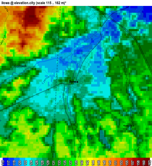
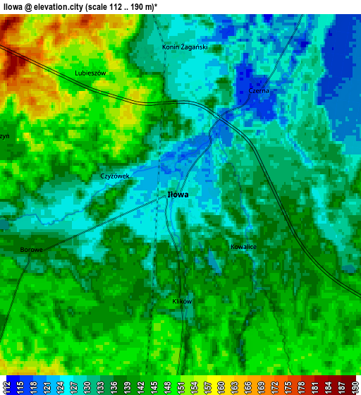
Below is the Elevation map of Iłowa, which displays elevation range with different colors. Scale of the first map is from 115 to 162 m (377 to 531 ft) with average elevation of 132.2 meters (=434 ft) [note 1]
These maps also provides idea of topography and contour of this city, they are displayed at different zoom levels. More info about maps, scale and edge coordinates you can find below images.
| \ | Map #1 | Map #2 | Topo.Map |
| Scale [m] | 115..162 m | 112..190 m | × |
| Scale [ft] | 377..531 ft | 367..623 ft | × |
| Average | 132.2 m = 434 ft | 137.5 m = 451 ft | × |
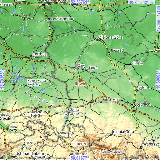
| Width | 6.08 km = 3.8 mi | 12.17 km = 7.6 mi | 194.7 km = 121 mi |
| Height | 6.08 km = 3.8 mi | 12.17 km = 7.6 mi | 194.7 km = 121 mi |
| ↑Max Latitude | 51.527948° | 51.55528° | 52.36761° |
| Latitude at center | 51.5006° | 51.5006° | 51.5006° |
| ↓Min Latitude | 51.473236° | 51.445855° | 50.61677° |
| ← Min Longitude | 15.155855° | 15.111909° | 13.79355° |
| Longitude center | 15.1998° | 15.1998° | 15.1998° |
| →Max Longitude | 15.243745° | 15.287691° | 16.60605° |
Nearby cities:
Cities around Iłowa sort by population:
• Żary elevation 152 m
16.3 km,  344°
344°
• Żagań 98 m
15.2 km,  31°
31°
• Szprotawa 130 m
24.4 km,  72°
72°
• Pieńsk 186 m
29.9 km,  200°
200°
• Małomice 121 m
18.4 km, 70°
• Gozdnica 150 m
10 km,  224°
224°
• Kunice Żarskie 142 m
11.3 km,  347°
347°
• Węgliniec 192 m
23.8 km,  175°
175°
• Lipinki Łużyckie 145 m
20.8 km,  318°
318°
• Wymiarki 144 m
8.2 km,  278°
278°
• Sieniawa Żarska 150 m
18.3 km,  328°
328°
• Przewóz 140 m
17.3 km,  262°
262°
Multilingual:
 En español:
Iłowa elevación 126 m.
 En France:
Iłowa élévation 126 m.
 Auf Deutsch:
Stadt Halbau, Halbau höhe über dem Meeresspiegel ist 126 m.

Sources and notes:
- [note 1] Map square and city borders are not equal. Map elevation data is calculated only from area inside that square.
- [src 1] Elevation data from geonames database provided with same terms of usage.
- [src 2] The elevation map of Iłowa is generated using elevation data from NASA's 3 arcsec (90m) resolution SRTM data.
- [src 3] Base (background) map © OpenStreetMap contributors tiles are generated by Geofabrik and OpenTopoMap.
Copyright & License:
This Iłowa Elevation Map is licensed under CC BY-SA. You may reuse any part from this page, if you give a proper credit by linking to this URL:
 More info on terms of use page.