Żary elevation
Żary (Lubusz, Powiat żarski), Poland elevation is 152 meters and Żary elevation in feet is 499 ft above sea level [src 1]. Żary is a seat of a second-order administrative division (feature code) with elevation that is 39 meters (128 ft) smaller than average city elevation in Poland.
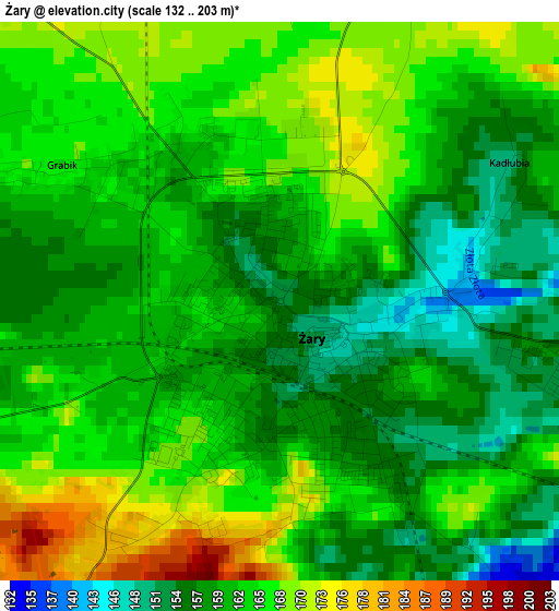
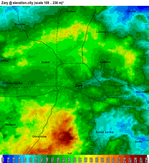
Below is the Elevation map of Żary, which displays elevation range with different colors. Scale of the first map is from 132 to 203 m (433 to 666 ft) with average elevation of 162.2 meters (=532 ft) [note 1]
These maps also provides idea of topography and contour of this city, they are displayed at different zoom levels. More info about maps, scale and edge coordinates you can find below images.
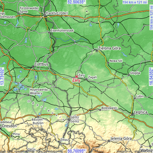
| \ | Map #1 | Map #2 | Topo.Map |
| Scale [m] | 132..203 m | 109..236 m | × |
| Scale [ft] | 433..666 ft | 358..774 ft | × |
| Average | 162.2 m = 532 ft | 159.7 m = 524 ft | × |
| Width | 6.06 km = 3.8 mi | 12.13 km = 7.5 mi | 194.1 km = 120.6 mi |
| Height | 6.06 km = 3.8 mi | 12.13 km = 7.5 mi | 194.1 km = 120.6 mi |
| ↑Max Latitude | 51.669313° | 51.69656° | 52.50635° |
| Latitude at center | 51.64205° | 51.64205° | 51.64205° |
| ↓Min Latitude | 51.614771° | 51.587475° | 50.76095° |
| ← Min Longitude | 15.093325° | 15.049379° | 13.73102° |
| Longitude center | 15.13727° | 15.13727° | 15.13727° |
| →Max Longitude | 15.181215° | 15.225161° | 16.54352° |
Nearby cities:
Cities around Żary sort by population:
• Żagań elevation 98 m
12.6 km,  102°
102°
• Lubsko 72 m
19.5 km,  324°
324°
• Nowogród Bobrzański 81 m
18.7 km,  21°
21°
• Jasień 85 m
14.8 km,  325°
325°
• Iłowa 126 m
16.3 km,  164°
164°
• Kunice Żarskie 142 m
5.1 km, 158°
• Lipinki Łużyckie 145 m
9.6 km,  268°
268°
• Tuplice 117 m
21.6 km,  280°
280°
• Trzebiel 131 m
22.2 km, 267°
• Wymiarki 144 m
15.1 km,  194°
194°
• Sieniawa Żarska 150 m
5.3 km, 267°
• Przewóz 140 m
22.1 km,  215°
215°
Multilingual:
 En español:
Żary elevación 152 m.
 En France:
Żary élévation 152 m.


Sources and notes:
- [note 1] Map square and city borders are not equal. Map elevation data is calculated only from area inside that square.
- [src 1] Elevation data from geonames database provided with same terms of usage.
- [src 2] The elevation map of Żary is generated using elevation data from NASA's 3 arcsec (90m) resolution SRTM data.
- [src 3] Base (background) map © OpenStreetMap contributors tiles are generated by Geofabrik and OpenTopoMap.
Copyright & License:
This Żary Elevation Map is licensed under CC BY-SA. You may reuse any part from this page, if you give a proper credit by linking to this URL:
 More info on terms of use page.