Jastrzębie Zdrój elevation
Jastrzębie Zdrój (Silesia, Jastrzębie-Zdrój), Poland elevation is 237 meters and Jastrzębie Zdrój elevation in feet is 778 ft above sea level [src 1]. Jastrzębie Zdrój is a seat of a second-order administrative division (feature code) with elevation that is 46 meters (151 ft) bigger than average city elevation in Poland.
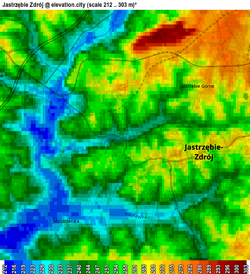
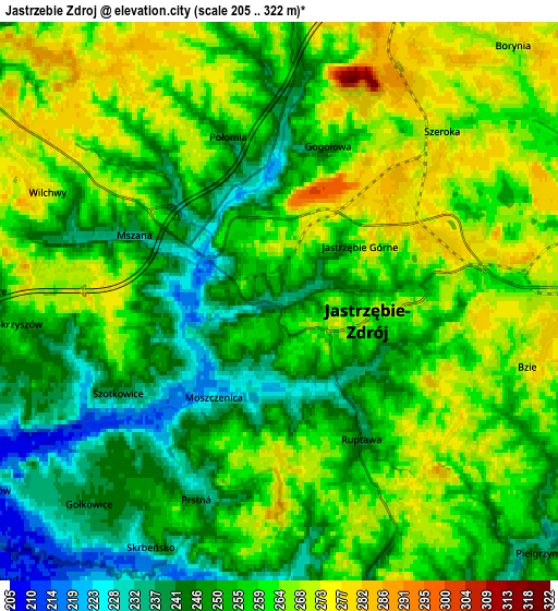
Below is the Elevation map of Jastrzębie Zdrój, which displays elevation range with different colors. Scale of the first map is from 212 to 303 m (696 to 994 ft) with average elevation of 248.8 meters (=816 ft) [note 1]
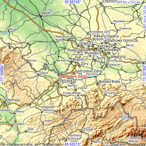
These maps also provides idea of topography and contour of this city, they are displayed at different zoom levels. More info about maps, scale and edge coordinates you can find below images.
| \ | Map #1 | Map #2 | Topo.Map |
| Scale [m] | 212..303 m | 205..322 m | × |
| Scale [ft] | 696..994 ft | 673..1056 ft | × |
| Average | 248.8 m = 816 ft | 256 m = 840 ft | × |
| Width | 6.29 km = 3.9 mi | 12.58 km = 7.8 mi | 201.2 km = 125 mi |
| Height | 6.29 km = 3.9 mi | 12.57 km = 7.8 mi | 201.2 km = 125 mi |
| ↑Max Latitude | 49.983685° | 50.011934° | 50.85169° |
| Latitude at center | 49.95542° | 49.95542° | 49.95542° |
| ↓Min Latitude | 49.927138° | 49.898839° | 49.04215° |
| ← Min Longitude | 18.530845° | 18.486899° | 17.16854° |
| Longitude center | 18.57479° | 18.57479° | 18.57479° |
| →Max Longitude | 18.618735° | 18.662681° | 19.98104° |
Nearby cities:
Cities around Jastrzębie Zdrój sort by population:
• Wodzisław Śląski elevation 246 m
9.1 km,  306°
306°
• Markłowice 253 m
7.8 km,  330°
330°
• Zebrzydowice 226 m
9 km,  163°
163°
• Świerklany Górne 284 m
8.1 km,  7°
7°
• Gołkowice 242 m
6.3 km,  223°
223°
• Mszana 237 m
3.7 km,  294°
294°
• Skrzyszów 258 m
6.2 km,  263°
263°
• Świerklany Dolne 264 m
7 km,  1°
1°
• Połomia 245 m
4.4 km,  337°
337°
• Pielgrzymowice 237 m
7.7 km,  136°
136°
• Godów 204 m
7.7 km,  243°
243°
• Krzyżowice 253 m
7.8 km,  64°
64°
Multilingual:
 En español:
Jastrzębie-Zdrój elevación 237 m.
 En France:
Jastrzębie Zdrój élévation 237 m.
 Auf Deutsch:
Jastrzębie Zdrój höhe über dem Meeresspiegel ist 237 m.

Sources and notes:
- [note 1] Map square and city borders are not equal. Map elevation data is calculated only from area inside that square.
- [src 1] Elevation data from geonames database provided with same terms of usage.
- [src 2] The elevation map of Jastrzębie Zdrój is generated using elevation data from NASA's 3 arcsec (90m) resolution SRTM data.
- [src 3] Base (background) map © OpenStreetMap contributors tiles are generated by Geofabrik and OpenTopoMap.
Copyright & License:
This Jastrzębie Zdrój Elevation Map is licensed under CC BY-SA. You may reuse any part from this page, if you give a proper credit by linking to this URL:
 More info on terms of use page.