Otmuchów elevation
Otmuchów (Opole Voivodeship, Powiat nyski), Poland elevation is 208 meters and Otmuchów elevation in feet is 682 ft above sea level [src 1]. Otmuchów is a seat of a third-order administrative division (feature code) with elevation that is 17 meters (56 ft) bigger than average city elevation in Poland.
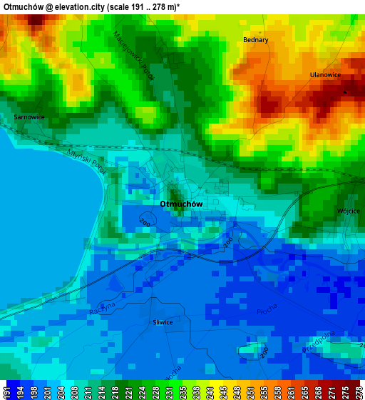
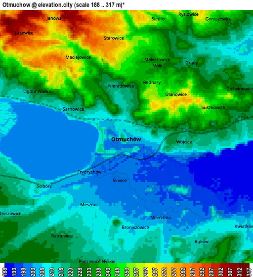
Below is the Elevation map of Otmuchów, which displays elevation range with different colors. Scale of the first map is from 191 to 278 m (627 to 912 ft) with average elevation of 216.6 meters (=711 ft) [note 1]
These maps also provides idea of topography and contour of this city, they are displayed at different zoom levels. More info about maps, scale and edge coordinates you can find below images.
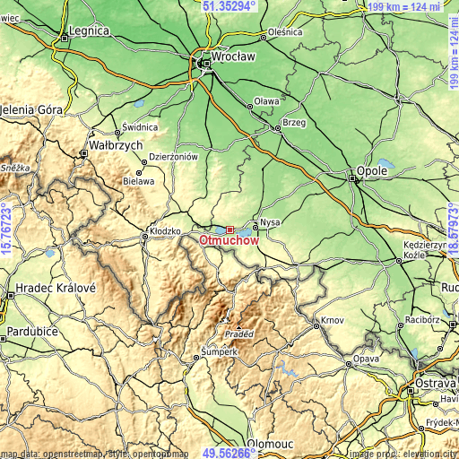
| \ | Map #1 | Map #2 | Topo.Map |
| Scale [m] | 191..278 m | 188..317 m | × |
| Scale [ft] | 627..912 ft | 617..1040 ft | × |
| Average | 216.6 m = 711 ft | 225.2 m = 739 ft | × |
| Width | 6.22 km = 3.9 mi | 12.44 km = 7.7 mi | 199.1 km = 123.7 mi |
| Height | 6.22 km = 3.9 mi | 12.44 km = 7.7 mi | 199 km = 123.7 mi |
| ↑Max Latitude | 50.494234° | 50.522182° | 51.35294° |
| Latitude at center | 50.46627° | 50.46627° | 50.46627° |
| ↓Min Latitude | 50.438289° | 50.410292° | 49.56266° |
| ← Min Longitude | 17.129535° | 17.085589° | 15.76723° |
| Longitude center | 17.17348° | 17.17348° | 17.17348° |
| →Max Longitude | 17.217425° | 17.261371° | 18.57973° |
Nearby cities:
Cities around Otmuchów sort by population:
• Nysa elevation 191 m
11.4 km,  85°
85°
• Głuchołazy 288 m
22.5 km,  138°
138°
• Ziębice 220 m
17.7 km,  327°
327°
• Paczków 229 m
11.8 km,  268°
268°
• Kamieniec Ząbkowicki 241 m
21.8 km,  287°
287°
• Złoty Stok 350 m
21.2 km,  263°
263°
• Chróścina 184 m
22.2 km,  38°
38°
• Skoroszyce 179 m
20.7 km,  45°
45°
• Kamienica 261 m
15.6 km, 263°
• Sidzina 169 m
22.9 km,  58°
58°
• Kamiennik 247 m
11.7 km,  351°
351°
• Pakosławice 186 m
16.2 km, 57°
Multilingual:
 En español:
Otmuchów elevación 208 m.
 En France:
Otmuchów élévation 208 m.
 Auf Deutsch:
Ottmachau höhe über dem Meeresspiegel ist 208 m.

Sources and notes:
- [note 1] Map square and city borders are not equal. Map elevation data is calculated only from area inside that square.
- [src 1] Elevation data from geonames database provided with same terms of usage.
- [src 2] The elevation map of Otmuchów is generated using elevation data from NASA's 3 arcsec (90m) resolution SRTM data.
- [src 3] Base (background) map © OpenStreetMap contributors tiles are generated by Geofabrik and OpenTopoMap.
Copyright & License:
This Otmuchów Elevation Map is licensed under CC BY-SA. You may reuse any part from this page, if you give a proper credit by linking to this URL:
 More info on terms of use page.