Pawłowice elevation
Pawłowice (Silesia, Powiat pszczyński), Poland elevation is 264 meters and Pawłowice elevation in feet is 866 ft above sea level [src 1]. Pawłowice is a populated place (feature code) with elevation that is 73 meters (240 ft) bigger than average city elevation in Poland.
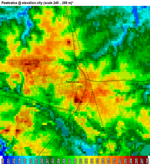
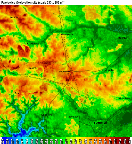
Below is the Elevation map of Pawłowice, which displays elevation range with different colors. Scale of the first map is from 249 to 288 m (817 to 945 ft) with average elevation of 267.1 meters (=876 ft) [note 1]
These maps also provides idea of topography and contour of this city, they are displayed at different zoom levels. More info about maps, scale and edge coordinates you can find below images.
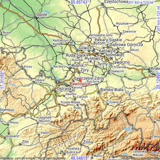
| \ | Map #1 | Map #2 | Topo.Map |
| Scale [m] | 249..288 m | 233..288 m | × |
| Scale [ft] | 817..945 ft | 764..945 ft | × |
| Average | 267.1 m = 876 ft | 263 m = 863 ft | × |
| Width | 6.29 km = 3.9 mi | 12.57 km = 7.8 mi | 201.2 km = 125 mi |
| Height | 6.29 km = 3.9 mi | 12.57 km = 7.8 mi | 201.2 km = 125 mi |
| ↑Max Latitude | 49.989532° | 50.017777° | 50.85743° |
| Latitude at center | 49.96127° | 49.96127° | 49.96127° |
| ↓Min Latitude | 49.932991° | 49.904696° | 49.04811° |
| ← Min Longitude | 18.673835° | 18.629889° | 17.31153° |
| Longitude center | 18.71778° | 18.71778° | 18.71778° |
| →Max Longitude | 18.761725° | 18.805671° | 20.12403° |
Nearby cities:
Cities around Pawłowice sort by population:
• Żory elevation 251 m
9.4 km,  352°
352°
• Suszec 265 m
9.2 km,  34°
34°
• Chybie 258 m
10.2 km,  129°
129°
• Strumień 258 m
5.7 km,  142°
142°
• Pielgrzymowice 237 m
7.9 km,  218°
218°
• Studzionka 256 m
3.9 km,  88°
88°
• Bąków 260 m
7.5 km,  181°
181°
• Kryry 267 m
8.8 km,  45°
45°
• Zabłocie 259 m
7.9 km, 144°
• Zbytków 260 m
4.3 km,  171°
171°
• Rudziczka 268 m
8.9 km,  20°
20°
• Krzyżowice 253 m
4.2 km,  309°
309°
Multilingual:
 En español:
Pawłowice elevación 264 m.
 En France:
Pawłowice élévation 264 m.
 Auf Deutsch:
Pawłowice höhe über dem Meeresspiegel ist 264 m.

Sources and notes:
- [note 1] Map square and city borders are not equal. Map elevation data is calculated only from area inside that square.
- [src 1] Elevation data from geonames database provided with same terms of usage.
- [src 2] The elevation map of Pawłowice is generated using elevation data from NASA's 3 arcsec (90m) resolution SRTM data.
- [src 3] Base (background) map © OpenStreetMap contributors tiles are generated by Geofabrik and OpenTopoMap.
Copyright & License:
This Pawłowice Elevation Map is licensed under CC BY-SA. You may reuse any part from this page, if you give a proper credit by linking to this URL:
 More info on terms of use page.