Żory elevation
Żory (Silesia), Poland elevation is 251 meters and Żory elevation in feet is 823 ft above sea level [src 1]. Żory is a seat of a second-order administrative division (feature code) with elevation that is 60 meters (197 ft) bigger than average city elevation in Poland.
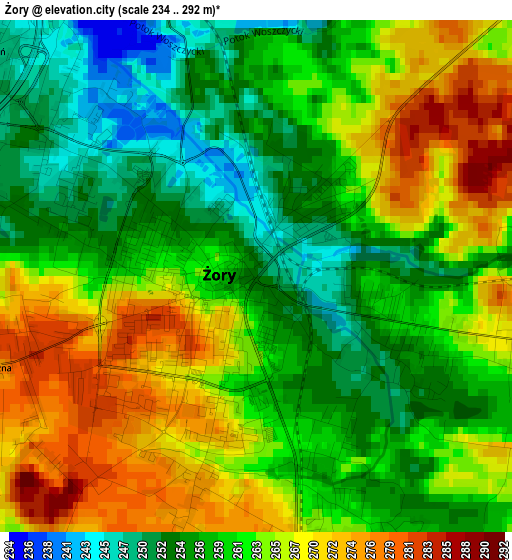
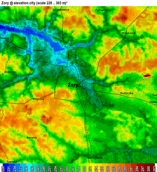
Below is the Elevation map of Żory, which displays elevation range with different colors. Scale of the first map is from 234 to 292 m (768 to 958 ft) with average elevation of 261.7 meters (=859 ft) [note 1]
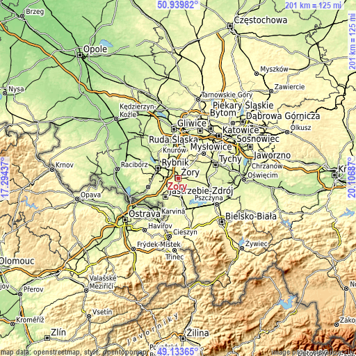
These maps also provides idea of topography and contour of this city, they are displayed at different zoom levels. More info about maps, scale and edge coordinates you can find below images.
| \ | Map #1 | Map #2 | Topo.Map |
| Scale [m] | 234..292 m | 228..303 m | × |
| Scale [ft] | 768..958 ft | 748..994 ft | × |
| Average | 261.7 m = 859 ft | 264 m = 866 ft | × |
| Width | 6.28 km = 3.9 mi | 12.55 km = 7.8 mi | 200.8 km = 124.8 mi |
| Height | 6.28 km = 3.9 mi | 12.55 km = 7.8 mi | 200.8 km = 124.8 mi |
| ↑Max Latitude | 50.073443° | 50.101639° | 50.93982° |
| Latitude at center | 50.04523° | 50.04523° | 50.04523° |
| ↓Min Latitude | 50.017001° | 49.988755° | 49.13365° |
| ← Min Longitude | 18.656675° | 18.612729° | 17.29437° |
| Longitude center | 18.70062° | 18.70062° | 18.70062° |
| →Max Longitude | 18.744565° | 18.788511° | 20.10687° |
Nearby cities:
Cities around Żory sort by population:
• Pawłowice elevation 264 m
9.4 km,  172°
172°
• Suszec 265 m
6.7 km,  104°
104°
• Świerklany Górne 284 m
8.1 km,  256°
256°
• Jankowice Rybnickie 267 m
11 km,  269°
269°
• Świerklany Dolne 264 m
9.3 km,  251°
251°
• Bełk 256 m
9.5 km,  6°
6°
• Stanowice 266 m
9.7 km,  347°
347°
• Studzionka 256 m
10.6 km,  150°
150°
• Gardawice 261 m
10.6 km,  41°
41°
• Kryry 267 m
8.1 km,  112°
112°
• Rudziczka 268 m
4.5 km, 103°
• Krzyżowice 253 m
7 km,  196°
196°
Multilingual:
 En español:
Żory elevación 251 m.
 En France:
Żory élévation 251 m.


Sources and notes:
- [note 1] Map square and city borders are not equal. Map elevation data is calculated only from area inside that square.
- [src 1] Elevation data from geonames database provided with same terms of usage.
- [src 2] The elevation map of Żory is generated using elevation data from NASA's 3 arcsec (90m) resolution SRTM data.
- [src 3] Base (background) map © OpenStreetMap contributors tiles are generated by Geofabrik and OpenTopoMap.
Copyright & License:
This Żory Elevation Map is licensed under CC BY-SA. You may reuse any part from this page, if you give a proper credit by linking to this URL:
 More info on terms of use page.