Rusocice elevation
Rusocice (Lesser Poland, Powiat krakowski), Poland elevation is 215 meters and Rusocice elevation in feet is 705 ft above sea level [src 1]. Rusocice is a populated place (feature code) with elevation that is 24 meters (79 ft) bigger than average city elevation in Poland.
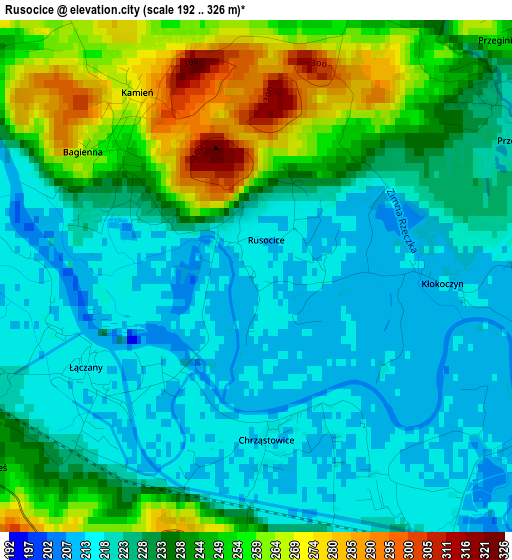
Below is the Elevation map of Rusocice, which displays elevation range with different colors. Scale of the first map is from 192 to 326 m (630 to 1070 ft) with average elevation of 233 meters (=764 ft) [note 1]
These maps also provides idea of topography and contour of this city, they are displayed at different zoom levels. More info about maps, scale and edge coordinates you can find below images.
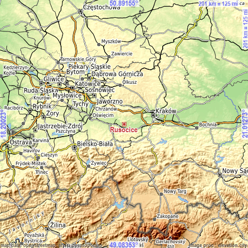
| \ | Map #1 | Topo.Map |
| Scale [m] | 192..326 m | × |
| Scale [ft] | 630..1070 ft | × |
| Average | 233 m = 764 ft | × |
| Width | 6.28 km = 3.9 mi | 201 km = 124.9 mi |
| Height | 6.28 km = 3.9 mi | 201 km = 124.9 mi |
| ↑Max Latitude | 50.024282° | 50.89155° |
| Latitude at center | 49.99604° | 49.99604° |
| ↓Min Latitude | 49.967782° | 49.08353° |
| ← Min Longitude | 19.562535° | 18.20023° |
| Longitude center | 19.60648° | 19.60648° |
| →Max Longitude | 19.650425° | 21.01273° |
Nearby cities:
Cities around Rusocice sort by population:
• Spytkowice elevation 227 m
6.8 km,  270°
270°
• Alwernia 276 m
8.6 km,  326°
326°
• Ryczów 235 m
4.4 km,  247°
247°
• Zalas 351 m
9.4 km,  6°
6°
• Bachowice 298 m
9.1 km,  242°
242°
• Czernichów 232 m
5.4 km,  98°
98°
• Łączany 213 m
2.4 km, 236°
• Kamień 259 m
2.3 km,  319°
319°
• Wołowice 209 m
8.6 km, 95°
• Brzeźnica 239 m
3.6 km,  164°
164°
• Sanka 357 m
8.6 km,  19°
19°
• Brodła 275 m
5.4 km,  346°
346°
Multilingual:
 En español:
Rusocice elevación 215 m.
 En France:
Rusocice élévation 215 m.
 Auf Deutsch:
Rusocice höhe über dem Meeresspiegel ist 215 m.

Sources and notes:
- [note 1] Map square and city borders are not equal. Map elevation data is calculated only from area inside that square.
- [src 1] Elevation data from geonames database provided with same terms of usage.
- [src 2] The elevation map of Rusocice is generated using elevation data from NASA's 3 arcsec (90m) resolution SRTM data.
- [src 3] Base (background) map © OpenStreetMap contributors tiles are generated by Geofabrik and OpenTopoMap.
Copyright & License:
This Rusocice Elevation Map is licensed under CC BY-SA. You may reuse any part from this page, if you give a proper credit by linking to this URL:
 More info on terms of use page.