Czernichów elevation
Czernichów (Lesser Poland, Powiat krakowski), Poland elevation is 232 meters and Czernichów elevation in feet is 761 ft above sea level [src 1]. Czernichów is a seat of a third-order administrative division (feature code) with elevation that is 41 meters (135 ft) bigger than average city elevation in Poland.
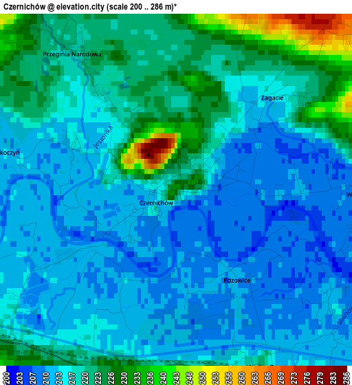
Below is the Elevation map of Czernichów, which displays elevation range with different colors. Scale of the first map is from 200 to 286 m (656 to 938 ft) with average elevation of 217 meters (=712 ft) [note 1]
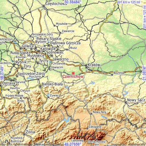
These maps also provides idea of topography and contour of this city, they are displayed at different zoom levels. More info about maps, scale and edge coordinates you can find below images.
| \ | Map #1 | Topo.Map |
| Scale [m] | 200..286 m | × |
| Scale [ft] | 656..938 ft | × |
| Average | 217 m = 712 ft | × |
| Width | 6.28 km = 3.9 mi | 201.1 km = 125 mi |
| Height | 6.28 km = 3.9 mi | 201 km = 124.9 mi |
| ↑Max Latitude | 50.017446° | 50.88484° |
| Latitude at center | 49.9892° | 49.9892° |
| ↓Min Latitude | 49.960938° | 49.07656° |
| ← Min Longitude | 19.637205° | 18.2749° |
| Longitude center | 19.68115° | 19.68115° |
| →Max Longitude | 19.725095° | 21.0874° |
Nearby cities:
Cities around Czernichów sort by population:
• Przytkowice elevation 328 m
7.9 km,  177°
177°
• Kaszów 235 m
6.2 km,  26°
26°
• Rączna 233 m
6.6 km,  69°
69°
• Liszki 226 m
8.3 km,  48°
48°
• Łączany 213 m
7.3 km,  265°
265°
• Kamień 259 m
7.3 km,  290°
290°
• Krzęcin 267 m
6.7 km,  139°
139°
• Wołowice 209 m
3.2 km,  90°
90°
• Brzeźnica 239 m
5.2 km,  238°
238°
• Rusocice 215 m
5.4 km,  278°
278°
• Czułów 278 m
8 km,  10°
10°
• Sosnowice 229 m
6 km,  156°
156°
Multilingual:
 En español:
Czernichów elevación 232 m.
 En France:
Czernichów élévation 232 m.
 Auf Deutsch:
Czernichów höhe über dem Meeresspiegel ist 232 m.

Sources and notes:
- [note 1] Map square and city borders are not equal. Map elevation data is calculated only from area inside that square.
- [src 1] Elevation data from geonames database provided with same terms of usage.
- [src 2] The elevation map of Czernichów is generated using elevation data from NASA's 3 arcsec (90m) resolution SRTM data.
- [src 3] Base (background) map © OpenStreetMap contributors tiles are generated by Geofabrik and OpenTopoMap.
Copyright & License:
This Czernichów Elevation Map is licensed under CC BY-SA. You may reuse any part from this page, if you give a proper credit by linking to this URL:
 More info on terms of use page.