Sława elevation
Sława (Lubusz, Powiat wschowski), Poland elevation is 59 meters and Sława elevation in feet is 194 ft above sea level [src 1]. Sława is a seat of a third-order administrative division (feature code) with elevation that is 132 meters (433 ft) smaller than average city elevation in Poland.
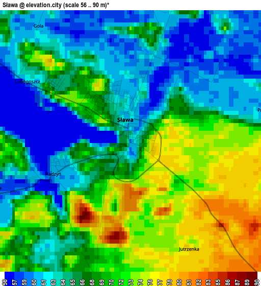
Below is the Elevation map of Sława, which displays elevation range with different colors. Scale of the first map is from 56 to 90 m (184 to 295 ft) with average elevation of 67.2 meters (=220 ft) [note 1]
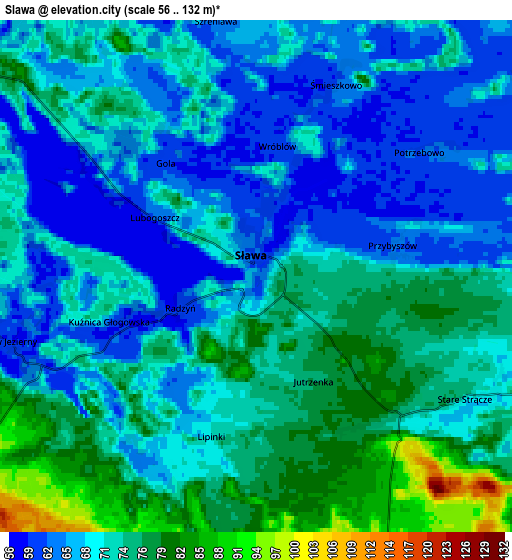
These maps also provides idea of topography and contour of this city, they are displayed at different zoom levels. More info about maps, scale and edge coordinates you can find below images.
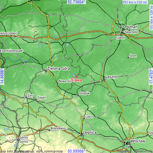
| \ | Map #1 | Map #2 | Topo.Map |
| Scale [m] | 56..90 m | 56..132 m | × |
| Scale [ft] | 184..295 ft | 184..433 ft | × |
| Average | 67.2 m = 220 ft | 70.3 m = 231 ft | × |
| Width | 6.03 km = 3.7 mi | 12.07 km = 7.5 mi | 193.1 km = 120 mi |
| Height | 6.03 km = 3.7 mi | 12.07 km = 7.5 mi | 193 km = 119.9 mi |
| ↑Max Latitude | 51.903352° | 51.930458° | 52.73604° |
| Latitude at center | 51.87623° | 51.87623° | 51.87623° |
| ↓Min Latitude | 51.849092° | 51.821937° | 50.99966° |
| ← Min Longitude | 16.028105° | 15.984159° | 14.6658° |
| Longitude center | 16.07205° | 16.07205° | 16.07205° |
| →Max Longitude | 16.115995° | 16.159941° | 17.4783° |
Nearby cities:
Cities around Sława sort by population:
• Wschowa elevation 100 m
18.5 km,  114°
114°
• Włoszakowice 88 m
20.9 km,  74°
74°
• Siedlisko 86 m
21.4 km,  236°
236°
• Przemęt 63 m
21.5 km,  46°
46°
• Kotla 87 m
14.8 km,  189°
189°
• Konotop 59 m
13.1 km,  298°
298°
• Szlichtyngowa 79 m
21.7 km,  146°
146°
• Przyborów 63 m
22.5 km,  247°
247°
• Bojadła 58 m
19.9 km, 295°
• Brenno 67 m
11.1 km,  62°
62°
• Wijewo 63 m
9 km, 60°
• Kolsko 56 m
12.2 km,  320°
320°
Multilingual:
 En español:
Sława elevación 59 m.
 En France:
Sława élévation 59 m.


Sources and notes:
- [note 1] Map square and city borders are not equal. Map elevation data is calculated only from area inside that square.
- [src 1] Elevation data from geonames database provided with same terms of usage.
- [src 2] The elevation map of Sława is generated using elevation data from NASA's 3 arcsec (90m) resolution SRTM data.
- [src 3] Base (background) map © OpenStreetMap contributors tiles are generated by Geofabrik and OpenTopoMap.
Copyright & License:
This Sława Elevation Map is licensed under CC BY-SA. You may reuse any part from this page, if you give a proper credit by linking to this URL:
 More info on terms of use page.