Begowala elevation
Begowala (Punjab), Pakistan elevation is 238 meters and Begowala elevation in feet is 781 ft above sea level [src 1]. Begowala is a populated place (feature code) with elevation that is 108 meters (354 ft) smaller than average city elevation in Pakistan.
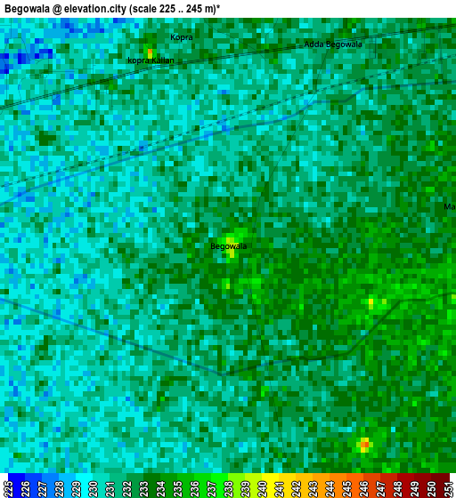
Below is the Elevation map of Begowala, which displays elevation range with different colors. Scale of the first map is from 225 to 245 m (738 to 804 ft) with average elevation of 231.3 meters (=759 ft) [note 1]
These maps also provides idea of topography and contour of this city, they are displayed at different zoom levels. More info about maps, scale and edge coordinates you can find below images.
| \ | Map #1 | Map #2 | Topo.Map |
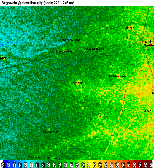
| Scale [m] | 225..245 m | 222..246 m | × |
| Scale [ft] | 738..804 ft | 728..807 ft | × |
| Average | 231.3 m = 759 ft | 231.4 m = 759 ft | × |
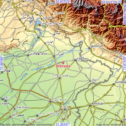
| Width | 8.25 km = 5.1 mi | 16.5 km = 10.3 mi | 263.9 km = 164 mi |
| Height | 8.25 km = 5.1 mi | 16.5 km = 10.3 mi | 263.9 km = 164 mi |
| ↑Max Latitude | 32.475241° | 32.512307° | 33.61713° |
| Latitude at center | 32.43816° | 32.43816° | 32.43816° |
| ↓Min Latitude | 32.401064° | 32.363952° | 31.24357° |
| ← Min Longitude | 74.223995° | 74.180049° | 72.86169° |
| Longitude center | 74.26794° | 74.26794° | 74.26794° |
| →Max Longitude | 74.311885° | 74.355831° | 75.67419° |
Nearby cities:
Cities around Begowala sort by population:
• Sialkot elevation 250 m
25.4 km,  76°
76°
• Gujrat 237 m
23.6 km,  309°
309°
• Daska Kalan 242 m
14.8 km,  148°
148°
• Wazirabad 231 m
13.9 km,  272°
272°
• Jalalpur Jattan 250 m
23.3 km,  345°
345°
• Sambrial 239 m
9.2 km,  60°
60°
• Kunjah 234 m
29.3 km,  290°
290°
• Kotli Loharan 235 m
27.1 km,  51°
51°
• Kot Ghulam Muhammad 238 m
28.7 km,  114°
114°
• Bhopalwala 245 m
9 km,  96°
96°
• Sodhri 238 m
8.5 km, 288°
• Dhaunkal 236 m
12.8 km,  253°
253°
Multilingual:
 En español:
Begowala elevación 238 m.
 En France:
Begowala élévation 238 m.
 Auf Deutsch:
Begowala höhe über dem Meeresspiegel ist 238 m.

Sources and notes:
- [note 1] Map square and city borders are not equal. Map elevation data is calculated only from area inside that square.
- [src 1] Elevation data from geonames database provided with same terms of usage.
- [src 2] The elevation map of Begowala is generated using elevation data from NASA's 3 arcsec (90m) resolution SRTM data.
- [src 3] Base (background) map © OpenStreetMap contributors tiles are generated by Geofabrik and OpenTopoMap.
Copyright & License:
This Begowala Elevation Map is licensed under CC BY-SA. You may reuse any part from this page, if you give a proper credit by linking to this URL:
 More info on terms of use page.