Chiniot elevation
Chiniot (Punjab), Pakistan elevation is 189 meters and Chiniot elevation in feet is 620 ft above sea level [src 1]. Chiniot is a seat of a second-order administrative division (feature code) with elevation that is 157 meters (515 ft) smaller than average city elevation in Pakistan.
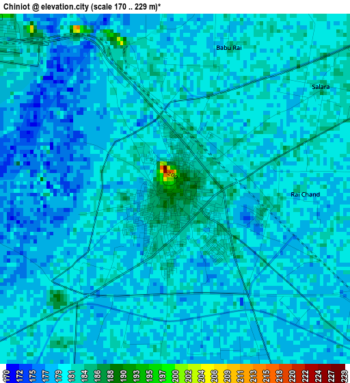
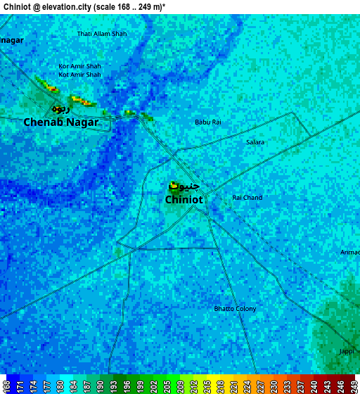
Below is the Elevation map of Chiniot, which displays elevation range with different colors. Scale of the first map is from 170 to 229 m (558 to 751 ft) with average elevation of 180 meters (=591 ft) [note 1]
These maps also provides idea of topography and contour of this city, they are displayed at different zoom levels. More info about maps, scale and edge coordinates you can find below images.
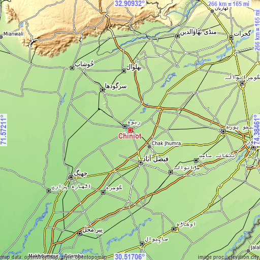
| \ | Map #1 | Map #2 | Topo.Map |
| Scale [m] | 170..229 m | 168..249 m | × |
| Scale [ft] | 558..751 ft | 551..817 ft | × |
| Average | 180 m = 591 ft | 180 m = 591 ft | × |
| Width | 8.31 km = 5.2 mi | 16.63 km = 10.3 mi | 266 km = 165.3 mi |
| Height | 8.31 km = 5.2 mi | 16.63 km = 10.3 mi | 266 km = 165.3 mi |
| ↑Max Latitude | 31.758283° | 31.795641° | 32.90932° |
| Latitude at center | 31.72091° | 31.72091° | 31.72091° |
| ↓Min Latitude | 31.683522° | 31.646118° | 30.51706° |
| ← Min Longitude | 72.934415° | 72.890469° | 71.57211° |
| Longitude center | 72.97836° | 72.97836° | 72.97836° |
| →Max Longitude | 73.022305° | 73.066251° | 74.38461° |
Nearby cities:
Cities around Chiniot sort by population:
• Faisalabad elevation 186 m
35.6 km,  162°
162°
• Sargodha 193 m
49.7 km,  324°
324°
• Shahkot 197 m
50.8 km,  109°
109°
• Chenab Nagar 183 m
7.2 km,  302°
302°
• Sangla Hill 194 m
38.3 km,  90°
90°
• Kot Mumin 197 m
52.2 km,  5°
5°
• Chak Jhumra 190 m
25.8 km,  131°
131°
• Khurrianwala 190 m
36.8 km, 131°
• Pindi Bhattian 194 m
34.2 km,  54°
54°
• Lalian 179 m
20.3 km, 304°
• Sillanwali 182 m
43 km,  285°
285°
• Bhawana 172 m
35.5 km,  241°
241°
Multilingual:
 En español:
Chiniot elevación 189 m.
 En France:
Chiniot élévation 189 m.


Sources and notes:
- [note 1] Map square and city borders are not equal. Map elevation data is calculated only from area inside that square.
- [src 1] Elevation data from geonames database provided with same terms of usage.
- [src 2] The elevation map of Chiniot is generated using elevation data from NASA's 3 arcsec (90m) resolution SRTM data.
- [src 3] Base (background) map © OpenStreetMap contributors tiles are generated by Geofabrik and OpenTopoMap.
Copyright & License:
This Chiniot Elevation Map is licensed under CC BY-SA. You may reuse any part from this page, if you give a proper credit by linking to this URL:
 More info on terms of use page.