Faisalabad elevation
Faisalabad (Punjab), Pakistan elevation is 186 meters and Faisalabad elevation in feet is 610 ft above sea level [src 1]. Faisalabad is a seat of a second-order administrative division (feature code) with elevation that is 160 meters (525 ft) smaller than average city elevation in Pakistan.
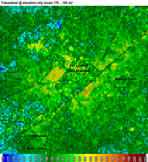
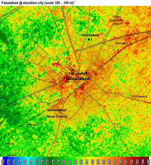
Below is the Elevation map of Faisalabad, which displays elevation range with different colors. Scale of the first map is from 176 to 195 m (577 to 640 ft) with average elevation of 185.4 meters (=608 ft) [note 1]
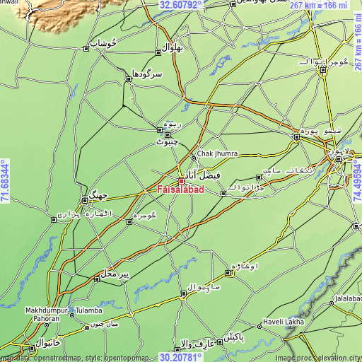
These maps also provides idea of topography and contour of this city, they are displayed at different zoom levels. More info about maps, scale and edge coordinates you can find below images.
| \ | Map #1 | Map #2 | Topo.Map |
| Scale [m] | 176..195 m | 169..195 m | × |
| Scale [ft] | 577..640 ft | 554..640 ft | × |
| Average | 185.4 m = 608 ft | 183.4 m = 602 ft | × |
| Width | 8.34 km = 5.2 mi | 16.68 km = 10.4 mi | 266.9 km = 165.8 mi |
| Height | 8.34 km = 5.2 mi | 16.68 km = 10.4 mi | 266.9 km = 165.8 mi |
| ↑Max Latitude | 31.453036° | 31.490517° | 32.60792° |
| Latitude at center | 31.41554° | 31.41554° | 31.41554° |
| ↓Min Latitude | 31.378029° | 31.340503° | 30.20781° |
| ← Min Longitude | 73.045745° | 73.001799° | 71.68344° |
| Longitude center | 73.08969° | 73.08969° | 73.08969° |
| →Max Longitude | 73.133635° | 73.177581° | 74.49594° |
Nearby cities:
Cities around Faisalabad sort by population:
• Chiniot elevation 189 m
35.6 km,  342°
342°
• Shahkot 197 m
41.3 km,  65°
65°
• Gojra 169 m
48.7 km,  232°
232°
• Jaranwala 193 m
32.5 km,  106°
106°
• Chenab Nagar 183 m
41.3 km, 336°
• Sangla Hill 194 m
43.5 km,  39°
39°
• Tandlianwala 184 m
42.7 km,  174°
174°
• Chak Jhumra 190 m
19.1 km,  27°
27°
• Khurrianwala 190 m
19.3 km,  61°
61°
• Lalian 179 m
53.1 km,  329°
329°
• Dijkot 179 m
23.8 km,  201°
201°
• Bhawana 172 m
45.1 km,  292°
292°
Multilingual:
 En español:
Faisalabad elevación 186 m.
 En France:
Faisalabad élévation 186 m.
 Auf Deutsch:
Faisalabad höhe über dem Meeresspiegel ist 186 m.

Sources and notes:
- [note 1] Map square and city borders are not equal. Map elevation data is calculated only from area inside that square.
- [src 1] Elevation data from geonames database provided with same terms of usage.
- [src 2] The elevation map of Faisalabad is generated using elevation data from NASA's 3 arcsec (90m) resolution SRTM data.
- [src 3] Base (background) map © OpenStreetMap contributors tiles are generated by Geofabrik and OpenTopoMap.
Copyright & License:
This Faisalabad Elevation Map is licensed under CC BY-SA. You may reuse any part from this page, if you give a proper credit by linking to this URL:
 More info on terms of use page.