Ghotki elevation
Ghotki (Sindh), Pakistan elevation is 71 meters and Ghotki elevation in feet is 233 ft above sea level [src 1]. Ghotki is a seat of a second-order administrative division (feature code) with elevation that is 275 meters (902 ft) smaller than average city elevation in Pakistan.
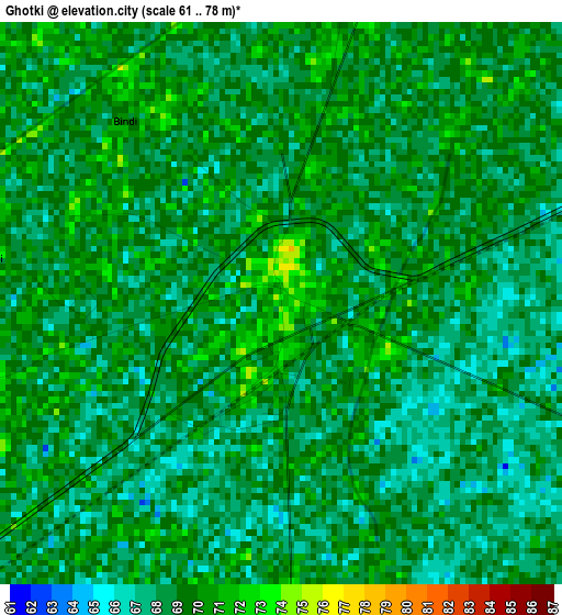
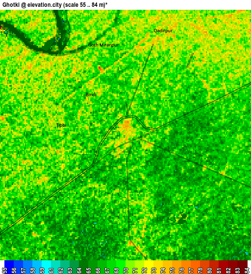
Below is the Elevation map of Ghotki, which displays elevation range with different colors. Scale of the first map is from 61 to 78 m (200 to 256 ft) with average elevation of 68.6 meters (=225 ft) [note 1]
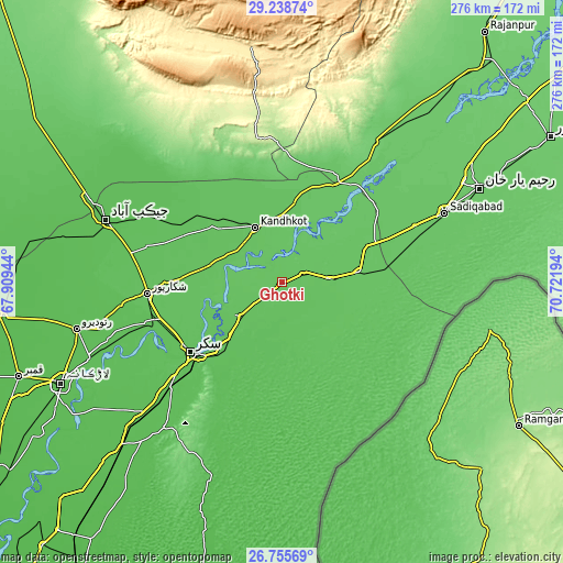
These maps also provides idea of topography and contour of this city, they are displayed at different zoom levels. More info about maps, scale and edge coordinates you can find below images.
| \ | Map #1 | Map #2 | Topo.Map |
| Scale [m] | 61..78 m | 55..84 m | × |
| Scale [ft] | 200..256 ft | 180..276 ft | × |
| Average | 68.6 m = 225 ft | 68.7 m = 225 ft | × |
| Width | 8.63 km = 5.4 mi | 17.26 km = 10.7 mi | 276.1 km = 171.6 mi |
| Height | 8.63 km = 5.4 mi | 17.26 km = 10.7 mi | 276.1 km = 171.6 mi |
| ↑Max Latitude | 28.043163° | 28.081942° | 29.23874° |
| Latitude at center | 28.00437° | 28.00437° | 28.00437° |
| ↓Min Latitude | 27.965563° | 27.926742° | 26.75569° |
| ← Min Longitude | 69.271745° | 69.227799° | 67.90944° |
| Longitude center | 69.31569° | 69.31569° | 69.31569° |
| →Max Longitude | 69.359635° | 69.403581° | 70.72194° |
Nearby cities:
Cities around Ghotki sort by population:
• Kandhkot elevation 71 m
30 km,  333°
333°
• Pano Aqil 69 m
26 km,  230°
230°
• Rohri 71 m
54 km, 229°
• Mirpur Mathelo 76 m
23 km,  85°
85°
• Khairpur 72 m
38.7 km,  80°
80°
• Ghauspur 73 m
27.3 km,  303°
303°
• Ubauro 74 m
44.5 km,  66°
66°
• Khanpur Mahar 70 m
20.5 km,  152°
152°
• Chak 66 m
50 km,  251°
251°
• Tangwani 68 m
43.6 km,  314°
314°
• Rustam 70 m
50.4 km,  265°
265°
• Adilpur 77 m
7.5 km,  177°
177°
Multilingual:
 En español:
Ghotki elevación 71 m.
 En France:
Ghotki élévation 71 m.


Sources and notes:
- [note 1] Map square and city borders are not equal. Map elevation data is calculated only from area inside that square.
- [src 1] Elevation data from geonames database provided with same terms of usage.
- [src 2] The elevation map of Ghotki is generated using elevation data from NASA's 3 arcsec (90m) resolution SRTM data.
- [src 3] Base (background) map © OpenStreetMap contributors tiles are generated by Geofabrik and OpenTopoMap.
Copyright & License:
This Ghotki Elevation Map is licensed under CC BY-SA. You may reuse any part from this page, if you give a proper credit by linking to this URL:
 More info on terms of use page.