Rustam elevation
Rustam (Sindh), Pakistan elevation is 70 meters and Rustam elevation in feet is 230 ft above sea level [src 1]. Rustam is a populated place (feature code) with elevation that is 276 meters (906 ft) smaller than average city elevation in Pakistan.
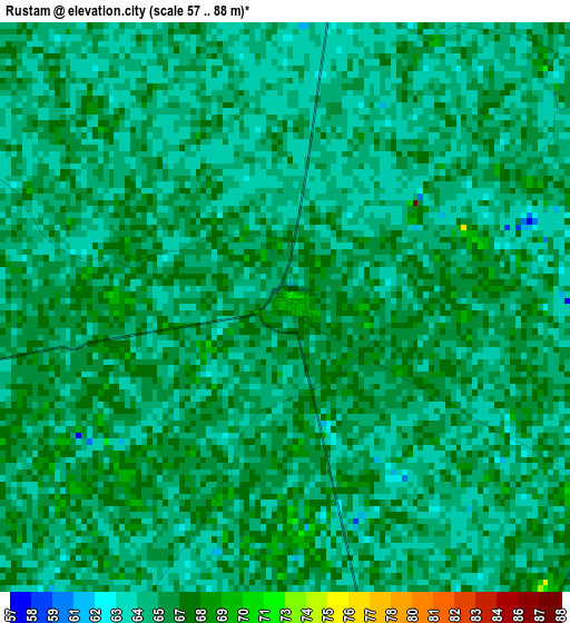
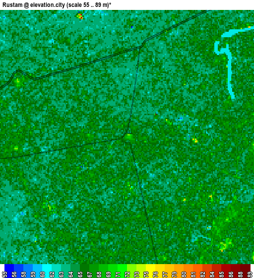
Below is the Elevation map of Rustam, which displays elevation range with different colors. Scale of the first map is from 57 to 88 m (187 to 289 ft) with average elevation of 65.5 meters (=215 ft) [note 1]
These maps also provides idea of topography and contour of this city, they are displayed at different zoom levels. More info about maps, scale and edge coordinates you can find below images.
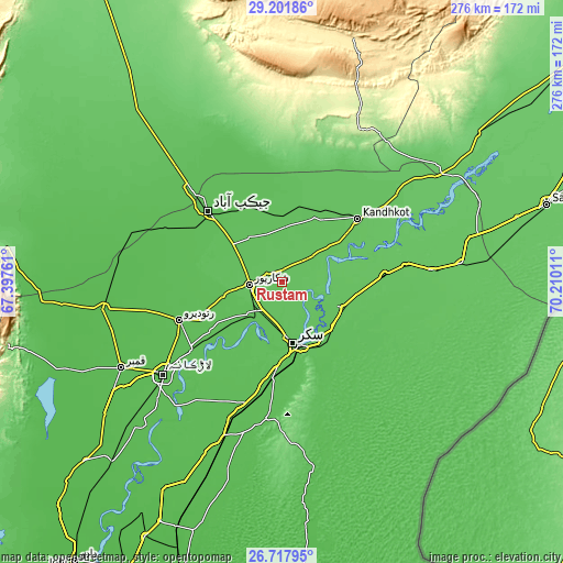
| \ | Map #1 | Map #2 | Topo.Map |
| Scale [m] | 57..88 m | 55..89 m | × |
| Scale [ft] | 187..289 ft | 180..292 ft | × |
| Average | 65.5 m = 215 ft | 65.4 m = 215 ft | × |
| Width | 8.63 km = 5.4 mi | 17.26 km = 10.7 mi | 276.2 km = 171.6 mi |
| Height | 8.63 km = 5.4 mi | 17.26 km = 10.7 mi | 276.2 km = 171.6 mi |
| ↑Max Latitude | 28.005856° | 28.044649° | 29.20186° |
| Latitude at center | 27.96705° | 27.96705° | 27.96705° |
| ↓Min Latitude | 27.92823° | 27.889396° | 26.71795° |
| ← Min Longitude | 68.759915° | 68.715969° | 67.39761° |
| Longitude center | 68.80386° | 68.80386° | 68.80386° |
| →Max Longitude | 68.847805° | 68.891751° | 70.21011° |
Nearby cities:
Cities around Rustam sort by population:
• Sukkur elevation 72 m
29.8 km,  169°
169°
• Shikarpur 71 m
16.3 km,  265°
265°
• Pano Aqil 69 m
32.6 km,  112°
112°
• Rohri 71 m
31.9 km,  163°
163°
• Thul 64 m
30.5 km,  354°
354°
• Ghauspur 73 m
33.3 km,  55°
55°
• Garhiyasin 60 m
29.4 km,  256°
256°
• Madeji 61 m
42 km,  235°
235°
• Chak 66 m
12.4 km, 166°
• Lakhi 72 m
16.7 km,  217°
217°
• Tangwani 68 m
39.5 km,  28°
28°
• Bagarji 63 m
24.1 km,  190°
190°
Multilingual:
 En español:
Rustam elevación 70 m.
 En France:
Rustam élévation 70 m.


Sources and notes:
- [note 1] Map square and city borders are not equal. Map elevation data is calculated only from area inside that square.
- [src 1] Elevation data from geonames database provided with same terms of usage.
- [src 2] The elevation map of Rustam is generated using elevation data from NASA's 3 arcsec (90m) resolution SRTM data.
- [src 3] Base (background) map © OpenStreetMap contributors tiles are generated by Geofabrik and OpenTopoMap.
Copyright & License:
This Rustam Elevation Map is licensed under CC BY-SA. You may reuse any part from this page, if you give a proper credit by linking to this URL:
 More info on terms of use page.