Mailsi elevation
Mailsi (Punjab), Pakistan elevation is 133 meters and Mailsi elevation in feet is 436 ft above sea level [src 1]. Mailsi is a populated place (feature code) with elevation that is 213 meters (699 ft) smaller than average city elevation in Pakistan.
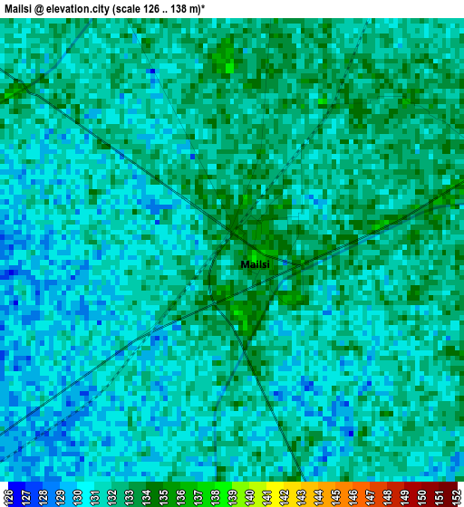
Below is the Elevation map of Mailsi, which displays elevation range with different colors. Scale of the first map is from 126 to 138 m (413 to 453 ft) with average elevation of 131.2 meters (=430 ft) [note 1]
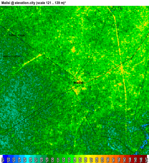
These maps also provides idea of topography and contour of this city, they are displayed at different zoom levels. More info about maps, scale and edge coordinates you can find below images.
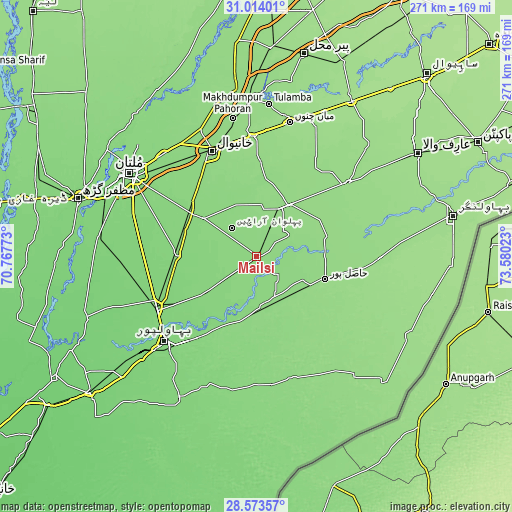
| \ | Map #1 | Map #2 | Topo.Map |
| Scale [m] | 126..138 m | 121..139 m | × |
| Scale [ft] | 413..453 ft | 397..456 ft | × |
| Average | 131.2 m = 430 ft | 130.7 m = 429 ft | × |
| Width | 8.48 km = 5.3 mi | 16.96 km = 10.5 mi | 271.4 km = 168.6 mi |
| Height | 8.48 km = 5.3 mi | 16.96 km = 10.5 mi | 271.4 km = 168.6 mi |
| ↑Max Latitude | 29.839356° | 29.877468° | 31.01401° |
| Latitude at center | 29.80123° | 29.80123° | 29.80123° |
| ↓Min Latitude | 29.763089° | 29.724933° | 28.57357° |
| ← Min Longitude | 72.130035° | 72.086089° | 70.76773° |
| Longitude center | 72.17398° | 72.17398° | 72.17398° |
| →Max Longitude | 72.217925° | 72.261871° | 73.58023° |
Nearby cities:
Cities around Mailsi sort by population:
• Bahawalpur elevation 121 m
65.9 km,  227°
227°
• Būrewāla 146 m
61.3 km,  48°
48°
• Chishtian 149 m
66 km,  90°
90°
• Vihari 140 m
32.2 km,  32°
32°
• Lodhran 116 m
60.2 km,  240°
240°
• Hasilpur 141 m
37.9 km,  108°
108°
• Kahror Pakka 132 m
31.9 km, 231°
• Dunyapur 122 m
41.5 km,  270°
270°
• Khairpur Tamewah 133 m
25.2 km,  165°
165°
• Qadirpur Ran 131 m
72.9 km,  318°
318°
• Dhanot 120 m
47.6 km, 238°
• Khanewal 138 m
60.3 km,  337°
337°
Multilingual:
 En español:
Mailsi elevación 133 m.
 En France:
Mailsi élévation 133 m.


Sources and notes:
- [note 1] Map square and city borders are not equal. Map elevation data is calculated only from area inside that square.
- [src 1] Elevation data from geonames database provided with same terms of usage.
- [src 2] The elevation map of Mailsi is generated using elevation data from NASA's 3 arcsec (90m) resolution SRTM data.
- [src 3] Base (background) map © OpenStreetMap contributors tiles are generated by Geofabrik and OpenTopoMap.
Copyright & License:
This Mailsi Elevation Map is licensed under CC BY-SA. You may reuse any part from this page, if you give a proper credit by linking to this URL:
 More info on terms of use page.