Shahdad Kot elevation
Shahdad Kot (Sindh), Pakistan elevation is 52 meters and Shahdad Kot elevation in feet is 171 ft above sea level [src 1]. Shahdad Kot is a seat of a second-order administrative division (feature code) with elevation that is 294 meters (965 ft) smaller than average city elevation in Pakistan.
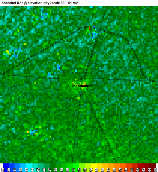
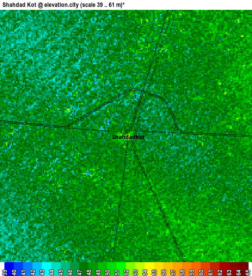
Below is the Elevation map of Shahdad Kot, which displays elevation range with different colors. Scale of the first map is from 39 to 61 m (128 to 200 ft) with average elevation of 47 meters (=154 ft) [note 1]
These maps also provides idea of topography and contour of this city, they are displayed at different zoom levels. More info about maps, scale and edge coordinates you can find below images.
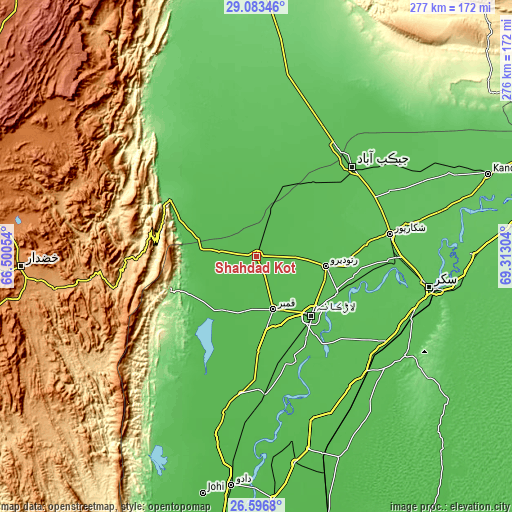
| \ | Map #1 | Map #2 | Topo.Map |
| Scale [m] | 39..61 m | 39..61 m | × |
| Scale [ft] | 128..200 ft | 128..200 ft | × |
| Average | 47 m = 154 ft | 47.1 m = 155 ft | × |
| Width | 8.64 km = 5.4 mi | 17.28 km = 10.7 mi | 276.5 km = 171.8 mi |
| Height | 8.64 km = 5.4 mi | 17.28 km = 10.7 mi | 276.5 km = 171.8 mi |
| ↑Max Latitude | 27.886109° | 27.924945° | 29.08346° |
| Latitude at center | 27.84726° | 27.84726° | 27.84726° |
| ↓Min Latitude | 27.808397° | 27.76952° | 26.5968° |
| ← Min Longitude | 67.862845° | 67.818899° | 66.50054° |
| Longitude center | 67.90679° | 67.90679° | 67.90679° |
| →Max Longitude | 67.950735° | 67.994681° | 69.31304° |
Nearby cities:
Cities around Shahdad Kot sort by population:
• Larkana elevation 52 m
43.9 km,  136°
136°
• Kambar 53 m
30.3 km,  162°
162°
• Ratodero 60 m
37.9 km,  97°
97°
• Usta Muhammad 57 m
39.1 km,  20°
20°
• Mehrabpur 53 m
31.2 km, 21°
• Naudero 57 m
49 km,  114°
114°
• Nasirabad 49 m
51.8 km,  178°
178°
• Warah 51 m
45.7 km,  193°
193°
• Garhi Khairo 51 m
24.8 km, 16°
• Miro Khan 55 m
20.6 km,  118°
118°
• Goth Garelo 58 m
48.7 km, 160°
• Chowki Jamali 48 m
19.2 km,  4°
4°
Multilingual:
 En español:
Shahdad Kot elevación 52 m.
 En France:
Shahdad Kot élévation 52 m.
 Auf Deutsch:
Shahdad Kot höhe über dem Meeresspiegel ist 52 m.

Sources and notes:
- [note 1] Map square and city borders are not equal. Map elevation data is calculated only from area inside that square.
- [src 1] Elevation data from geonames database provided with same terms of usage.
- [src 2] The elevation map of Shahdad Kot is generated using elevation data from NASA's 3 arcsec (90m) resolution SRTM data.
- [src 3] Base (background) map © OpenStreetMap contributors tiles are generated by Geofabrik and OpenTopoMap.
Copyright & License:
This Shahdad Kot Elevation Map is licensed under CC BY-SA. You may reuse any part from this page, if you give a proper credit by linking to this URL:
 More info on terms of use page.