Goth Garelo elevation
Goth Garelo (Sindh), Pakistan elevation is 58 meters and Goth Garelo elevation in feet is 190 ft above sea level [src 1]. Goth Garelo is a populated place (feature code) with elevation that is 288 meters (945 ft) smaller than average city elevation in Pakistan.
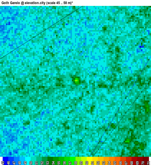
Below is the Elevation map of Goth Garelo, which displays elevation range with different colors. Scale of the first map is from 45 to 58 m (148 to 190 ft) with average elevation of 49.9 meters (=164 ft) [note 1]
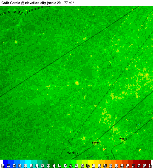
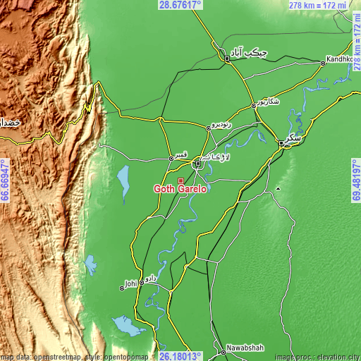
These maps also provides idea of topography and contour of this city, they are displayed at different zoom levels. More info about maps, scale and edge coordinates you can find below images.
| \ | Map #1 | Map #2 | Topo.Map |
| Scale [m] | 45..58 m | 29..77 m | × |
| Scale [ft] | 148..190 ft | 95..253 ft | × |
| Average | 49.9 m = 164 ft | 49.4 m = 162 ft | × |
| Width | 8.67 km = 5.4 mi | 17.35 km = 10.8 mi | 277.5 km = 172.4 mi |
| Height | 8.67 km = 5.4 mi | 17.35 km = 10.8 mi | 277.5 km = 172.4 mi |
| ↑Max Latitude | 27.474206° | 27.513188° | 28.67617° |
| Latitude at center | 27.43521° | 27.43521° | 27.43521° |
| ↓Min Latitude | 27.3962° | 27.357177° | 26.18013° |
| ← Min Longitude | 68.031775° | 67.987829° | 66.66947° |
| Longitude center | 68.07572° | 68.07572° | 68.07572° |
| →Max Longitude | 68.119665° | 68.163611° | 69.48197° |
Nearby cities:
Cities around Goth Garelo sort by population:
• Larkana elevation 52 m
19.2 km,  44°
44°
• Kambar 53 m
18.5 km,  336°
336°
• New Bādāh 47 m
11.3 km,  202°
202°
• Naudero 57 m
38.1 km,  47°
47°
• Mehar 48 m
37.9 km,  221°
221°
• Nasirabad 49 m
16.8 km,  249°
249°
• Hingorja 55 m
41.9 km,  126°
126°
• Warah 51 m
27.6 km,  272°
272°
• Goth Radhan 50 m
29 km, 204°
• Dokri 54 m
7.1 km,  162°
162°
• Sobhodero 55 m
34.9 km,  114°
114°
• Miro Khan 55 m
36.1 km,  2°
2°
Multilingual:
 En español:
Goth Garelo elevación 58 m.
 En France:
Goth Garelo élévation 58 m.
 Auf Deutsch:
Goth Garelo höhe über dem Meeresspiegel ist 58 m.

Sources and notes:
- [note 1] Map square and city borders are not equal. Map elevation data is calculated only from area inside that square.
- [src 1] Elevation data from geonames database provided with same terms of usage.
- [src 2] The elevation map of Goth Garelo is generated using elevation data from NASA's 3 arcsec (90m) resolution SRTM data.
- [src 3] Base (background) map © OpenStreetMap contributors tiles are generated by Geofabrik and OpenTopoMap.
Copyright & License:
This Goth Garelo Elevation Map is licensed under CC BY-SA. You may reuse any part from this page, if you give a proper credit by linking to this URL:
 More info on terms of use page.