Shahr Sultan elevation
Shahr Sultan (Punjab), Pakistan elevation is 111 meters and Shahr Sultan elevation in feet is 364 ft above sea level [src 1]. Shahr Sultan is a populated place (feature code) with elevation that is 235 meters (771 ft) smaller than average city elevation in Pakistan.
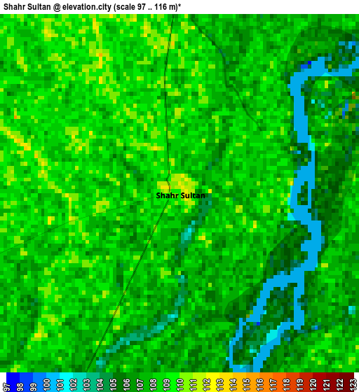
Below is the Elevation map of Shahr Sultan, which displays elevation range with different colors. Scale of the first map is from 97 to 116 m (318 to 381 ft) with average elevation of 107.2 meters (=352 ft) [note 1]
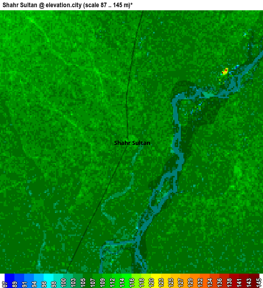
These maps also provides idea of topography and contour of this city, they are displayed at different zoom levels. More info about maps, scale and edge coordinates you can find below images.
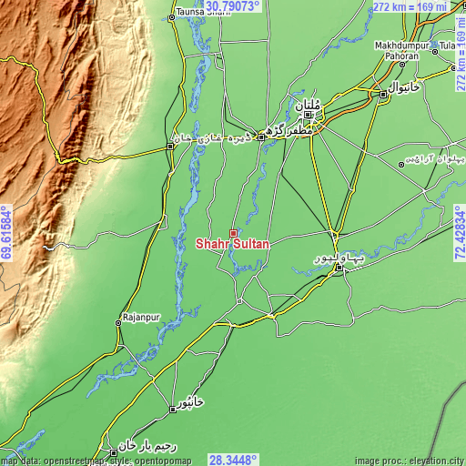
| \ | Map #1 | Map #2 | Topo.Map |
| Scale [m] | 97..116 m | 87..145 m | × |
| Scale [ft] | 318..381 ft | 285..476 ft | × |
| Average | 107.2 m = 352 ft | 107.2 m = 352 ft | × |
| Width | 8.5 km = 5.3 mi | 17 km = 10.6 mi | 272 km = 169 mi |
| Height | 8.5 km = 5.3 mi | 17 km = 10.6 mi | 272 km = 169 mi |
| ↑Max Latitude | 29.613382° | 29.65158° | 30.79073° |
| Latitude at center | 29.57517° | 29.57517° | 29.57517° |
| ↓Min Latitude | 29.536943° | 29.498702° | 28.3448° |
| ← Min Longitude | 70.978145° | 70.934199° | 69.61584° |
| Longitude center | 71.02209° | 71.02209° | 71.02209° |
| →Max Longitude | 71.066035° | 71.109981° | 72.42834° |
Nearby cities:
Cities around Shahr Sultan sort by population:
• Bahawalpur elevation 121 m
66.2 km,  107°
107°
• Dera Ghazi Khan 122 m
64 km,  324°
324°
• Muzaffargarh 120 m
57.7 km,  16°
16°
• Ahmadpur East 105 m
53.2 km,  154°
154°
• Lodhran 116 m
59.2 km,  94°
94°
• Shujaabad 123 m
42.9 km,  37°
37°
• Jampur 107 m
41.9 km,  280°
280°
• Jatoi Shimali 106 m
18.3 km,  249°
249°
• Jalalpur Pirwala 109 m
20.9 km, 111°
• Alipur 107 m
24 km,  206°
206°
• Khangarh 120 m
40 km, 19°
• Dajal 124 m
62.5 km,  268°
268°
Multilingual:
 En español:
Shahr Sultan elevación 111 m.
 En France:
Shahr Sultan élévation 111 m.
 Auf Deutsch:
Shahr Sultan höhe über dem Meeresspiegel ist 111 m.

Sources and notes:
- [note 1] Map square and city borders are not equal. Map elevation data is calculated only from area inside that square.
- [src 1] Elevation data from geonames database provided with same terms of usage.
- [src 2] The elevation map of Shahr Sultan is generated using elevation data from NASA's 3 arcsec (90m) resolution SRTM data.
- [src 3] Base (background) map © OpenStreetMap contributors tiles are generated by Geofabrik and OpenTopoMap.
Copyright & License:
This Shahr Sultan Elevation Map is licensed under CC BY-SA. You may reuse any part from this page, if you give a proper credit by linking to this URL:
 More info on terms of use page.