Alabel elevation
Alabel (Soccsksargen, Province of Sarangani), Philippines elevation is 40 meters and Alabel elevation in feet is 131 ft above sea level [src 1]. Alabel is a seat of a second-order administrative division (feature code) with elevation that is 48 meters (157 ft) smaller than average city elevation in Philippines.
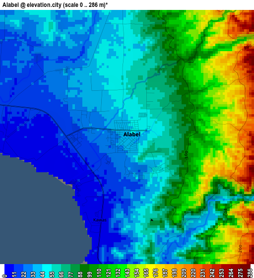
Below is the Elevation map of Alabel, which displays elevation range with different colors. Scale of the first map is from 0 to 286 m (0 to 938 ft) with average elevation of 74.3 meters (=244 ft) [note 1]
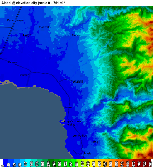
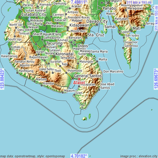
These maps also provides idea of topography and contour of this city, they are displayed at different zoom levels. More info about maps, scale and edge coordinates you can find below images.
| \ | Map #1 | Map #2 | Topo.Map |
| Scale [m] | 0..286 m | 0..761 m | × |
| Scale [ft] | 0..938 ft | 0..2497 ft | × |
| Average | 74.3 m = 244 ft | 142.9 m = 469 ft | × |
| Width | 9.72 km = 6 mi | 19.43 km = 12.1 mi | 310.9 km = 193.2 mi |
| Height | 9.72 km = 6 mi | 19.43 km = 12.1 mi | 310.9 km = 193.2 mi |
| ↑Max Latitude | 6.145485° | 6.189176° | 7.49811° |
| Latitude at center | 6.10179° | 6.10179° | 6.10179° |
| ↓Min Latitude | 6.058092° | 6.01439° | 4.70182° |
| ← Min Longitude | 125.246535° | 125.202589° | 123.88423° |
| Longitude center | 125.29048° | 125.29048° | 125.29048° |
| →Max Longitude | 125.334425° | 125.378371° | 126.69673° |
Nearby cities:
Cities around Alabel sort by population:
• General Santos elevation 22 m
13.2 km,  275°
275°
• Maluñgun 127 m
19.7 km,  357°
357°
• Malapatan 26 m
14.7 km,  180°
180°
• Buayan 13 m
6.4 km, 284°
• Lun Pequeño 13 m
7.2 km,  185°
185°
• Conel 100 m
16 km,  314°
314°
• Katangawan 38 m
10.9 km,  315°
315°
• Suyan 112 m
11.5 km,  113°
113°
• Tinagacan 55 m
12.8 km,  328°
328°
• Tuyan 1 m
11.3 km, 183°
• Batutitik 49 m
14.2 km,  342°
342°
• Klinan 165 m
19.4 km,  299°
299°
Multilingual:
 En español:
Alabel elevación 40 m.
 En France:
Alabel élévation 40 m.


Sources and notes:
- [note 1] Map square and city borders are not equal. Map elevation data is calculated only from area inside that square.
- [src 1] Elevation data from geonames database provided with same terms of usage.
- [src 2] The elevation map of Alabel is generated using elevation data from NASA's 3 arcsec (90m) resolution SRTM data.
- [src 3] Base (background) map © OpenStreetMap contributors tiles are generated by Geofabrik and OpenTopoMap.
Copyright & License:
This Alabel Elevation Map is licensed under CC BY-SA. You may reuse any part from this page, if you give a proper credit by linking to this URL:
 More info on terms of use page.