Conel elevation
Conel (Soccsksargen, Province of South Cotabato), Philippines elevation is 100 meters and Conel elevation in feet is 328 ft above sea level [src 1]. Conel is a populated place (feature code) with elevation that is 12 meters (39 ft) bigger than average city elevation in Philippines.
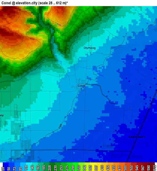
Below is the Elevation map of Conel, which displays elevation range with different colors. Scale of the first map is from 28 to 612 m (92 to 2008 ft) with average elevation of 147.6 meters (=484 ft) [note 1]
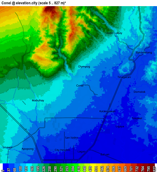
These maps also provides idea of topography and contour of this city, they are displayed at different zoom levels. More info about maps, scale and edge coordinates you can find below images.
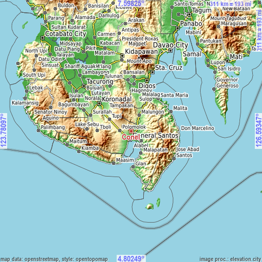
| \ | Map #1 | Map #2 | Topo.Map |
| Scale [m] | 28..612 m | 5..827 m | × |
| Scale [ft] | 92..2008 ft | 16..2713 ft | × |
| Average | 147.6 m = 484 ft | 174 m = 571 ft | × |
| Width | 9.72 km = 6 mi | 19.43 km = 12.1 mi | 310.9 km = 193.2 mi |
| Height | 9.72 km = 6 mi | 19.43 km = 12.1 mi | 310.9 km = 193.2 mi |
| ↑Max Latitude | 6.245906° | 6.289589° | 7.59825° |
| Latitude at center | 6.20222° | 6.20222° | 6.20222° |
| ↓Min Latitude | 6.15853° | 6.114837° | 4.80249° |
| ← Min Longitude | 125.143275° | 125.099329° | 123.78097° |
| Longitude center | 125.18722° | 125.18722° | 125.18722° |
| →Max Longitude | 125.231165° | 125.275111° | 126.59347° |
Nearby cities:
Cities around Conel sort by population:
• General Santos elevation 22 m
10.1 km,  189°
189°
• Maluñgun 127 m
13.5 km,  50°
50°
• Buayan 13 m
10.9 km,  151°
151°
• Malandag 198 m
13.7 km,  29°
29°
• Katangawan 38 m
5 km,  131°
131°
• Silway 7 146 m
7.9 km,  249°
249°
• Tinagacan 55 m
4.7 km,  94°
94°
• Glamang 228 m
12.2 km, 248°
• Upper Klinan 288 m
7.8 km,  290°
290°
• Batutitik 49 m
7.5 km,  71°
71°
• Klinan 165 m
5.8 km, 252°
• Polo 452 m
10.8 km,  310°
310°
Multilingual:
 En español:
Conel elevación 100 m.
 En France:
Conel élévation 100 m.


Sources and notes:
- [note 1] Map square and city borders are not equal. Map elevation data is calculated only from area inside that square.
- [src 1] Elevation data from geonames database provided with same terms of usage.
- [src 2] The elevation map of Conel is generated using elevation data from NASA's 3 arcsec (90m) resolution SRTM data.
- [src 3] Base (background) map © OpenStreetMap contributors tiles are generated by Geofabrik and OpenTopoMap.
Copyright & License:
This Conel Elevation Map is licensed under CC BY-SA. You may reuse any part from this page, if you give a proper credit by linking to this URL:
 More info on terms of use page.