Alfonso elevation
Alfonso (Calabarzon, Province of Cavite), Philippines elevation is 413 meters and Alfonso elevation in feet is 1355 ft above sea level [src 1]. Alfonso is a seat of a third-order administrative division (feature code) with elevation that is 325 meters (1066 ft) bigger than average city elevation in Philippines.
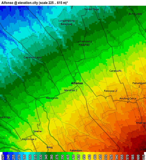
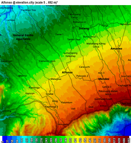
Below is the Elevation map of Alfonso, which displays elevation range with different colors. Scale of the first map is from 225 to 615 m (738 to 2018 ft) with average elevation of 407.5 meters (=1337 ft) [note 1]
These maps also provides idea of topography and contour of this city, they are displayed at different zoom levels. More info about maps, scale and edge coordinates you can find below images.
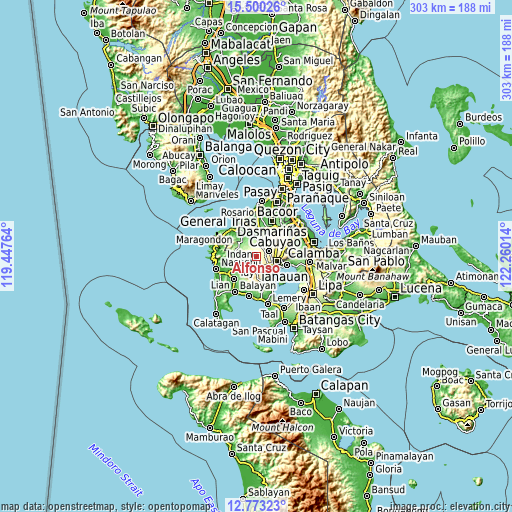
| \ | Map #1 | Map #2 | Topo.Map |
| Scale [m] | 225..615 m | 5..692 m | × |
| Scale [ft] | 738..2018 ft | 16..2270 ft | × |
| Average | 407.5 m = 1337 ft | 358.1 m = 1175 ft | × |
| Width | 9.48 km = 5.9 mi | 18.95 km = 11.8 mi | 303.2 km = 188.4 mi |
| Height | 9.48 km = 5.9 mi | 18.95 km = 11.8 mi | 303.2 km = 188.4 mi |
| ↑Max Latitude | 14.18344° | 14.226041° | 15.50026° |
| Latitude at center | 14.14083° | 14.14083° | 14.14083° |
| ↓Min Latitude | 14.098212° | 14.055587° | 12.77323° |
| ← Min Longitude | 120.809945° | 120.765999° | 119.44764° |
| Longitude center | 120.85389° | 120.85389° | 120.85389° |
| →Max Longitude | 120.897835° | 120.941781° | 122.26014° |
Nearby cities:
Cities around Alfonso sort by population:
• Indang elevation 300 m
6.5 km,  22°
22°
• Mendez-Nuñez 532 m
5.8 km,  103°
103°
• General Emilio Aguinaldo 213 m
7.9 km,  307°
307°
• Aga 368 m
7.4 km,  228°
228°
• Mangas 498 m
2.9 km,  151°
151°
• Luksuhin 569 m
5.7 km, 149°
• Kaytitinga 450 m
4.6 km,  215°
215°
• Anuling 522 m
4.5 km,  114°
114°
• Taywanak Ilaya 351 m
2 km,  336°
336°
• Guyam Malaki 395 m
1.5 km,  30°
30°
• Matagbak 402 m
2.4 km,  241°
241°
• Batas 201 m
7.7 km,  328°
328°
Multilingual:
 En español:
Alfonso elevación 413 m.
 En France:
Alfonso élévation 413 m.


Sources and notes:
- [note 1] Map square and city borders are not equal. Map elevation data is calculated only from area inside that square.
- [src 1] Elevation data from geonames database provided with same terms of usage.
- [src 2] The elevation map of Alfonso is generated using elevation data from NASA's 3 arcsec (90m) resolution SRTM data.
- [src 3] Base (background) map © OpenStreetMap contributors tiles are generated by Geofabrik and OpenTopoMap.
Copyright & License:
This Alfonso Elevation Map is licensed under CC BY-SA. You may reuse any part from this page, if you give a proper credit by linking to this URL:
 More info on terms of use page.