Banaba elevation
Banaba (Calabarzon, Province of Cavite), Philippines elevation is 223 meters and Banaba elevation in feet is 732 ft above sea level [src 1]. Banaba is a populated place (feature code) with elevation that is 135 meters (443 ft) bigger than average city elevation in Philippines.
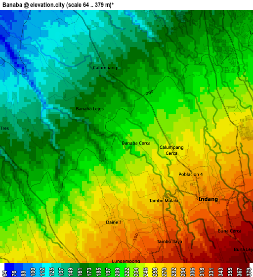
Below is the Elevation map of Banaba, which displays elevation range with different colors. Scale of the first map is from 64 to 379 m (210 to 1243 ft) with average elevation of 213.9 meters (=702 ft) [note 1]
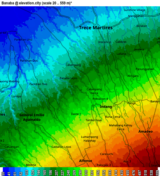
These maps also provides idea of topography and contour of this city, they are displayed at different zoom levels. More info about maps, scale and edge coordinates you can find below images.
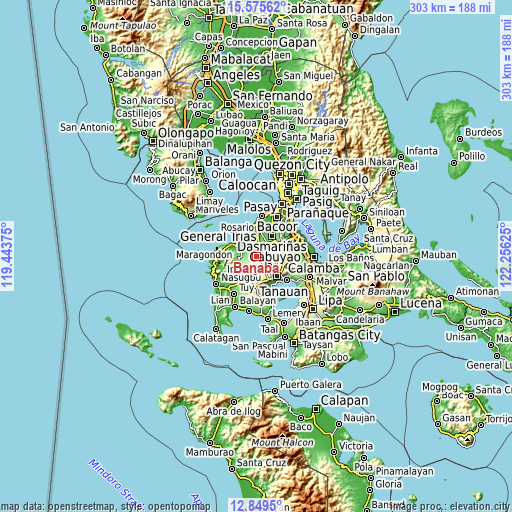
| \ | Map #1 | Map #2 | Topo.Map |
| Scale [m] | 64..379 m | 20..559 m | × |
| Scale [ft] | 210..1243 ft | 66..1834 ft | × |
| Average | 213.9 m = 702 ft | 222.8 m = 731 ft | × |
| Width | 9.47 km = 5.9 mi | 18.95 km = 11.8 mi | 303.1 km = 188.3 mi |
| Height | 9.47 km = 5.9 mi | 18.95 km = 11.8 mi | 303.1 km = 188.3 mi |
| ↑Max Latitude | 14.259265° | 14.301853° | 15.57562° |
| Latitude at center | 14.21667° | 14.21667° | 14.21667° |
| ↓Min Latitude | 14.174067° | 14.131455° | 12.8495° |
| ← Min Longitude | 120.806055° | 120.762109° | 119.44375° |
| Longitude center | 120.85° | 120.85° | 120.85° |
| →Max Longitude | 120.893945° | 120.937891° | 122.25625° |
Nearby cities:
Cities around Banaba sort by population:
• Indang elevation 300 m
3.8 km,  129°
129°
• General Emilio Aguinaldo 213 m
6.9 km,  238°
238°
• Palangue 61 m
8.6 km,  330°
330°
• Alfonso 413 m
8.4 km,  177°
177°
• Pantijan No 2 104 m
5.6 km,  288°
288°
• Javalera 198 m
8.4 km,  56°
56°
• Bitangan 178 m
5.1 km,  36°
36°
• Taywanak Ilaya 351 m
6.6 km, 183°
• Guyam Malaki 395 m
7.2 km,  170°
170°
• Aliang 124 m
8.2 km,  25°
25°
• Batas 201 m
4 km, 242°
• Pangil 327 m
6.5 km,  105°
105°
Multilingual:
 En español:
Banaba elevación 223 m.
 En France:
Banaba élévation 223 m.


Sources and notes:
- [note 1] Map square and city borders are not equal. Map elevation data is calculated only from area inside that square.
- [src 1] Elevation data from geonames database provided with same terms of usage.
- [src 2] The elevation map of Banaba is generated using elevation data from NASA's 3 arcsec (90m) resolution SRTM data.
- [src 3] Base (background) map © OpenStreetMap contributors tiles are generated by Geofabrik and OpenTopoMap.
Copyright & License:
This Banaba Elevation Map is licensed under CC BY-SA. You may reuse any part from this page, if you give a proper credit by linking to this URL:
 More info on terms of use page.