Pantijan No 2 elevation
Pantijan No 2 (Calabarzon, Province of Cavite), Philippines elevation is 104 meters and Pantijan No 2 elevation in feet is 341 ft above sea level [src 1]. Pantijan No 2 is a populated place (feature code) with elevation that is 16 meters (52 ft) bigger than average city elevation in Philippines.
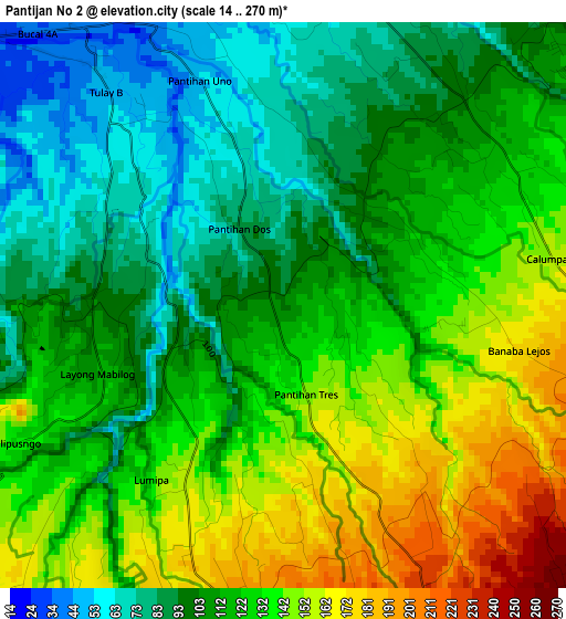
Below is the Elevation map of Pantijan No 2, which displays elevation range with different colors. Scale of the first map is from 14 to 270 m (46 to 886 ft) with average elevation of 118.7 meters (=389 ft) [note 1]
These maps also provides idea of topography and contour of this city, they are displayed at different zoom levels. More info about maps, scale and edge coordinates you can find below images.
| \ | Map #1 | Map #2 | Topo.Map |
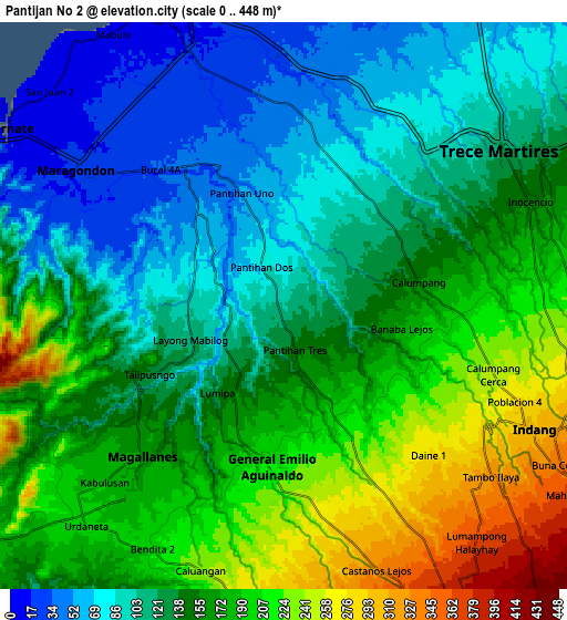
| Scale [m] | 14..270 m | 0..448 m | × |
| Scale [ft] | 46..886 ft | 0..1470 ft | × |
| Average | 118.7 m = 389 ft | 148.7 m = 488 ft | × |
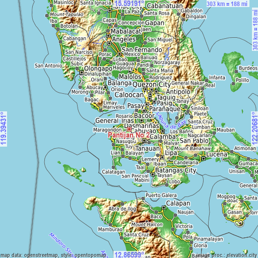
| Width | 9.47 km = 5.9 mi | 18.95 km = 11.8 mi | 303.1 km = 188.3 mi |
| Height | 9.47 km = 5.9 mi | 18.95 km = 11.8 mi | 303.1 km = 188.3 mi |
| ↑Max Latitude | 14.275652° | 14.318237° | 15.59191° |
| Latitude at center | 14.23306° | 14.23306° | 14.23306° |
| ↓Min Latitude | 14.19046° | 14.147851° | 12.86599° |
| ← Min Longitude | 120.756615° | 120.712669° | 119.39431° |
| Longitude center | 120.80056° | 120.80056° | 120.80056° |
| →Max Longitude | 120.844505° | 120.888451° | 122.20681° |
Nearby cities:
Cities around Pantijan No 2 sort by population:
• Indang elevation 300 m
9.2 km,  117°
117°
• Maragondon 21 m
8.1 km,  303°
303°
• General Emilio Aguinaldo 213 m
5.5 km,  185°
185°
• Palangue 61 m
5.8 km,  11°
11°
• Banaba 223 m
5.6 km,  108°
108°
• Sabang 38 m
8.1 km,  2°
2°
• Magallanes 169 m
6.8 km,  223°
223°
• Tulay 40 m
5.3 km,  320°
320°
• Bitangan 178 m
8.7 km,  74°
74°
• Taywanak Ilaya 351 m
9.7 km,  149°
149°
• Malainen Luma 50 m
4.3 km,  342°
342°
• Batas 201 m
4.1 km, 154°
Multilingual:
 En español:
Pantijan No 2 elevación 104 m.
 En France:
Pantijan No 2 élévation 104 m.
 Auf Deutsch:
Pantijan No 2 höhe über dem Meeresspiegel ist 104 m.

Sources and notes:
- [note 1] Map square and city borders are not equal. Map elevation data is calculated only from area inside that square.
- [src 1] Elevation data from geonames database provided with same terms of usage.
- [src 2] The elevation map of Pantijan No 2 is generated using elevation data from NASA's 3 arcsec (90m) resolution SRTM data.
- [src 3] Base (background) map © OpenStreetMap contributors tiles are generated by Geofabrik and OpenTopoMap.
Copyright & License:
This Pantijan No 2 Elevation Map is licensed under CC BY-SA. You may reuse any part from this page, if you give a proper credit by linking to this URL:
 More info on terms of use page.