Bau elevation
Bau (Soccsksargen, Province of Cotabato), Philippines elevation is 162 meters and Bau elevation in feet is 531 ft above sea level [src 1]. Bau is a populated place (feature code) with elevation that is 74 meters (243 ft) bigger than average city elevation in Philippines.
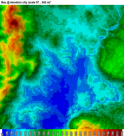
Below is the Elevation map of Bau, which displays elevation range with different colors. Scale of the first map is from 97 to 842 m (318 to 2762 ft) with average elevation of 297.1 meters (=975 ft) [note 1]
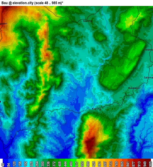
These maps also provides idea of topography and contour of this city, they are displayed at different zoom levels. More info about maps, scale and edge coordinates you can find below images.
| \ | Map #1 | Map #2 | Topo.Map |
| Scale [m] | 97..842 m | 48..985 m | × |
| Scale [ft] | 318..2762 ft | 157..3232 ft | × |
| Average | 297.1 m = 975 ft | 327.6 m = 1075 ft | × |
| Width | 9.69 km = 6 mi | 19.38 km = 12 mi | 310.1 km = 192.7 mi |
| Height | 9.69 km = 6 mi | 19.38 km = 12 mi | 310.1 km = 192.7 mi |
| ↑Max Latitude | 7.448857° | 7.492429° | 8.79746° |
| Latitude at center | 7.40528° | 7.40528° | 7.40528° |
| ↓Min Latitude | 7.361699° | 7.318114° | 6.00869° |
| ← Min Longitude | 124.605775° | 124.561829° | 123.24347° |
| Longitude center | 124.64972° | 124.64972° | 124.64972° |
| →Max Longitude | 124.693665° | 124.737611° | 126.05597° |
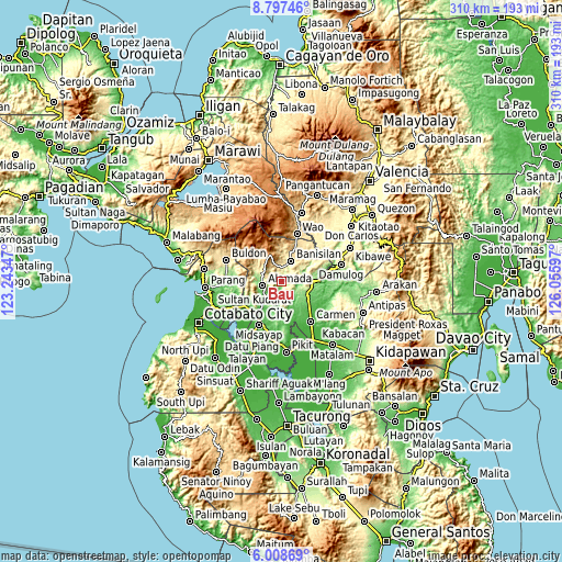
Nearby cities:
Cities around Bau sort by population:
• Banisilan elevation 391 m
12.6 km,  40°
40°
• Libungan 27 m
23.2 km,  218°
218°
• Buayan 98 m
20.8 km, 219°
• Alamada 80 m
12.2 km,  228°
228°
• Malinao 516 m
18.4 km,  20°
20°
• Baguer 21 m
23.1 km, 224°
• Balogo 34 m
24.6 km,  236°
236°
• Liliongan 167 m
16.5 km,  106°
106°
• Barongis 39 m
18.6 km,  210°
210°
• Tomado 87 m
24.1 km,  190°
190°
• Malitubog 81 m
10.1 km, 187°
• Nuyo 129 m
26.4 km,  273°
273°
Multilingual:
 En español:
Bau elevación 162 m.
 En France:
Bau élévation 162 m.


Sources and notes:
- [note 1] Map square and city borders are not equal. Map elevation data is calculated only from area inside that square.
- [src 1] Elevation data from geonames database provided with same terms of usage.
- [src 2] The elevation map of Bau is generated using elevation data from NASA's 3 arcsec (90m) resolution SRTM data.
- [src 3] Base (background) map © OpenStreetMap contributors tiles are generated by Geofabrik and OpenTopoMap.
Copyright & License:
This Bau Elevation Map is licensed under CC BY-SA. You may reuse any part from this page, if you give a proper credit by linking to this URL:
 More info on terms of use page.