Buhi elevation
Buhi (Bicol, Province of Camarines Sur), Philippines elevation is 96 meters and Buhi elevation in feet is 315 ft above sea level [src 1]. Buhi is a seat of a third-order administrative division (feature code) with elevation that is 8 meters (26 ft) bigger than average city elevation in Philippines.
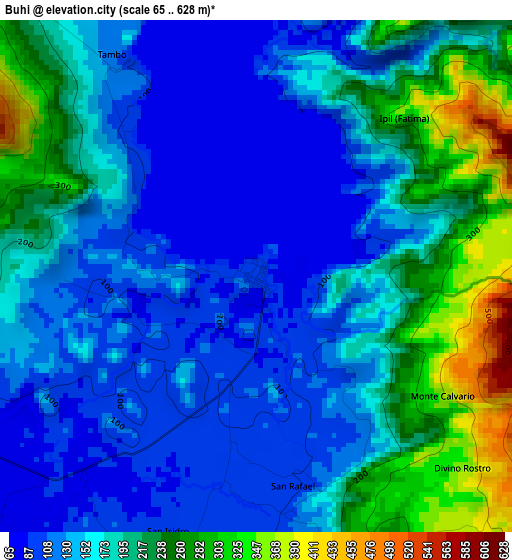
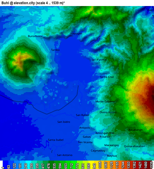
Below is the Elevation map of Buhi, which displays elevation range with different colors. Scale of the first map is from 65 to 628 m (213 to 2060 ft) with average elevation of 173.9 meters (=571 ft) [note 1]
These maps also provides idea of topography and contour of this city, they are displayed at different zoom levels. More info about maps, scale and edge coordinates you can find below images.
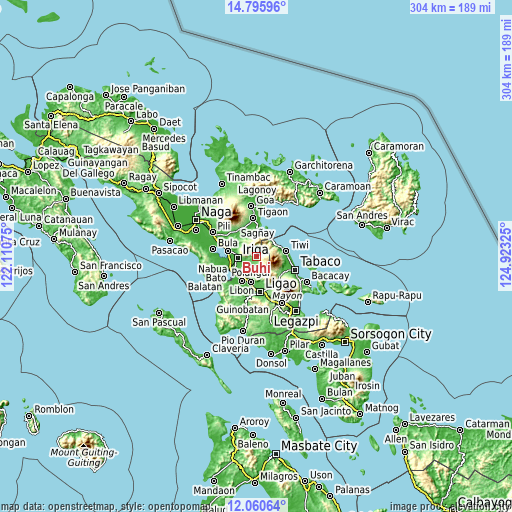
| \ | Map #1 | Map #2 | Topo.Map |
| Scale [m] | 65..628 m | 4..1539 m | × |
| Scale [ft] | 213..2060 ft | 13..5049 ft | × |
| Average | 173.9 m = 571 ft | 306.5 m = 1006 ft | × |
| Width | 9.51 km = 5.9 mi | 19.01 km = 11.8 mi | 304.1 km = 189 mi |
| Height | 9.51 km = 5.9 mi | 19.01 km = 11.8 mi | 304.2 km = 189 mi |
| ↑Max Latitude | 13.474939° | 13.517671° | 14.79596° |
| Latitude at center | 13.4322° | 13.4322° | 13.4322° |
| ↓Min Latitude | 13.389453° | 13.346698° | 12.06064° |
| ← Min Longitude | 123.473055° | 123.429109° | 122.11075° |
| Longitude center | 123.517° | 123.517° | 123.517° |
| →Max Longitude | 123.560945° | 123.604891° | 124.92325° |
Nearby cities:
Cities around Buhi sort by population:
• Iriga City elevation 30 m
11.4 km,  270°
270°
• San Jose 199 m
9.8 km,  158°
158°
• Santa Justina 70 m
6.2 km,  230°
230°
• Santo Domingo 126 m
7.5 km,  259°
259°
• San Antonio 42 m
12.5 km,  236°
236°
• San Vicente 25 m
11 km, 255°
• San Miguel 19 m
11.8 km, 263°
• Sagrada 65 m
12.9 km,  327°
327°
• Lanigay 175 m
13 km,  188°
188°
• Joroan 30 m
12.7 km,  60°
60°
• Santa Teresita 80 m
11.8 km,  295°
295°
• Antipolo 106 m
4.4 km,  171°
171°
Multilingual:
 En español:
Buhi elevación 96 m.
 En France:
Buhi élévation 96 m.


Sources and notes:
- [note 1] Map square and city borders are not equal. Map elevation data is calculated only from area inside that square.
- [src 1] Elevation data from geonames database provided with same terms of usage.
- [src 2] The elevation map of Buhi is generated using elevation data from NASA's 3 arcsec (90m) resolution SRTM data.
- [src 3] Base (background) map © OpenStreetMap contributors tiles are generated by Geofabrik and OpenTopoMap.
Copyright & License:
This Buhi Elevation Map is licensed under CC BY-SA. You may reuse any part from this page, if you give a proper credit by linking to this URL:
 More info on terms of use page.