San Jose elevation
San Jose (Bicol, Province of Albay), Philippines elevation is 199 meters and San Jose elevation in feet is 653 ft above sea level [src 1]. San Jose is a populated place (feature code) with elevation that is 111 meters (364 ft) bigger than average city elevation in Philippines.
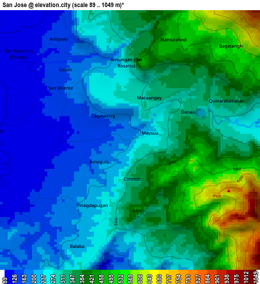
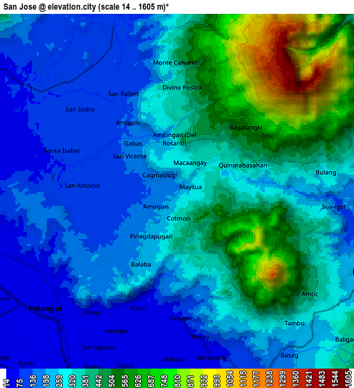
Below is the Elevation map of San Jose, which displays elevation range with different colors. Scale of the first map is from 89 to 1049 m (292 to 3442 ft) with average elevation of 308.3 meters (=1011 ft) [note 1]
These maps also provides idea of topography and contour of this city, they are displayed at different zoom levels. More info about maps, scale and edge coordinates you can find below images.
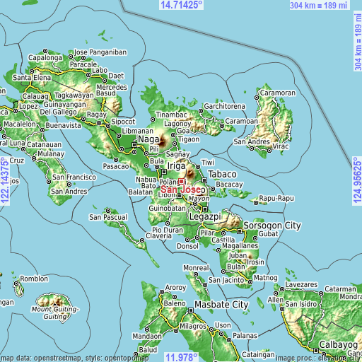
| \ | Map #1 | Map #2 | Topo.Map |
| Scale [m] | 89..1049 m | 14..1605 m | × |
| Scale [ft] | 292..3442 ft | 46..5266 ft | × |
| Average | 308.3 m = 1011 ft | 319.8 m = 1049 ft | × |
| Width | 9.51 km = 5.9 mi | 19.02 km = 11.8 mi | 304.2 km = 189 mi |
| Height | 9.51 km = 5.9 mi | 19.02 km = 11.8 mi | 304.3 km = 189.1 mi |
| ↑Max Latitude | 13.392754° | 13.4355° | 14.71425° |
| Latitude at center | 13.35° | 13.35° | 13.35° |
| ↓Min Latitude | 13.307238° | 13.264469° | 11.978° |
| ← Min Longitude | 123.506055° | 123.462109° | 122.14375° |
| Longitude center | 123.55° | 123.55° | 123.55° |
| →Max Longitude | 123.593945° | 123.637891° | 124.95625° |
Nearby cities:
Cities around San Jose sort by population:
• Polangui elevation 28 m
9.5 km,  227°
227°
• Buhi 96 m
9.8 km,  338°
338°
• Santa Justina 70 m
9.8 km,  301°
301°
• Ponso 42 m
7.5 km,  208°
208°
• Balogo 61 m
7 km,  180°
180°
• Mahaba 62 m
9.2 km, 179°
• Balinad 55 m
6.4 km, 184°
• Batana 73 m
11.2 km,  172°
172°
• Lanigay 175 m
6.6 km,  235°
235°
• Buang 240 m
10.8 km,  113°
113°
• Antipolo 106 m
5.6 km,  328°
328°
• Herrera 80 m
9.4 km,  162°
162°
Multilingual:
 En español:
San Jose elevación 199 m.
 En France:
San Jose élévation 199 m.
 Auf Deutsch:
San Jose höhe über dem Meeresspiegel ist 199 m.

Sources and notes:
- [note 1] Map square and city borders are not equal. Map elevation data is calculated only from area inside that square.
- [src 1] Elevation data from geonames database provided with same terms of usage.
- [src 2] The elevation map of San Jose is generated using elevation data from NASA's 3 arcsec (90m) resolution SRTM data.
- [src 3] Base (background) map © OpenStreetMap contributors tiles are generated by Geofabrik and OpenTopoMap.
Copyright & License:
This San Jose Elevation Map is licensed under CC BY-SA. You may reuse any part from this page, if you give a proper credit by linking to this URL:
 More info on terms of use page.