Cabanglasan elevation
Cabanglasan (Northern Mindanao, Province of Bukidnon), Philippines elevation is 479 meters and Cabanglasan elevation in feet is 1572 ft above sea level [src 1]. Cabanglasan is a seat of a third-order administrative division (feature code) with elevation that is 391 meters (1283 ft) bigger than average city elevation in Philippines.
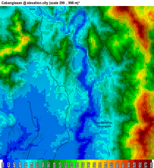
Below is the Elevation map of Cabanglasan, which displays elevation range with different colors. Scale of the first map is from 399 to 998 m (1309 to 3274 ft) with average elevation of 564.3 meters (=1851 ft) [note 1]
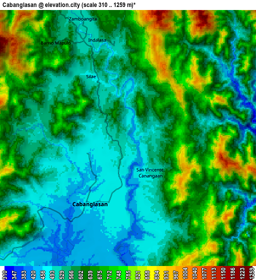
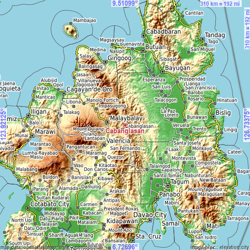
These maps also provides idea of topography and contour of this city, they are displayed at different zoom levels. More info about maps, scale and edge coordinates you can find below images.
| \ | Map #1 | Map #2 | Topo.Map |
| Scale [m] | 399..998 m | 310..1259 m | × |
| Scale [ft] | 1309..3274 ft | 1017..4131 ft | × |
| Average | 564.3 m = 1851 ft | 614.6 m = 2016 ft | × |
| Width | 9.67 km = 6 mi | 19.35 km = 12 mi | 309.6 km = 192.4 mi |
| Height | 9.67 km = 6 mi | 19.35 km = 12 mi | 309.6 km = 192.4 mi |
| ↑Max Latitude | 8.164892° | 8.20839° | 9.51099° |
| Latitude at center | 8.12139° | 8.12139° | 8.12139° |
| ↓Min Latitude | 8.077883° | 8.034371° | 6.72696° |
| ← Min Longitude | 125.283555° | 125.239609° | 123.92125° |
| Longitude center | 125.3275° | 125.3275° | 125.3275° |
| →Max Longitude | 125.371445° | 125.415391° | 126.73375° |
Nearby cities:
Cities around Cabanglasan sort by population:
• Malaybalay elevation 629 m
22.3 km,  280°
280°
• Casisang 592 m
22.4 km,  274°
274°
• Managok 346 m
18.4 km,  236°
236°
• Linabo 359 m
20.4 km,  248°
248°
• Canayan 661 m
21.7 km,  292°
292°
• Lumbayao 327 m
21.2 km, 236°
• Kabulohan 400 m
10.3 km,  212°
212°
• Maglamin 461 m
10.6 km,  223°
223°
• Imbatug 398 m
8.9 km, 212°
• Silae 510 m
6.5 km,  310°
310°
• Laguitas 541 m
22 km,  260°
260°
• Busdi 632 m
19.1 km,  334°
334°
Multilingual:
 En español:
Cabanglasan elevación 479 m.
 En France:
Cabanglasan élévation 479 m.
 Auf Deutsch:
Cabanglasan höhe über dem Meeresspiegel ist 479 m.

Sources and notes:
- [note 1] Map square and city borders are not equal. Map elevation data is calculated only from area inside that square.
- [src 1] Elevation data from geonames database provided with same terms of usage.
- [src 2] The elevation map of Cabanglasan is generated using elevation data from NASA's 3 arcsec (90m) resolution SRTM data.
- [src 3] Base (background) map © OpenStreetMap contributors tiles are generated by Geofabrik and OpenTopoMap.
Copyright & License:
This Cabanglasan Elevation Map is licensed under CC BY-SA. You may reuse any part from this page, if you give a proper credit by linking to this URL:
 More info on terms of use page.