Malaybalay elevation
Malaybalay (Northern Mindanao, Province of Bukidnon), Philippines elevation is 629 meters and Malaybalay elevation in feet is 2064 ft above sea level [src 1]. Malaybalay is a seat of a second-order administrative division (feature code) with elevation that is 541 meters (1775 ft) bigger than average city elevation in Philippines.
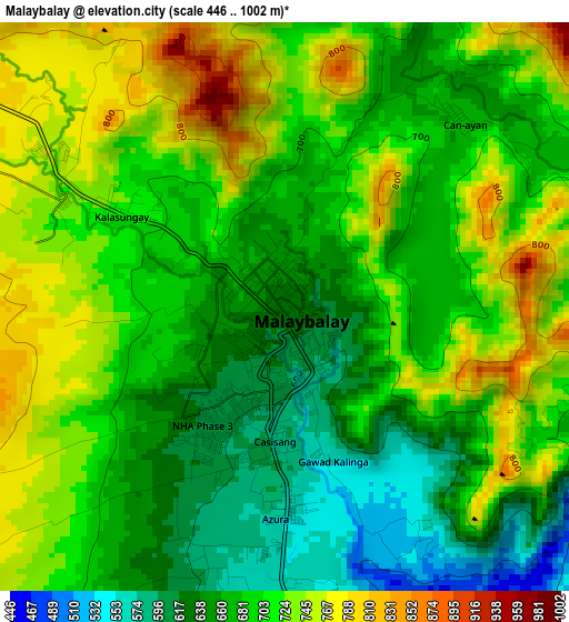
Below is the Elevation map of Malaybalay, which displays elevation range with different colors. Scale of the first map is from 446 to 1002 m (1463 to 3287 ft) with average elevation of 694.5 meters (=2279 ft) [note 1]
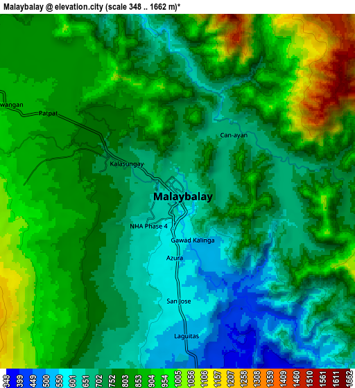
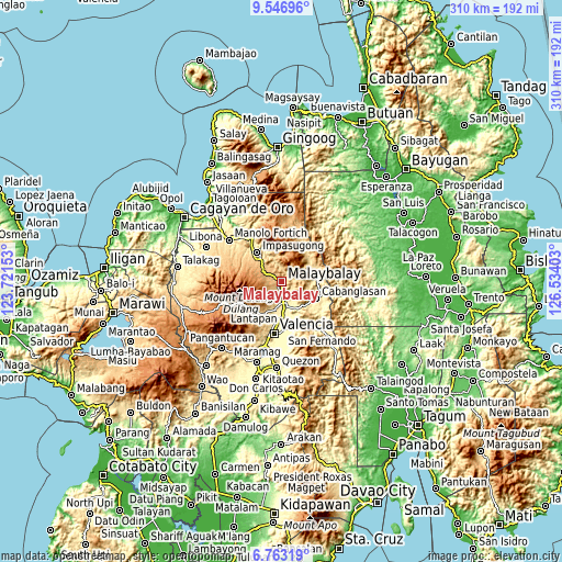
These maps also provides idea of topography and contour of this city, they are displayed at different zoom levels. More info about maps, scale and edge coordinates you can find below images.
| \ | Map #1 | Map #2 | Topo.Map |
| Scale [m] | 446..1002 m | 348..1662 m | × |
| Scale [ft] | 1463..3287 ft | 1142..5453 ft | × |
| Average | 694.5 m = 2279 ft | 790.2 m = 2593 ft | × |
| Width | 9.67 km = 6 mi | 19.35 km = 12 mi | 309.5 km = 192.3 mi |
| Height | 9.67 km = 6 mi | 19.35 km = 12 mi | 309.6 km = 192.4 mi |
| ↑Max Latitude | 8.200998° | 8.244492° | 9.54696° |
| Latitude at center | 8.1575° | 8.1575° | 8.1575° |
| ↓Min Latitude | 8.113997° | 8.070489° | 6.76319° |
| ← Min Longitude | 125.083835° | 125.039889° | 123.72153° |
| Longitude center | 125.12778° | 125.12778° | 125.12778° |
| →Max Longitude | 125.171725° | 125.215671° | 126.53403° |
Nearby cities:
Cities around Malaybalay sort by population:
• Casisang elevation 592 m
2.2 km,  188°
188°
• Sumpong 655 m
1.2 km,  301°
301°
• Managok 346 m
15.8 km,  154°
154°
• Linabo 359 m
11.9 km,  165°
165°
• Aglayan 403 m
11.4 km,  176°
176°
• Dalwangan 902 m
10.7 km, 296°
• Canayan 661 m
4.6 km,  23°
23°
• Bugcaon 449 m
12.5 km, 187°
• Lumbayao 327 m
16.2 km,  164°
164°
• Cabangahan 369 m
15 km, 175°
• Impalutao 749 m
15.7 km,  315°
315°
• Laguitas 541 m
7.6 km, 177°
Multilingual:
 En español:
Malaybalay elevación 629 m.
 En France:
Malaybalay élévation 629 m.
 Auf Deutsch:
Malaybalay City höhe über dem Meeresspiegel ist 629 m.

Sources and notes:
- [note 1] Map square and city borders are not equal. Map elevation data is calculated only from area inside that square.
- [src 1] Elevation data from geonames database provided with same terms of usage.
- [src 2] The elevation map of Malaybalay is generated using elevation data from NASA's 3 arcsec (90m) resolution SRTM data.
- [src 3] Base (background) map © OpenStreetMap contributors tiles are generated by Geofabrik and OpenTopoMap.
Copyright & License:
This Malaybalay Elevation Map is licensed under CC BY-SA. You may reuse any part from this page, if you give a proper credit by linking to this URL:
 More info on terms of use page.