Isulan elevation
Isulan (Soccsksargen, Province of Sultan Kudarat), Philippines elevation is 65 meters and Isulan elevation in feet is 213 ft above sea level [src 1]. Isulan is a seat of a second-order administrative division (feature code) with elevation that is 23 meters (75 ft) smaller than average city elevation in Philippines.
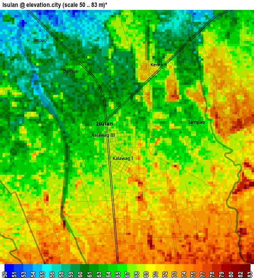
Below is the Elevation map of Isulan, which displays elevation range with different colors. Scale of the first map is from 50 to 83 m (164 to 272 ft) with average elevation of 67 meters (=220 ft) [note 1]
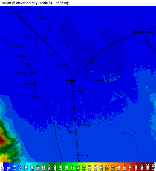
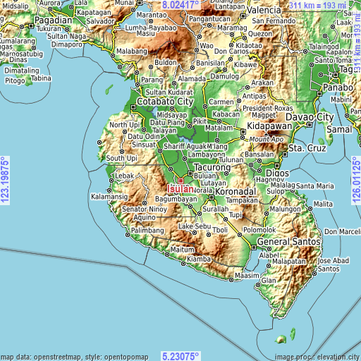
These maps also provides idea of topography and contour of this city, they are displayed at different zoom levels. More info about maps, scale and edge coordinates you can find below images.
| \ | Map #1 | Map #2 | Topo.Map |
| Scale [m] | 50..83 m | 34..1103 m | × |
| Scale [ft] | 164..272 ft | 112..3619 ft | × |
| Average | 67 m = 220 ft | 79.4 m = 260 ft | × |
| Width | 9.71 km = 6 mi | 19.41 km = 12.1 mi | 310.6 km = 193 mi |
| Height | 9.71 km = 6 mi | 19.41 km = 12.1 mi | 310.6 km = 193 mi |
| ↑Max Latitude | 6.67309° | 6.716735° | 8.02417° |
| Latitude at center | 6.62944° | 6.62944° | 6.62944° |
| ↓Min Latitude | 6.585787° | 6.542129° | 5.23075° |
| ← Min Longitude | 124.561055° | 124.517109° | 123.19875° |
| Longitude center | 124.605° | 124.605° | 124.605° |
| →Max Longitude | 124.648945° | 124.692891° | 126.01125° |
Nearby cities:
Cities around Isulan sort by population:
• Tacurong elevation 48 m
10.6 km,  48°
48°
• Laguilayan 59 m
10 km,  298°
298°
• Dansuli 61 m
2.8 km, 296°
• Kapaya 122 m
10.7 km,  205°
205°
• Daguma 79 m
4.8 km,  233°
233°
• Kudanding 76 m
5.5 km,  146°
146°
• Kapingkong 54 m
5.6 km,  24°
24°
• Dukay 50 m
6.7 km,  308°
308°
• Biwang 89 m
7.3 km,  248°
248°
• Matiompong 49 m
8.6 km,  329°
329°
• Dumaguil 75 m
5.4 km,  101°
101°
• New Lagao 50 m
9 km,  26°
26°
Multilingual:
 En español:
Isulan elevación 65 m.
 En France:
Isulan élévation 65 m.


Sources and notes:
- [note 1] Map square and city borders are not equal. Map elevation data is calculated only from area inside that square.
- [src 1] Elevation data from geonames database provided with same terms of usage.
- [src 2] The elevation map of Isulan is generated using elevation data from NASA's 3 arcsec (90m) resolution SRTM data.
- [src 3] Base (background) map © OpenStreetMap contributors tiles are generated by Geofabrik and OpenTopoMap.
Copyright & License:
This Isulan Elevation Map is licensed under CC BY-SA. You may reuse any part from this page, if you give a proper credit by linking to this URL:
 More info on terms of use page.