Tacurong elevation
Tacurong (Soccsksargen, Province of Sultan Kudarat), Philippines elevation is 48 meters and Tacurong elevation in feet is 157 ft above sea level [src 1]. Tacurong is a seat of a third-order administrative division (feature code) with elevation that is 40 meters (131 ft) smaller than average city elevation in Philippines.
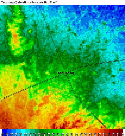
Below is the Elevation map of Tacurong, which displays elevation range with different colors. Scale of the first map is from 28 to 81 m (92 to 266 ft) with average elevation of 48.4 meters (=159 ft) [note 1]
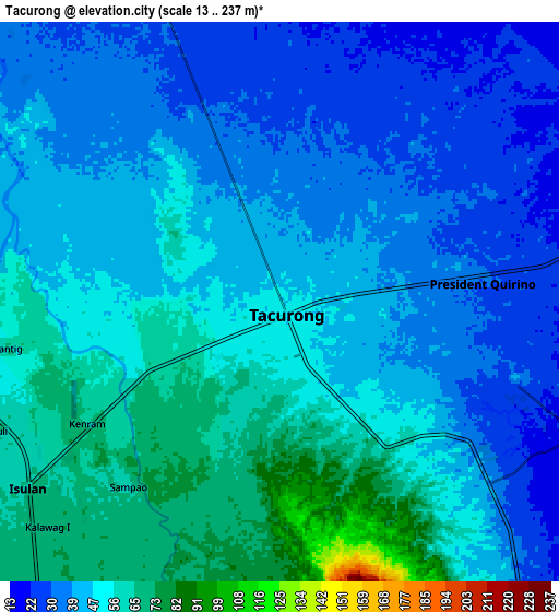
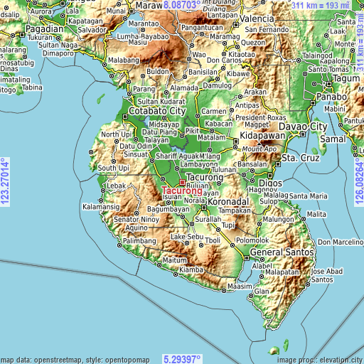
These maps also provides idea of topography and contour of this city, they are displayed at different zoom levels. More info about maps, scale and edge coordinates you can find below images.
| \ | Map #1 | Map #2 | Topo.Map |
| Scale [m] | 28..81 m | 13..237 m | × |
| Scale [ft] | 92..266 ft | 43..778 ft | × |
| Average | 48.4 m = 159 ft | 46.6 m = 153 ft | × |
| Width | 9.71 km = 6 mi | 19.41 km = 12.1 mi | 310.6 km = 193 mi |
| Height | 9.71 km = 6 mi | 19.41 km = 12.1 mi | 310.6 km = 193 mi |
| ↑Max Latitude | 6.736144° | 6.779784° | 8.08703° |
| Latitude at center | 6.6925° | 6.6925° | 6.6925° |
| ↓Min Latitude | 6.648852° | 6.605201° | 5.29397° |
| ← Min Longitude | 124.632445° | 124.588499° | 123.27014° |
| Longitude center | 124.67639° | 124.67639° | 124.67639° |
| →Max Longitude | 124.720335° | 124.764281° | 126.08264° |
Nearby cities:
Cities around Tacurong sort by population:
• Isulan elevation 65 m
10.6 km,  228°
228°
• Gansing 40 m
3.8 km,  318°
318°
• President Quirino 31 m
6.8 km,  79°
79°
• Katico 23 m
9.7 km,  39°
39°
• Kapingkong 54 m
5.9 km,  250°
250°
• Mamali 30 m
9.6 km,  340°
340°
• Damawato 18 m
11.8 km,  85°
85°
• Tambak 32 m
6.9 km,  301°
301°
• Dumaguil 75 m
8.5 km,  197°
197°
• New Lagao 50 m
4 km,  285°
285°
• Kalandagan 33 m
5.6 km,  106°
106°
• Mariano Marcos 35 m
4.7 km,  346°
346°
Multilingual:
 En español:
Tacurong elevación 48 m.
 En France:
Tacurong élévation 48 m.
 Auf Deutsch:
Tacurong City höhe über dem Meeresspiegel ist 48 m.

Sources and notes:
- [note 1] Map square and city borders are not equal. Map elevation data is calculated only from area inside that square.
- [src 1] Elevation data from geonames database provided with same terms of usage.
- [src 2] The elevation map of Tacurong is generated using elevation data from NASA's 3 arcsec (90m) resolution SRTM data.
- [src 3] Base (background) map © OpenStreetMap contributors tiles are generated by Geofabrik and OpenTopoMap.
Copyright & License:
This Tacurong Elevation Map is licensed under CC BY-SA. You may reuse any part from this page, if you give a proper credit by linking to this URL:
 More info on terms of use page.