La Libertad elevation
La Libertad (Central Visayas, Province of Negros Oriental), Philippines elevation is 9 meters and La Libertad elevation in feet is 30 ft above sea level [src 1]. La Libertad is a seat of a third-order administrative division (feature code) with elevation that is 79 meters (259 ft) smaller than average city elevation in Philippines.
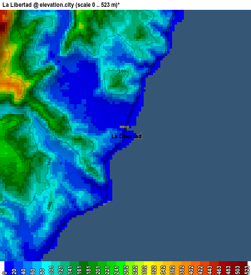
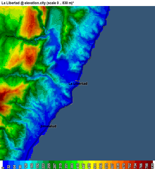
Below is the Elevation map of La Libertad, which displays elevation range with different colors. Scale of the first map is from 0 to 523 m (0 to 1716 ft) with average elevation of 98.9 meters (=324 ft) [note 1]
These maps also provides idea of topography and contour of this city, they are displayed at different zoom levels. More info about maps, scale and edge coordinates you can find below images.
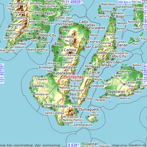
| \ | Map #1 | Map #2 | Topo.Map |
| Scale [m] | 0..523 m | 0..830 m | × |
| Scale [ft] | 0..1716 ft | 0..2723 ft | × |
| Average | 98.9 m = 324 ft | 248.1 m = 814 ft | × |
| Width | 9.62 km = 6 mi | 19.25 km = 12 mi | 307.9 km = 191.3 mi |
| Height | 9.62 km = 6 mi | 19.25 km = 12 mi | 307.9 km = 191.3 mi |
| ↑Max Latitude | 10.069871° | 10.113137° | 11.40828° |
| Latitude at center | 10.0266° | 10.0266° | 10.0266° |
| ↓Min Latitude | 9.983323° | 9.94004° | 8.639° |
| ← Min Longitude | 123.189555° | 123.145609° | 121.82725° |
| Longitude center | 123.2335° | 123.2335° | 123.2335° |
| →Max Longitude | 123.277445° | 123.321391° | 124.63975° |
Nearby cities:
Cities around La Libertad sort by population:
• Guihulñgan elevation 6 m
11.4 km,  22°
22°
• Buenavista 66 m
12.4 km,  5°
5°
• Basdiot 15 m
17.8 km,  119°
119°
• Balogo 461 m
12 km,  324°
324°
• Jimalalud 10 m
6.4 km,  215°
215°
• Calamba 14 m
17.4 km, 17°
• Malusay 58 m
13.7 km, 17°
• Padre Zamora 11 m
4.8 km, 22°
• McKinley 13 m
7 km, 23°
• Saavedra 11 m
15.8 km,  106°
106°
• Ronda 6 m
19.5 km,  99°
99°
• Tayasan 17 m
13.4 km,  211°
211°
Multilingual:
 En español:
La Libertad elevación 9 m.
 En France:
La Libertad élévation 9 m.
 Auf Deutsch:
La Libertad höhe über dem Meeresspiegel ist 9 m.

Sources and notes:
- [note 1] Map square and city borders are not equal. Map elevation data is calculated only from area inside that square.
- [src 1] Elevation data from geonames database provided with same terms of usage.
- [src 2] The elevation map of La Libertad is generated using elevation data from NASA's 3 arcsec (90m) resolution SRTM data.
- [src 3] Base (background) map © OpenStreetMap contributors tiles are generated by Geofabrik and OpenTopoMap.
Copyright & License:
This La Libertad Elevation Map is licensed under CC BY-SA. You may reuse any part from this page, if you give a proper credit by linking to this URL:
 More info on terms of use page.