Manga elevation
Manga (Soccsksargen, Province of Sarangani), Philippines elevation is 121 meters and Manga elevation in feet is 397 ft above sea level [src 1]. Manga is a populated place (feature code) with elevation that is 33 meters (108 ft) bigger than average city elevation in Philippines.
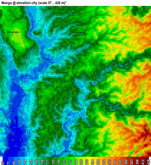
Below is the Elevation map of Manga, which displays elevation range with different colors. Scale of the first map is from 57 to 426 m (187 to 1398 ft) with average elevation of 192 meters (=630 ft) [note 1]
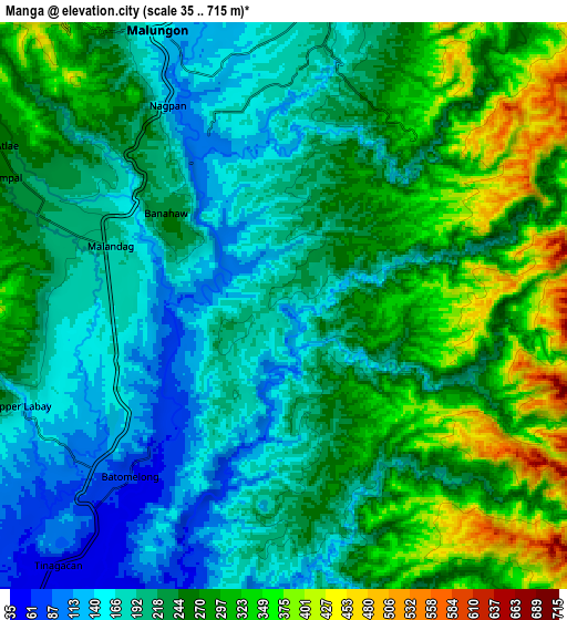
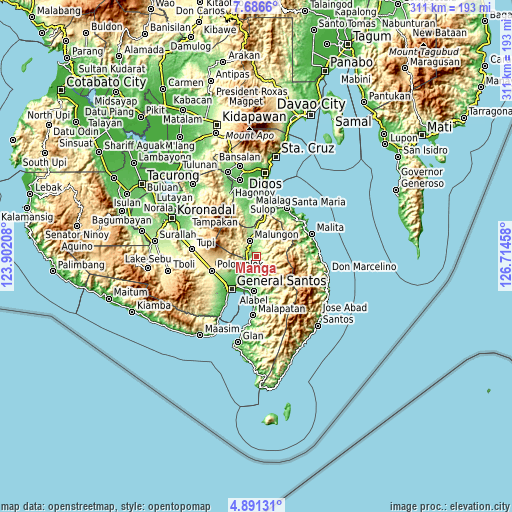
These maps also provides idea of topography and contour of this city, they are displayed at different zoom levels. More info about maps, scale and edge coordinates you can find below images.
| \ | Map #1 | Map #2 | Topo.Map |
| Scale [m] | 57..426 m | 35..715 m | × |
| Scale [ft] | 187..1398 ft | 115..2346 ft | × |
| Average | 192 m = 630 ft | 239.4 m = 785 ft | × |
| Width | 9.71 km = 6 mi | 19.43 km = 12.1 mi | 310.8 km = 193.1 mi |
| Height | 9.71 km = 6 mi | 19.43 km = 12.1 mi | 310.8 km = 193.1 mi |
| ↑Max Latitude | 6.334509° | 6.378184° | 7.6866° |
| Latitude at center | 6.29083° | 6.29083° | 6.29083° |
| ↓Min Latitude | 6.247147° | 6.203461° | 4.89131° |
| ← Min Longitude | 125.264385° | 125.220439° | 123.90208° |
| Longitude center | 125.30833° | 125.30833° | 125.30833° |
| →Max Longitude | 125.352275° | 125.396221° | 126.71458° |
Nearby cities:
Cities around Manga sort by population:
• Maluñgun elevation 127 m
3.2 km,  246°
246°
• Alabel 40 m
21.1 km,  185°
185°
• Buayan 13 m
21 km,  202°
202°
• Malandag 198 m
7.1 km,  287°
287°
• Conel 100 m
16.6 km,  233°
233°
• Katangawan 38 m
16.3 km,  216°
216°
• Silway 7 146 m
24.3 km,  238°
238°
• Tinagacan 55 m
13.4 km, 220°
• Upper Klinan 288 m
21.9 km, 251°
• Batutitik 49 m
9.8 km, 219°
• Klinan 165 m
22.2 km, 238°
• Polo 452 m
21.8 km,  262°
262°
Multilingual:
 En español:
Manga elevación 121 m.
 En France:
Manga élévation 121 m.


Sources and notes:
- [note 1] Map square and city borders are not equal. Map elevation data is calculated only from area inside that square.
- [src 1] Elevation data from geonames database provided with same terms of usage.
- [src 2] The elevation map of Manga is generated using elevation data from NASA's 3 arcsec (90m) resolution SRTM data.
- [src 3] Base (background) map © OpenStreetMap contributors tiles are generated by Geofabrik and OpenTopoMap.
Copyright & License:
This Manga Elevation Map is licensed under CC BY-SA. You may reuse any part from this page, if you give a proper credit by linking to this URL:
 More info on terms of use page.