Mayantoc elevation
Mayantoc (Central Luzon, Province of Tarlac), Philippines elevation is 56 meters and Mayantoc elevation in feet is 184 ft above sea level [src 1]. Mayantoc is a seat of a third-order administrative division (feature code) with elevation that is 32 meters (105 ft) smaller than average city elevation in Philippines.
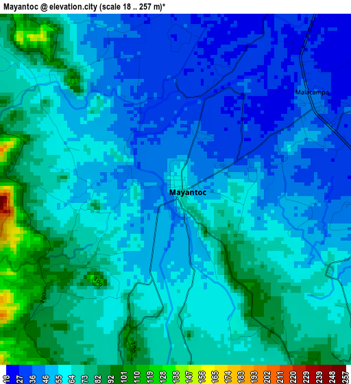
Below is the Elevation map of Mayantoc, which displays elevation range with different colors. Scale of the first map is from 18 to 257 m (59 to 843 ft) with average elevation of 59.3 meters (=195 ft) [note 1]
These maps also provides idea of topography and contour of this city, they are displayed at different zoom levels. More info about maps, scale and edge coordinates you can find below images.
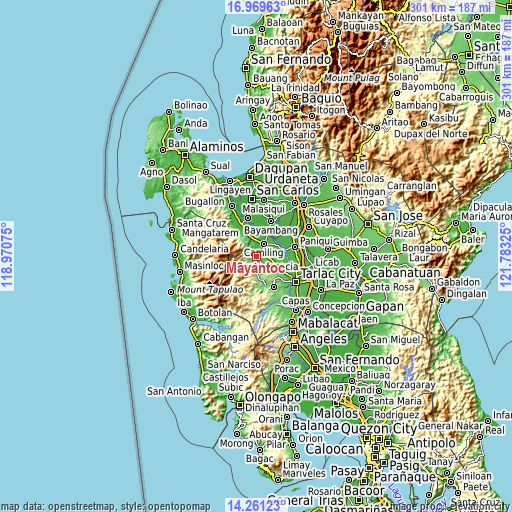
| \ | Map #1 | Map #2 | Topo.Map |
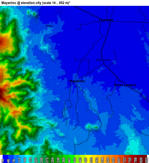
| Scale [m] | 18..257 m | 14..852 m | × |
| Scale [ft] | 59..843 ft | 46..2795 ft | × |
| Average | 59.3 m = 195 ft | 123.6 m = 406 ft | × |
| Width | 9.41 km = 5.8 mi | 18.82 km = 11.7 mi | 301.1 km = 187.1 mi |
| Height | 9.41 km = 5.8 mi | 18.82 km = 11.7 mi | 301.2 km = 187.2 mi |
| ↑Max Latitude | 15.662218° | 15.704527° | 16.96963° |
| Latitude at center | 15.6199° | 15.6199° | 15.6199° |
| ↓Min Latitude | 15.577573° | 15.535238° | 14.26123° |
| ← Min Longitude | 120.333055° | 120.289109° | 118.97075° |
| Longitude center | 120.377° | 120.377° | 120.377° |
| →Max Longitude | 120.420945° | 120.464891° | 121.78325° |
Nearby cities:
Cities around Mayantoc sort by population:
• Camiling elevation 25 m
8.3 km,  27°
27°
• Santa Ignacia 44 m
6.3 km,  93°
93°
• Santa Ines West 98 m
11.7 km,  126°
126°
• Malacampa 35 m
4.5 km,  54°
54°
• Bobon Second 36 m
4.1 km,  6°
6°
• San Clemente 25 m
10.5 km,  349°
349°
• Bacsay 74 m
3.6 km,  271°
271°
• Bamban 72 m
7.8 km,  321°
321°
• Santa Maria 39 m
5.9 km,  63°
63°
• Nambalan 49 m
9.2 km,  104°
104°
• San Francisco 34 m
6.4 km,  81°
81°
• Mamonit 88 m
4.2 km,  150°
150°
Multilingual:
 En español:
Mayantoc elevación 56 m.
 En France:
Mayantoc élévation 56 m.


Sources and notes:
- [note 1] Map square and city borders are not equal. Map elevation data is calculated only from area inside that square.
- [src 1] Elevation data from geonames database provided with same terms of usage.
- [src 2] The elevation map of Mayantoc is generated using elevation data from NASA's 3 arcsec (90m) resolution SRTM data.
- [src 3] Base (background) map © OpenStreetMap contributors tiles are generated by Geofabrik and OpenTopoMap.
Copyright & License:
This Mayantoc Elevation Map is licensed under CC BY-SA. You may reuse any part from this page, if you give a proper credit by linking to this URL:
 More info on terms of use page.