Nambalan elevation
Nambalan (Central Luzon, Province of Tarlac), Philippines elevation is 49 meters and Nambalan elevation in feet is 161 ft above sea level [src 1]. Nambalan is a populated place (feature code) with elevation that is 39 meters (128 ft) smaller than average city elevation in Philippines.
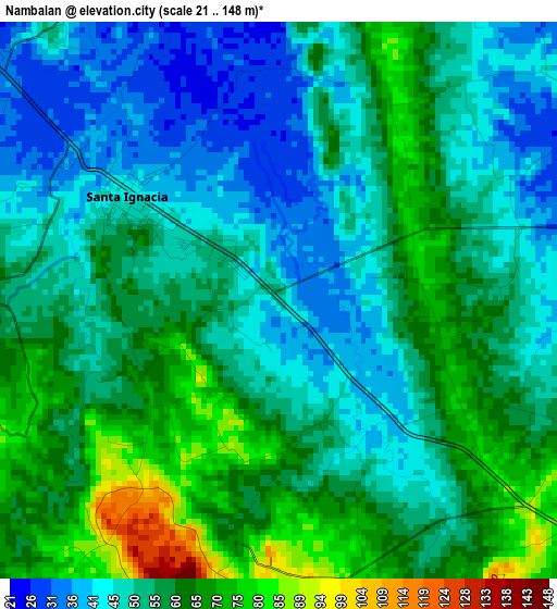
Below is the Elevation map of Nambalan, which displays elevation range with different colors. Scale of the first map is from 21 to 148 m (69 to 486 ft) with average elevation of 54.6 meters (=179 ft) [note 1]
These maps also provides idea of topography and contour of this city, they are displayed at different zoom levels. More info about maps, scale and edge coordinates you can find below images.
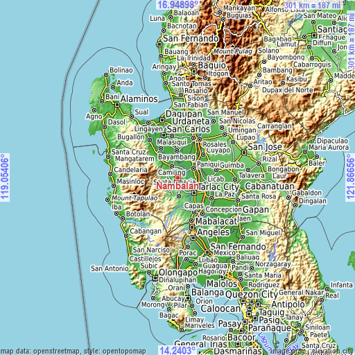
| \ | Map #1 | Topo.Map |
| Scale [m] | 21..148 m | × |
| Scale [ft] | 69..486 ft | × |
| Average | 54.6 m = 179 ft | × |
| Width | 9.41 km = 5.8 mi | 301.2 km = 187.2 mi |
| Height | 9.41 km = 5.8 mi | 301.2 km = 187.2 mi |
| ↑Max Latitude | 15.641432° | 16.94898° |
| Latitude at center | 15.59911° | 15.59911° |
| ↓Min Latitude | 15.556779° | 14.2403° |
| ← Min Longitude | 120.416365° | 119.05406° |
| Longitude center | 120.46031° | 120.46031° |
| →Max Longitude | 120.504255° | 121.86656° |
Nearby cities:
Cities around Nambalan sort by population:
• Santa Ignacia elevation 44 m
3.3 km,  307°
307°
• Mayantoc 56 m
9.2 km,  284°
284°
• Santa Ines West 98 m
4.7 km,  174°
174°
• Malacampa 35 m
7.2 km, 313°
• Balaoang 24 m
9.2 km,  39°
39°
• Padapada 71 m
8 km,  131°
131°
• Vargas 70 m
2.9 km,  102°
102°
• Santa Maria 39 m
6.1 km,  323°
323°
• Calayaan 71 m
6.8 km,  121°
121°
• Mabilang 27 m
9 km,  19°
19°
• San Francisco 34 m
4.2 km, 322°
• Mamonit 88 m
7 km,  259°
259°
Multilingual:
 En español:
Nambalan elevación 49 m.
 En France:
Nambalan élévation 49 m.


Sources and notes:
- [note 1] Map square and city borders are not equal. Map elevation data is calculated only from area inside that square.
- [src 1] Elevation data from geonames database provided with same terms of usage.
- [src 2] The elevation map of Nambalan is generated using elevation data from NASA's 3 arcsec (90m) resolution SRTM data.
- [src 3] Base (background) map © OpenStreetMap contributors tiles are generated by Geofabrik and OpenTopoMap.
Copyright & License:
This Nambalan Elevation Map is licensed under CC BY-SA. You may reuse any part from this page, if you give a proper credit by linking to this URL:
 More info on terms of use page.