Santa Ines West elevation
Santa Ines West (Central Luzon, Province of Tarlac), Philippines elevation is 98 meters and Santa Ines West elevation in feet is 322 ft above sea level [src 1]. Santa Ines West is a populated place (feature code) with elevation that is 10 meters (33 ft) bigger than average city elevation in Philippines.
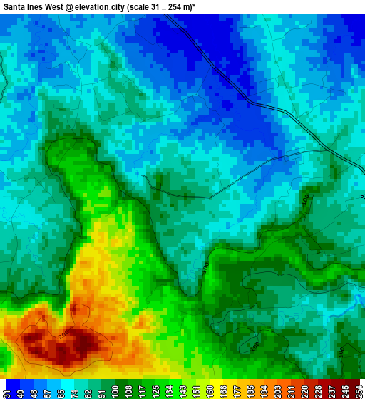
Below is the Elevation map of Santa Ines West, which displays elevation range with different colors. Scale of the first map is from 31 to 254 m (102 to 833 ft) with average elevation of 93.5 meters (=307 ft) [note 1]
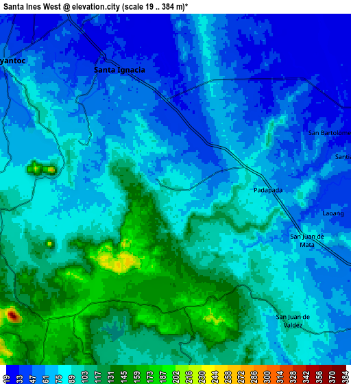
These maps also provides idea of topography and contour of this city, they are displayed at different zoom levels. More info about maps, scale and edge coordinates you can find below images.
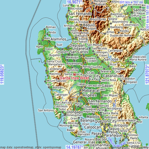
| \ | Map #1 | Map #2 | Topo.Map |
| Scale [m] | 31..254 m | 19..384 m | × |
| Scale [ft] | 102..833 ft | 62..1260 ft | × |
| Average | 93.5 m = 307 ft | 83.8 m = 275 ft | × |
| Width | 9.41 km = 5.8 mi | 18.83 km = 11.7 mi | 301.2 km = 187.2 mi |
| Height | 9.41 km = 5.8 mi | 18.83 km = 11.7 mi | 301.3 km = 187.2 mi |
| ↑Max Latitude | 15.599271° | 15.641593° | 16.9071° |
| Latitude at center | 15.55694° | 15.55694° | 15.55694° |
| ↓Min Latitude | 15.5146° | 15.472252° | 14.19787° |
| ← Min Longitude | 120.420535° | 120.376589° | 119.05823° |
| Longitude center | 120.46448° | 120.46448° | 120.46448° |
| →Max Longitude | 120.508425° | 120.552371° | 121.87073° |
Nearby cities:
Cities around Santa Ines West sort by population:
• Santa Ignacia elevation 44 m
7.3 km,  335°
335°
• Villa Aglipay 91 m
10.2 km,  187°
187°
• Mababanaba 158 m
6.7 km,  183°
183°
• San Juan de Mata 77 m
7.4 km,  108°
108°
• Padapada 71 m
5.6 km,  95°
95°
• Vargas 70 m
4.7 km,  30°
30°
• Burgos 194 m
9.4 km,  222°
222°
• Santa Maria 39 m
10.5 km, 337°
• Calayaan 71 m
5.5 km,  77°
77°
• Nambalan 49 m
4.7 km,  354°
354°
• San Francisco 34 m
8.5 km, 339°
• Mamonit 88 m
8 km,  294°
294°
Multilingual:
 En español:
Santa Ines West elevación 98 m.
 En France:
Santa Ines West élévation 98 m.
 Auf Deutsch:
Santa Ines West höhe über dem Meeresspiegel ist 98 m.

Sources and notes:
- [note 1] Map square and city borders are not equal. Map elevation data is calculated only from area inside that square.
- [src 1] Elevation data from geonames database provided with same terms of usage.
- [src 2] The elevation map of Santa Ines West is generated using elevation data from NASA's 3 arcsec (90m) resolution SRTM data.
- [src 3] Base (background) map © OpenStreetMap contributors tiles are generated by Geofabrik and OpenTopoMap.
Copyright & License:
This Santa Ines West Elevation Map is licensed under CC BY-SA. You may reuse any part from this page, if you give a proper credit by linking to this URL:
 More info on terms of use page.