Paitan Norte elevation
Paitan Norte (Central Luzon, Province of Nueva Ecija), Philippines elevation is 79 meters and Paitan Norte elevation in feet is 259 ft above sea level [src 1]. Paitan Norte is a populated place (feature code) with elevation that is 9 meters (30 ft) smaller than average city elevation in Philippines.
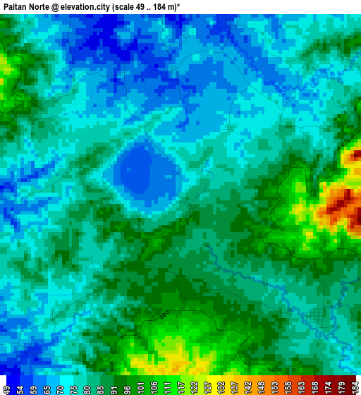
Below is the Elevation map of Paitan Norte, which displays elevation range with different colors. Scale of the first map is from 49 to 184 m (161 to 604 ft) with average elevation of 81.9 meters (=269 ft) [note 1]
These maps also provides idea of topography and contour of this city, they are displayed at different zoom levels. More info about maps, scale and edge coordinates you can find below images.
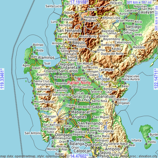
| \ | Map #1 | Topo.Map |
| Scale [m] | 49..184 m | × |
| Scale [ft] | 161..604 ft | × |
| Average | 81.9 m = 269 ft | × |
| Width | 9.4 km = 5.8 mi | 300.8 km = 186.9 mi |
| Height | 9.4 km = 5.8 mi | 300.9 km = 187 mi |
| ↑Max Latitude | 15.875604° | 17.18158° |
| Latitude at center | 15.83333° | 15.83333° |
| ↓Min Latitude | 15.791048° | 14.47602° |
| ← Min Longitude | 120.696915° | 119.33461° |
| Longitude center | 120.74086° | 120.74086° |
| →Max Longitude | 120.784805° | 122.14711° |
Nearby cities:
Cities around Paitan Norte sort by population:
• Rosales elevation 37 m
13.4 km,  300°
300°
• Cuyapo 34 m
10 km,  234°
234°
• Talugtug 91 m
9.7 km,  129°
129°
• Umingan 96 m
9.7 km,  39°
39°
• Diaz 105 m
10.1 km,  81°
81°
• San Andres 53 m
13.3 km,  162°
162°
• Guiling 34 m
13.5 km,  274°
274°
• Esmeralda 55 m
4.7 km,  323°
323°
• Calancuasan Norte 25 m
11.3 km,  251°
251°
• Bued 33 m
9.7 km, 272°
• Baloy 85 m
4.7 km, 131°
• Balungao 43 m
9.1 km, 322°
Multilingual:
 En español:
Paitan Norte elevación 79 m.
 En France:
Paitan Norte élévation 79 m.
 Auf Deutsch:
Paitan Norte höhe über dem Meeresspiegel ist 79 m.

Sources and notes:
- [note 1] Map square and city borders are not equal. Map elevation data is calculated only from area inside that square.
- [src 1] Elevation data from geonames database provided with same terms of usage.
- [src 2] The elevation map of Paitan Norte is generated using elevation data from NASA's 3 arcsec (90m) resolution SRTM data.
- [src 3] Base (background) map © OpenStreetMap contributors tiles are generated by Geofabrik and OpenTopoMap.
Copyright & License:
This Paitan Norte Elevation Map is licensed under CC BY-SA. You may reuse any part from this page, if you give a proper credit by linking to this URL:
 More info on terms of use page.