Talugtug elevation
Talugtug (Central Luzon, Province of Nueva Ecija), Philippines elevation is 91 meters and Talugtug elevation in feet is 299 ft above sea level [src 1]. Talugtug is a populated place (feature code) with elevation that is 3 meters (10 ft) bigger than average city elevation in Philippines.
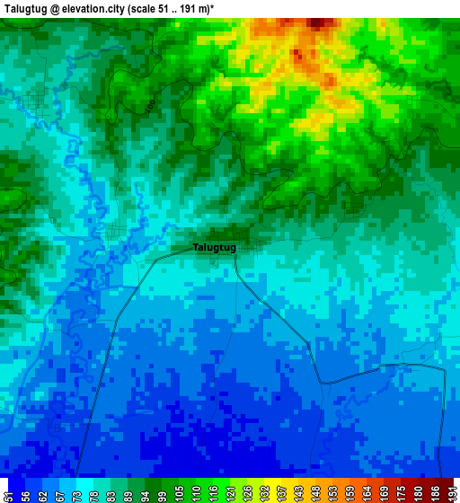
Below is the Elevation map of Talugtug, which displays elevation range with different colors. Scale of the first map is from 51 to 191 m (167 to 627 ft) with average elevation of 83.5 meters (=274 ft) [note 1]
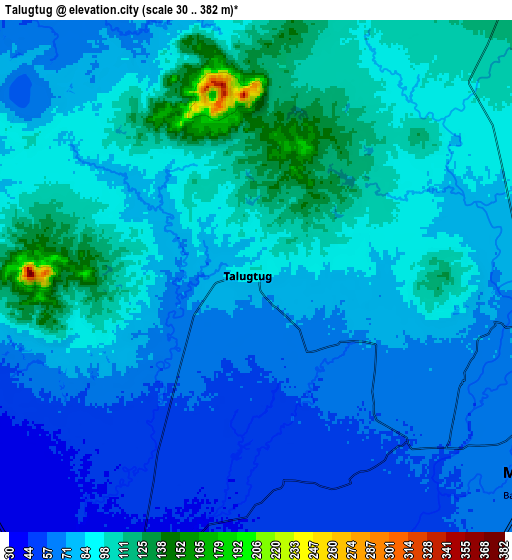
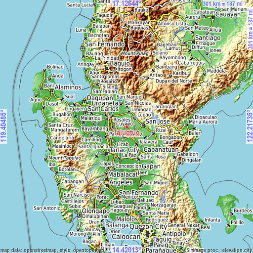
These maps also provides idea of topography and contour of this city, they are displayed at different zoom levels. More info about maps, scale and edge coordinates you can find below images.
| \ | Map #1 | Map #2 | Topo.Map |
| Scale [m] | 51..191 m | 30..382 m | × |
| Scale [ft] | 167..627 ft | 98..1253 ft | × |
| Average | 83.5 m = 274 ft | 83.5 m = 274 ft | × |
| Width | 9.4 km = 5.8 mi | 18.81 km = 11.7 mi | 300.9 km = 187 mi |
| Height | 9.4 km = 5.8 mi | 18.81 km = 11.7 mi | 300.9 km = 187 mi |
| ↑Max Latitude | 15.820085° | 15.862362° | 17.12644° |
| Latitude at center | 15.7778° | 15.7778° | 15.7778° |
| ↓Min Latitude | 15.735506° | 15.693203° | 14.42013° |
| ← Min Longitude | 120.767155° | 120.723209° | 119.40485° |
| Longitude center | 120.8111° | 120.8111° | 120.8111° |
| →Max Longitude | 120.855045° | 120.898991° | 122.21735° |
Nearby cities:
Cities around Talugtug sort by population:
• Muñoz elevation 70 m
12 km,  124°
124°
• Diaz 105 m
8 km,  18°
18°
• Salvacion I 113 m
13.2 km,  58°
58°
• San Andres 53 m
7.4 km,  208°
208°
• Bunol 47 m
12.6 km,  168°
168°
• Paitan Norte 79 m
9.7 km,  309°
309°
• Palusapis 53 m
11.9 km,  152°
152°
• Cavite 41 m
12 km,  201°
201°
• Baloy 85 m
5 km, 307°
• Villa Isla 93 m
6 km,  97°
97°
• Sampaloc 102 m
7.4 km,  53°
53°
• Magtangol 78 m
11.4 km, 101°
Multilingual:
 En español:
Talugtug elevación 91 m.
 En France:
Talugtug élévation 91 m.


Sources and notes:
- [note 1] Map square and city borders are not equal. Map elevation data is calculated only from area inside that square.
- [src 1] Elevation data from geonames database provided with same terms of usage.
- [src 2] The elevation map of Talugtug is generated using elevation data from NASA's 3 arcsec (90m) resolution SRTM data.
- [src 3] Base (background) map © OpenStreetMap contributors tiles are generated by Geofabrik and OpenTopoMap.
Copyright & License:
This Talugtug Elevation Map is licensed under CC BY-SA. You may reuse any part from this page, if you give a proper credit by linking to this URL:
 More info on terms of use page.