Parang elevation
Parang (Autonomous Region in Muslim Mindanao, Province of Maguindanao), Philippines elevation is 57 meters and Parang elevation in feet is 187 ft above sea level [src 1]. Parang is a seat of a third-order administrative division (feature code) with elevation that is 31 meters (102 ft) smaller than average city elevation in Philippines.
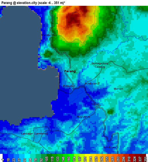
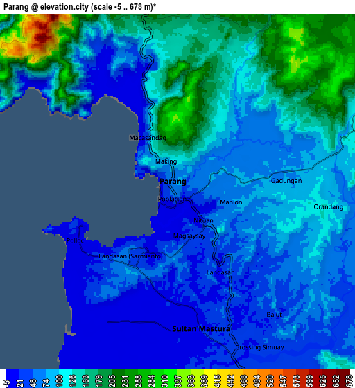
Below is the Elevation map of Parang, which displays elevation range with different colors. Scale of the first map is from -4 to 351 m (-13 to 1152 ft) with average elevation of 71.1 meters (=233 ft) [note 1]
These maps also provides idea of topography and contour of this city, they are displayed at different zoom levels. More info about maps, scale and edge coordinates you can find below images.
| \ | Map #1 | Map #2 | Topo.Map |
| Scale [m] | -4..351 m | -5..678 m | × |
| Scale [ft] | -13..1152 ft | -16..2224 ft | × |
| Average | 71.1 m = 233 ft | 99.9 m = 328 ft | × |
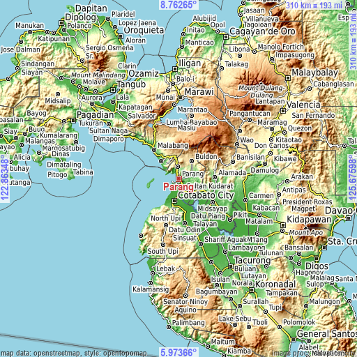
| Width | 9.69 km = 6 mi | 19.38 km = 12 mi | 310.1 km = 192.7 mi |
| Height | 9.69 km = 6 mi | 19.38 km = 12 mi | 310.1 km = 192.7 mi |
| ↑Max Latitude | 7.41393° | 7.457506° | 8.76265° |
| Latitude at center | 7.37035° | 7.37035° | 7.37035° |
| ↓Min Latitude | 7.326766° | 7.283177° | 5.97366° |
| ← Min Longitude | 124.225785° | 124.181839° | 122.86348° |
| Longitude center | 124.26973° | 124.26973° | 124.26973° |
| →Max Longitude | 124.313675° | 124.357621° | 125.67598° |
Nearby cities:
Cities around Parang sort by population:
• Bugasan elevation 122 m
7.9 km,  351°
351°
• Limbo 11 m
13.5 km,  192°
192°
• Katuli 137 m
9.1 km,  320°
320°
• Simuay 51 m
11.1 km,  158°
158°
• Dinganen 136 m
12.9 km,  111°
111°
• Sapadun 374 m
12.7 km, 350°
• Barira 534 m
13.4 km,  14°
14°
• Gang 10 m
13.9 km,  181°
181°
• Tapayan 15 m
8.4 km, 182°
• Polloc 8 m
5.7 km,  250°
250°
• Bualan 157 m
8.6 km,  358°
358°
• Baka 20 m
10.5 km, 183°
Multilingual:
 En español:
Parang elevación 57 m.
 En France:
Parang élévation 57 m.


Sources and notes:
- [note 1] Map square and city borders are not equal. Map elevation data is calculated only from area inside that square.
- [src 1] Elevation data from geonames database provided with same terms of usage.
- [src 2] The elevation map of Parang is generated using elevation data from NASA's 3 arcsec (90m) resolution SRTM data.
- [src 3] Base (background) map © OpenStreetMap contributors tiles are generated by Geofabrik and OpenTopoMap.
Copyright & License:
This Parang Elevation Map is licensed under CC BY-SA. You may reuse any part from this page, if you give a proper credit by linking to this URL:
 More info on terms of use page.