Pasil elevation
Pasil (Cordillera, Kalinga), Philippines elevation is 999 meters and Pasil elevation in feet is 3278 ft above sea level [src 1]. Pasil is a seat of a third-order administrative division (feature code) with elevation that is 911 meters (2989 ft) bigger than average city elevation in Philippines.
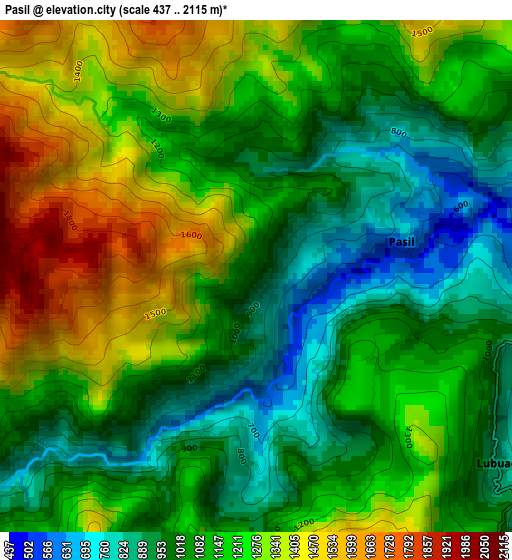
Below is the Elevation map of Pasil, which displays elevation range with different colors. Scale of the first map is from 437 to 2115 m (1434 to 6939 ft) with average elevation of 1145.3 meters (=3758 ft) [note 1]
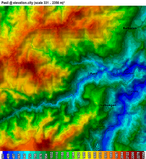
These maps also provides idea of topography and contour of this city, they are displayed at different zoom levels. More info about maps, scale and edge coordinates you can find below images.
| \ | Map #1 | Map #2 | Topo.Map |
| Scale [m] | 437..2115 m | 331..2356 m | × |
| Scale [ft] | 1434..6939 ft | 1086..7730 ft | × |
| Average | 1145.3 m = 3758 ft | 1263.1 m = 4144 ft | × |
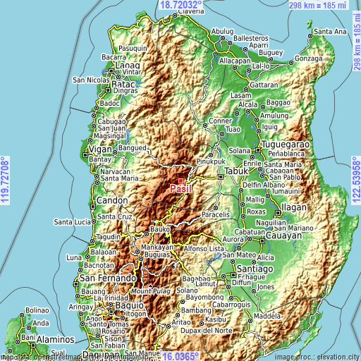
| Width | 9.33 km = 5.8 mi | 18.65 km = 11.6 mi | 298.4 km = 185.4 mi |
| Height | 9.33 km = 5.8 mi | 18.65 km = 11.6 mi | 298.4 km = 185.4 mi |
| ↑Max Latitude | 17.425263° | 17.467187° | 18.72032° |
| Latitude at center | 17.38333° | 17.38333° | 17.38333° |
| ↓Min Latitude | 17.341387° | 17.299434° | 16.0365° |
| ← Min Longitude | 121.089385° | 121.045439° | 119.72708° |
| Longitude center | 121.13333° | 121.13333° | 121.13333° |
| →Max Longitude | 121.177275° | 121.221221° | 122.53958° |
Nearby cities:
Cities around Pasil sort by population:
• Tabuk elevation 141 m
36.9 km,  74°
74°
• Laya 142 m
36.8 km, 74°
• Lubuagan 816 m
5.4 km,  125°
125°
• Balbalan 986 m
9.7 km,  48°
48°
• Licuan 377 m
34.8 km,  316°
316°
• Natonin 973 m
34 km,  153°
153°
• Bucloc 341 m
29.8 km,  282°
282°
• Sadanga 1249 m
27.2 km,  206°
206°
• Daguioman 444 m
24.3 km,  287°
287°
• Tabuk 316 m
15.7 km,  79°
79°
• Tanudan 517 m
14.8 km, 131°
• Tinglayan 483 m
12.3 km,  165°
165°
Multilingual:
 En español:
Pasil elevación 999 m.
 En France:
Pasil élévation 999 m.


Sources and notes:
- [note 1] Map square and city borders are not equal. Map elevation data is calculated only from area inside that square.
- [src 1] Elevation data from geonames database provided with same terms of usage.
- [src 2] The elevation map of Pasil is generated using elevation data from NASA's 3 arcsec (90m) resolution SRTM data.
- [src 3] Base (background) map © OpenStreetMap contributors tiles are generated by Geofabrik and OpenTopoMap.
Copyright & License:
This Pasil Elevation Map is licensed under CC BY-SA. You may reuse any part from this page, if you give a proper credit by linking to this URL:
 More info on terms of use page.