San Ramon elevation
San Ramon (Cordillera, Province of Abra), Philippines elevation is 131 meters and San Ramon elevation in feet is 430 ft above sea level [src 1]. San Ramon is a populated place (feature code) with elevation that is 43 meters (141 ft) bigger than average city elevation in Philippines.
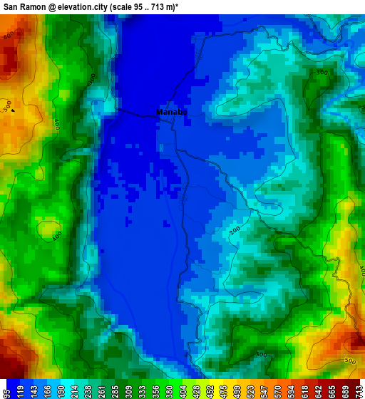
Below is the Elevation map of San Ramon, which displays elevation range with different colors. Scale of the first map is from 95 to 713 m (312 to 2339 ft) with average elevation of 258.7 meters (=849 ft) [note 1]
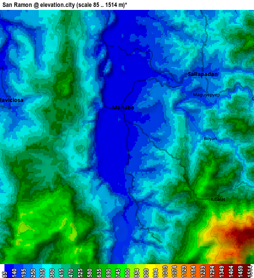
These maps also provides idea of topography and contour of this city, they are displayed at different zoom levels. More info about maps, scale and edge coordinates you can find below images.
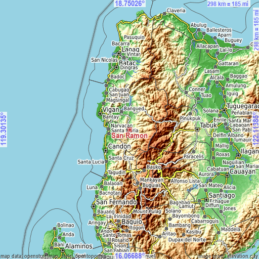
| \ | Map #1 | Map #2 | Topo.Map |
| Scale [m] | 95..713 m | 85..1514 m | × |
| Scale [ft] | 312..2339 ft | 279..4967 ft | × |
| Average | 258.7 m = 849 ft | 383.1 m = 1257 ft | × |
| Width | 9.32 km = 5.8 mi | 18.65 km = 11.6 mi | 298.4 km = 185.4 mi |
| Height | 9.32 km = 5.8 mi | 18.65 km = 11.6 mi | 298.4 km = 185.4 mi |
| ↑Max Latitude | 17.455426° | 17.497343° | 18.75026° |
| Latitude at center | 17.4135° | 17.4135° | 17.4135° |
| ↓Min Latitude | 17.371564° | 17.329618° | 16.06688° |
| ← Min Longitude | 120.663655° | 120.619709° | 119.30135° |
| Longitude center | 120.7076° | 120.7076° | 120.7076° |
| →Max Longitude | 120.751545° | 120.795491° | 122.11385° |
Nearby cities:
Cities around San Ramon sort by population:
• Bantay elevation 183 m
6 km,  62°
62°
• Nagbukel 22 m
19.8 km,  280°
280°
• Peñarrubia 94 m
17.8 km,  340°
340°
• Tubo 333 m
16.6 km,  169°
169°
• Bucloc 341 m
16.3 km,  79°
79°
• Bucay 96 m
14.2 km,  4°
4°
• San Isidro 139 m
12.4 km,  297°
297°
• Pilar 332 m
11.9 km,  271°
271°
• Luba 175 m
10.7 km,  187°
187°
• Villaviciosa 178 m
9.1 km,  287°
287°
• Boliney 255 m
7.8 km,  94°
94°
• Manabo 125 m
2.2 km,  353°
353°
Multilingual:
 En español:
San Ramon elevación 131 m.
 En France:
San Ramon élévation 131 m.
 Auf Deutsch:
San Ramon höhe über dem Meeresspiegel ist 131 m.

Sources and notes:
- [note 1] Map square and city borders are not equal. Map elevation data is calculated only from area inside that square.
- [src 1] Elevation data from geonames database provided with same terms of usage.
- [src 2] The elevation map of San Ramon is generated using elevation data from NASA's 3 arcsec (90m) resolution SRTM data.
- [src 3] Base (background) map © OpenStreetMap contributors tiles are generated by Geofabrik and OpenTopoMap.
Copyright & License:
This San Ramon Elevation Map is licensed under CC BY-SA. You may reuse any part from this page, if you give a proper credit by linking to this URL:
 More info on terms of use page.