Tayug elevation
Tayug (Ilocos, Province of Pangasinan), Philippines elevation is 62 meters and Tayug elevation in feet is 203 ft above sea level [src 1]. Tayug is a seat of a third-order administrative division (feature code) with elevation that is 26 meters (85 ft) smaller than average city elevation in Philippines.
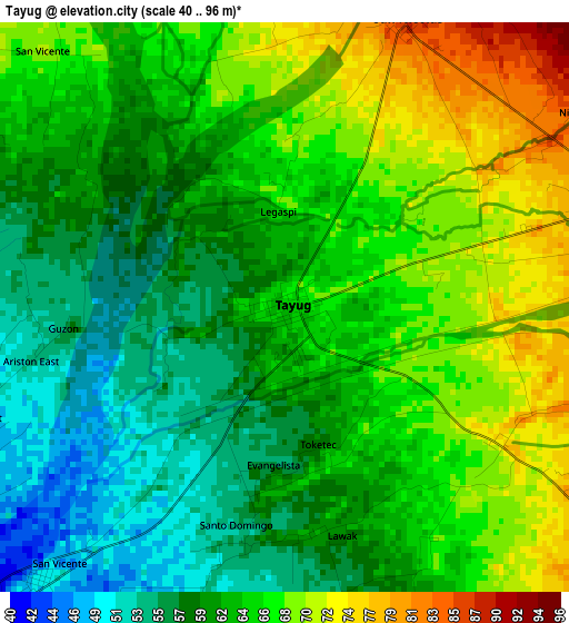
Below is the Elevation map of Tayug, which displays elevation range with different colors. Scale of the first map is from 40 to 96 m (131 to 315 ft) with average elevation of 63.4 meters (=208 ft) [note 1]
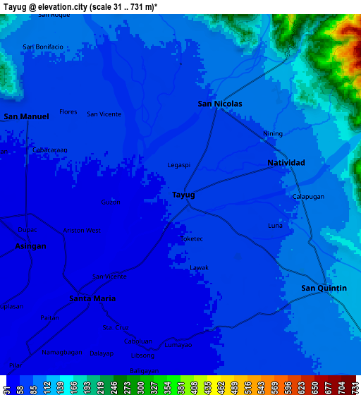
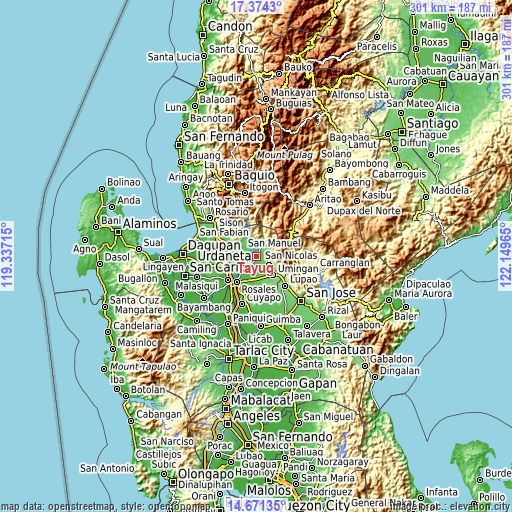
These maps also provides idea of topography and contour of this city, they are displayed at different zoom levels. More info about maps, scale and edge coordinates you can find below images.
| \ | Map #1 | Map #2 | Topo.Map |
| Scale [m] | 40..96 m | 31..731 m | × |
| Scale [ft] | 131..315 ft | 102..2398 ft | × |
| Average | 63.4 m = 208 ft | 86.8 m = 285 ft | × |
| Width | 9.39 km = 5.8 mi | 18.79 km = 11.7 mi | 300.5 km = 186.7 mi |
| Height | 9.39 km = 5.8 mi | 18.79 km = 11.7 mi | 300.6 km = 186.8 mi |
| ↑Max Latitude | 16.069633° | 16.111856° | 17.3743° |
| Latitude at center | 16.0274° | 16.0274° | 16.0274° |
| ↓Min Latitude | 15.985158° | 15.942908° | 14.67135° |
| ← Min Longitude | 120.699455° | 120.655509° | 119.33715° |
| Longitude center | 120.7434° | 120.7434° | 120.7434° |
| →Max Longitude | 120.787345° | 120.831291° | 122.14965° |
Nearby cities:
Cities around Tayug sort by population:
• Guiset East elevation 71 m
7.8 km,  304°
304°
• Natividad 94 m
6.2 km,  72°
72°
• Bantog 50 m
5.8 km,  249°
249°
• Alac 100 m
8.1 km,  123°
123°
• Lagasit 93 m
6.6 km, 124°
• Baro 40 m
8.1 km, 247°
• Panganiban 74 m
4.1 km, 123°
• Cabalaoangan 77 m
6.5 km,  138°
138°
• Carriedo 67 m
1.3 km, 71°
• Magallanes 62 m
1 km,  208°
208°
• Santa Maria 46 m
6.9 km,  221°
221°
• San Nicolas 87 m
5.2 km,  23°
23°
Multilingual:
 En español:
Tayug elevación 62 m.
 En France:
Tayug élévation 62 m.


Sources and notes:
- [note 1] Map square and city borders are not equal. Map elevation data is calculated only from area inside that square.
- [src 1] Elevation data from geonames database provided with same terms of usage.
- [src 2] The elevation map of Tayug is generated using elevation data from NASA's 3 arcsec (90m) resolution SRTM data.
- [src 3] Base (background) map © OpenStreetMap contributors tiles are generated by Geofabrik and OpenTopoMap.
Copyright & License:
This Tayug Elevation Map is licensed under CC BY-SA. You may reuse any part from this page, if you give a proper credit by linking to this URL:
 More info on terms of use page.