Aitape elevation
Aitape (Sandaun), Papua New Guinea elevation is 1 meters and Aitape elevation in feet is 3 ft above sea level [src 1]. Aitape is a populated place (feature code) with elevation that is 561 meters (1841 ft) smaller than average city elevation in Papua New Guinea.
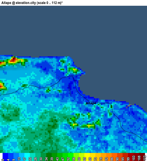
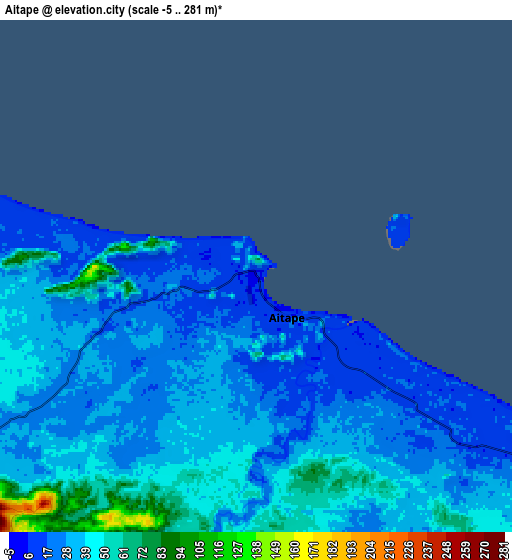
Below is the Elevation map of Aitape, which displays elevation range with different colors. Scale of the first map is from 0 to 112 m (0 to 367 ft) with average elevation of 18.1 meters (=59 ft) [note 1]
These maps also provides idea of topography and contour of this city, they are displayed at different zoom levels. More info about maps, scale and edge coordinates you can find below images.
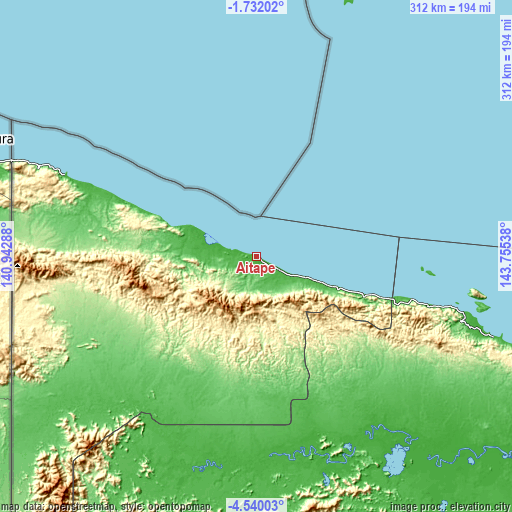
| \ | Map #1 | Map #2 | Topo.Map |
| Scale [m] | 0..112 m | -5..281 m | × |
| Scale [ft] | 0..367 ft | -16..922 ft | × |
| Average | 18.1 m = 59 ft | 33.4 m = 110 ft | × |
| Width | 9.76 km = 6.1 mi | 19.52 km = 12.1 mi | 312.2 km = 194 mi |
| Height | 9.76 km = 6.1 mi | 19.52 km = 12.1 mi | 312.3 km = 194.1 mi |
| ↑Max Latitude | -3.09309° | -3.049207° | -1.73202° |
| Latitude at center | -3.13697° | -3.13697° | -3.13697° |
| ↓Min Latitude | -3.180849° | -3.224725° | -4.54003° |
| ← Min Longitude | 142.305185° | 142.261239° | 140.94288° |
| Longitude center | 142.34913° | 142.34913° | 142.34913° |
| →Max Longitude | 142.393075° | 142.437021° | 143.75538° |
Nearby cities:
Cities around Aitape sort by population:
• Mount Hagen elevation 1728 m
367.4 km,  145°
145°
• Mendi 1729 m
364.7 km,  156°
156°
• Wewak 44 m
149.6 km,  107°
107°
• Kiunga 40 m
352 km,  199°
199°
• Vanimo 5 m
126.7 km,  293°
293°
• Tari 1676 m
308.3 km,  167°
167°
• Wabag 2069 m
302.8 km, 149°
• Ambunti 29 m
130.9 km, 156°
• Angoram 0 m
216.5 km,  118°
118°
• Porgera 2248 m
273.4 km, 161°
• Kurumul 1591 m
394.1 km,  140°
140°
• Rauna 1587 m
360.2 km, 143°
Multilingual:
 En español:
Aitape elevación 1 m.
 En France:
Aitape élévation 1 m.
 Auf Deutsch:
Eitape, Berlinhafen, Bodinhafen höhe über dem Meeresspiegel ist 1 m.

Sources and notes:
- [note 1] Map square and city borders are not equal. Map elevation data is calculated only from area inside that square.
- [src 1] Elevation data from geonames database provided with same terms of usage.
- [src 2] The elevation map of Aitape is generated using elevation data from NASA's 3 arcsec (90m) resolution SRTM data.
- [src 3] Base (background) map © OpenStreetMap contributors tiles are generated by Geofabrik and OpenTopoMap.
Copyright & License:
This Aitape Elevation Map is licensed under CC BY-SA. You may reuse any part from this page, if you give a proper credit by linking to this URL:
 More info on terms of use page.