Kiunga elevation
Kiunga (Western Province), Papua New Guinea elevation is 40 meters and Kiunga elevation in feet is 131 ft above sea level [src 1]. Kiunga is a populated place (feature code) with elevation that is 522 meters (1713 ft) smaller than average city elevation in Papua New Guinea.
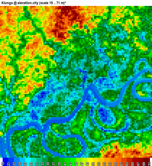
Below is the Elevation map of Kiunga, which displays elevation range with different colors. Scale of the first map is from 19 to 71 m (62 to 233 ft) with average elevation of 37.9 meters (=124 ft) [note 1]
These maps also provides idea of topography and contour of this city, they are displayed at different zoom levels. More info about maps, scale and edge coordinates you can find below images.
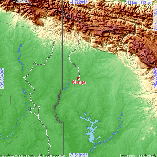
| \ | Map #1 | Map #2 | Topo.Map |
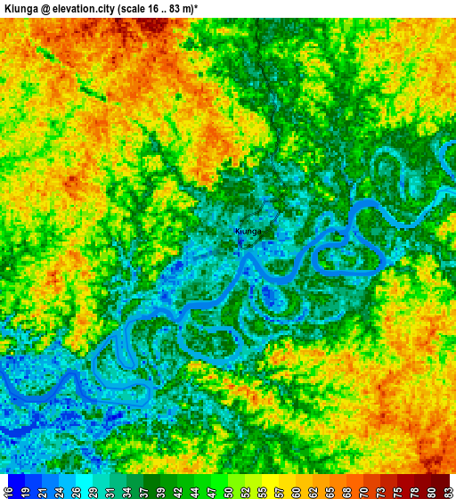
| Scale [m] | 19..71 m | 16..83 m | × |
| Scale [ft] | 62..233 ft | 52..272 ft | × |
| Average | 37.9 m = 124 ft | 45.5 m = 149 ft | × |
| Width | 9.72 km = 6 mi | 19.43 km = 12.1 mi | 310.9 km = 193.2 mi |
| Height | 9.72 km = 6 mi | 19.43 km = 12.1 mi | 310.9 km = 193.2 mi |
| ↑Max Latitude | -6.078234° | -6.034533° | -4.72201° |
| Latitude at center | -6.12193° | -6.12193° | -6.12193° |
| ↓Min Latitude | -6.165623° | -6.209312° | -7.51819° |
| ← Min Longitude | 141.246665° | 141.202719° | 139.88436° |
| Longitude center | 141.29061° | 141.29061° | 141.29061° |
| →Max Longitude | 141.334555° | 141.378501° | 142.69686° |
Nearby cities:
Cities around Kiunga sort by population:
• Mount Hagen elevation 1728 m
326.4 km,  84°
84°
• Mendi 1729 m
261.6 km,  90°
90°
• Tari 1676 m
185.7 km, 80°
• Ialibu 2061 m
299.3 km, 93°
• Aitape 1 m
352 km,  19°
19°
• Wabag 2069 m
277.9 km, 75°
• Morehead 11 m
290.4 km,  172°
172°
• Ambunti 29 m
271.1 km,  38°
38°
• Porgera 2248 m
218.1 km,  70°
70°
• Minj 1607 m
376.8 km, 86°
• Kurumul 1591 m
370.6 km, 85°
• Rauna 1587 m
334.3 km, 82°
Multilingual:
 En español:
Kiunga elevación 40 m.
 En France:
Kiunga élévation 40 m.


Sources and notes:
- [note 1] Map square and city borders are not equal. Map elevation data is calculated only from area inside that square.
- [src 1] Elevation data from geonames database provided with same terms of usage.
- [src 2] The elevation map of Kiunga is generated using elevation data from NASA's 3 arcsec (90m) resolution SRTM data.
- [src 3] Base (background) map © OpenStreetMap contributors tiles are generated by Geofabrik and OpenTopoMap.
Copyright & License:
This Kiunga Elevation Map is licensed under CC BY-SA. You may reuse any part from this page, if you give a proper credit by linking to this URL:
 More info on terms of use page.