Conchopata elevation
Conchopata (Cusco, Provincia de Canas), Peru elevation is 3973 meters and Conchopata elevation in feet is 13035 ft above sea level [src 1]. Conchopata is a populated place (feature code) with elevation that is 1652 meters (5420 ft) bigger than average city elevation in Peru.
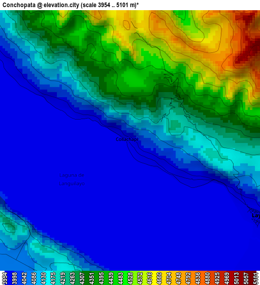
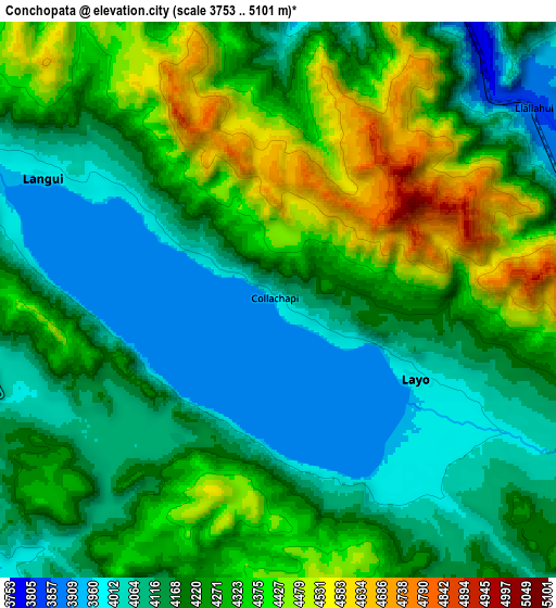
Below is the Elevation map of Conchopata, which displays elevation range with different colors. Scale of the first map is from 3954 to 5101 m (12972 to 16736 ft) with average elevation of 4172.1 meters (=13688 ft) [note 1]
These maps also provides idea of topography and contour of this city, they are displayed at different zoom levels. More info about maps, scale and edge coordinates you can find below images.
| \ | Map #1 | Map #2 | Topo.Map |
| Scale [m] | 3954..5101 m | 3753..5101 m | × |
| Scale [ft] | 12972..16736 ft | 12313..16736 ft | × |
| Average | 4172.1 m = 13688 ft | 4229.3 m = 13876 ft | × |
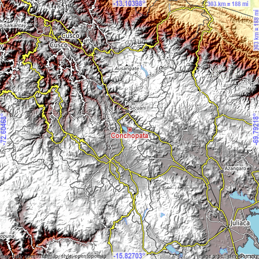
| Width | 9.46 km = 5.9 mi | 18.93 km = 11.8 mi | 302.8 km = 188.2 mi |
| Height | 9.46 km = 5.9 mi | 18.93 km = 11.8 mi | 302.8 km = 188.2 mi |
| ↑Max Latitude | -14.427125° | -14.384561° | -13.10398° |
| Latitude at center | -14.46968° | -14.46968° | -14.46968° |
| ↓Min Latitude | -14.512227° | -14.554766° | -15.82703° |
| ← Min Longitude | -71.242375° | -71.286321° | -72.60468° |
| Longitude center | -71.19843° | -71.19843° | -71.19843° |
| →Max Longitude | -71.154485° | -71.110539° | -69.79218° |
Nearby cities:
Cities around Conchopata sort by population:
• Sicuani elevation 3551 m
22.5 km,  352°
352°
• Mosoc Cancha 4301 m
23.7 km,  30°
30°
• Huayna Alcalde 4149 m
24.8 km, 26°
• Callanca 4036 m
32.7 km,  10°
10°
• Layo 3985 m
5.4 km,  119°
119°
• Langui 3967 m
9.1 km,  297°
297°
• Cahuanuyo 3892 m
31.9 km, 296°
• Checca 3820 m
21 km,  269°
269°
• Maranganí 3701 m
12.9 km, 14°
• San Pablo 3488 m
32.2 km,  336°
336°
• Quehue 3805 m
29.4 km,  289°
289°
• El Descanso 3961 m
13.5 km,  238°
238°
Multilingual:
 En español:
Conchopata elevación 3973 m.
 En France:
Conchopata élévation 3973 m.
 Auf Deutsch:
Conchopata höhe über dem Meeresspiegel ist 3973 m.

Sources and notes:
- [note 1] Map square and city borders are not equal. Map elevation data is calculated only from area inside that square.
- [src 1] Elevation data from geonames database provided with same terms of usage.
- [src 2] The elevation map of Conchopata is generated using elevation data from NASA's 3 arcsec (90m) resolution SRTM data.
- [src 3] Base (background) map © OpenStreetMap contributors tiles are generated by Geofabrik and OpenTopoMap.
Copyright & License:
This Conchopata Elevation Map is licensed under CC BY-SA. You may reuse any part from this page, if you give a proper credit by linking to this URL:
 More info on terms of use page.