Huarancante elevation
Huarancante (Arequipa, Provincia de Caylloma), Peru elevation is 4587 meters and Huarancante elevation in feet is 15049 ft above sea level [src 1]. Huarancante is a populated place (feature code) with elevation that is 2266 meters (7434 ft) bigger than average city elevation in Peru.
Below is the Elevation map of Huarancante, which displays elevation range with different colors. Scale of the first map is from 4321 to 5337 m (14177 to 17510 ft) with average elevation of 4653.7 meters (=15268 ft) [note 1]
These maps also provides idea of topography and contour of this city, they are displayed at different zoom levels. More info about maps, scale and edge coordinates you can find below images.
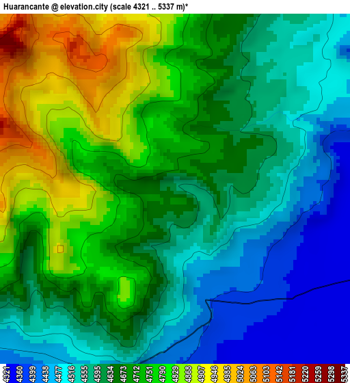
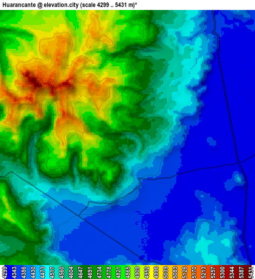
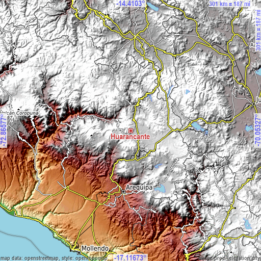
| \ | Map #1 | Map #2 | Topo.Map |
| Scale [m] | 4321..5337 m | 4299..5431 m | × |
| Scale [ft] | 14177..17510 ft | 14104..17818 ft | × |
| Average | 4653.7 m = 15268 ft | 4597.2 m = 15083 ft | × |
| Width | 9.4 km = 5.8 mi | 18.81 km = 11.7 mi | 300.9 km = 187 mi |
| Height | 9.4 km = 5.8 mi | 18.81 km = 11.7 mi | 301 km = 187 mi |
| ↑Max Latitude | -15.725734° | -15.683429° | -14.4103° |
| Latitude at center | -15.76803° | -15.76803° | -15.76803° |
| ↓Min Latitude | -15.810317° | -15.852596° | -17.11673° |
| ← Min Longitude | -71.503465° | -71.547411° | -72.86577° |
| Longitude center | -71.45952° | -71.45952° | -71.45952° |
| →Max Longitude | -71.415575° | -71.371629° | -70.05327° |
Nearby cities:
Cities around Huarancante sort by population:
• Llongasora elevation 4622 m
22.3 km,  50°
50°
• Chivay 3639 m
20.9 km,  313°
313°
• Vizcachane 4432 m
28 km,  99°
99°
• Jatun Orcochiri 4327 m
12.3 km,  80°
80°
• Pucara 4352 m
23.6 km,  180°
180°
• Jayune 4242 m
28.3 km,  36°
36°
• Callalli 3878 m
28.9 km,  2°
2°
• Achoma 3488 m
28.4 km,  294°
294°
• Tuti 3802 m
27.9 km,  339°
339°
• Ichupampa 3405 m
27.7 km,  298°
298°
• Coporaque 3583 m
25.4 km, 308°
• Yanque 3431 m
25 km, 301°
Multilingual:
 En español:
Huarancante elevación 4587 m.
 En France:
Huarancante élévation 4587 m.
 Auf Deutsch:
Huarancante höhe über dem Meeresspiegel ist 4587 m.

Sources and notes:
- [note 1] Map square and city borders are not equal. Map elevation data is calculated only from area inside that square.
- [src 1] Elevation data from geonames database provided with same terms of usage.
- [src 2] The elevation map of Huarancante is generated using elevation data from NASA's 3 arcsec (90m) resolution SRTM data.
- [src 3] Base (background) map © OpenStreetMap contributors tiles are generated by Geofabrik and OpenTopoMap.
Copyright & License:
This Huarancante Elevation Map is licensed under CC BY-SA. You may reuse any part from this page, if you give a proper credit by linking to this URL:
 More info on terms of use page.