Iberia elevation
Iberia (Madre de Dios, Provincia de Tahuamanú), Peru elevation is 306 meters and Iberia elevation in feet is 1004 ft above sea level [src 1]. Iberia is a seat of a third-order administrative division (feature code) with elevation that is 2015 meters (6611 ft) smaller than average city elevation in Peru.
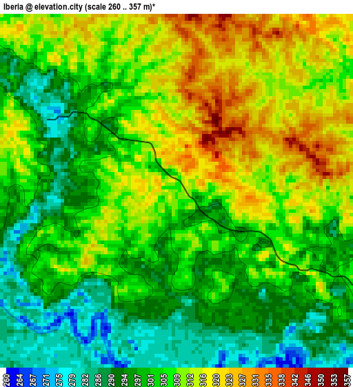
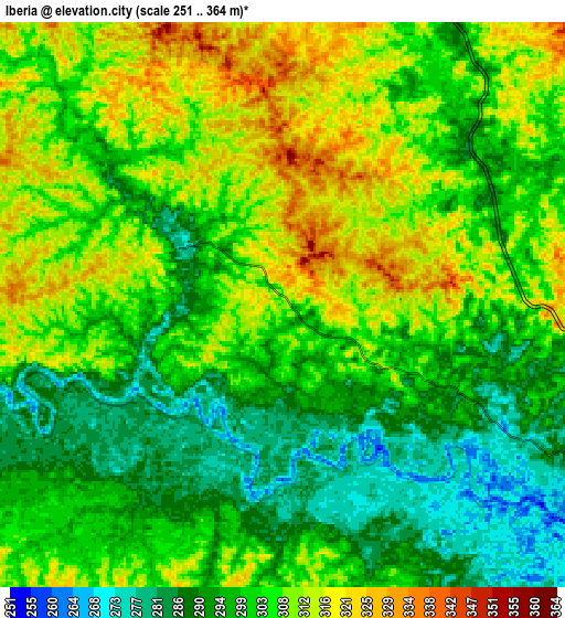
Below is the Elevation map of Iberia, which displays elevation range with different colors. Scale of the first map is from 260 to 357 m (853 to 1171 ft) with average elevation of 305 meters (=1001 ft) [note 1]
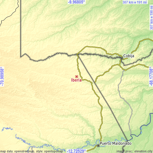
These maps also provides idea of topography and contour of this city, they are displayed at different zoom levels. More info about maps, scale and edge coordinates you can find below images.
| \ | Map #1 | Map #2 | Topo.Map |
| Scale [m] | 260..357 m | 251..364 m | × |
| Scale [ft] | 853..1171 ft | 823..1194 ft | × |
| Average | 305 m = 1001 ft | 302.3 m = 992 ft | × |
| Width | 9.58 km = 6 mi | 19.16 km = 11.9 mi | 306.6 km = 190.5 mi |
| Height | 9.58 km = 6 mi | 19.16 km = 11.9 mi | 306.6 km = 190.5 mi |
| ↑Max Latitude | -11.306911° | -11.263815° | -9.96805° |
| Latitude at center | -11.35° | -11.35° | -11.35° |
| ↓Min Latitude | -11.393083° | -11.436159° | -12.72529° |
| ← Min Longitude | -69.627275° | -69.671221° | -70.98958° |
| Longitude center | -69.58333° | -69.58333° | -69.58333° |
| →Max Longitude | -69.539385° | -69.495439° | -68.17708° |
Nearby cities:
Cities around Iberia sort by population:
• Tambopata elevation 224 m
149.1 km,  170°
170°
• Puerto Maldonado 205 m
144.7 km,  162°
162°
• Salvación 1000 m
254.6 km,  229°
229°
• Corani 4201 m
301.5 km,  201°
201°
• Coasa 4430 m
297.6 km,  188°
188°
• Marcapata 3038 m
291.1 km,  211°
211°
• Ollachea 2907 m
291.1 km, 199°
• Pillcopata 968 m
257 km,  222°
222°
• Lanlacuni Bajo 707 m
253.9 km, 200°
• Quince Mil 642 m
244.8 km, 211°
• Iñapari 240 m
44.5 km,  0°
0°
• San Lorenzo 257 m
33.5 km,  112°
112°
Multilingual:
 En español:
Iberia elevación 306 m.
 En France:
Iberia élévation 306 m.


Sources and notes:
- [note 1] Map square and city borders are not equal. Map elevation data is calculated only from area inside that square.
- [src 1] Elevation data from geonames database provided with same terms of usage.
- [src 2] The elevation map of Iberia is generated using elevation data from NASA's 3 arcsec (90m) resolution SRTM data.
- [src 3] Base (background) map © OpenStreetMap contributors tiles are generated by Geofabrik and OpenTopoMap.
Copyright & License:
This Iberia Elevation Map is licensed under CC BY-SA. You may reuse any part from this page, if you give a proper credit by linking to this URL:
 More info on terms of use page.