Yunguyo elevation
Yunguyo (Puno), Peru elevation is 3857 meters and Yunguyo elevation in feet is 12654 ft above sea level [src 1]. Yunguyo is a seat of a third-order administrative division (feature code) with elevation that is 1536 meters (5039 ft) bigger than average city elevation in Peru.
Below is the Elevation map of Yunguyo, which displays elevation range with different colors. Scale of the first map is from 3807 to 4181 m (12490 to 13717 ft) with average elevation of 3863.2 meters (=12675 ft) [note 1]
These maps also provides idea of topography and contour of this city, they are displayed at different zoom levels. More info about maps, scale and edge coordinates you can find below images.
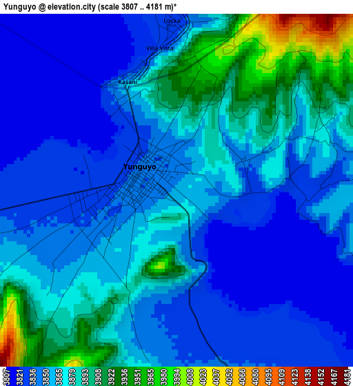
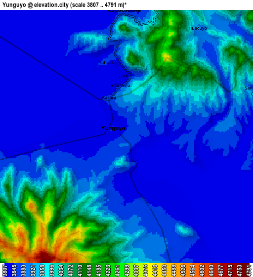
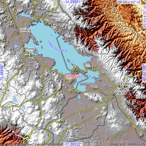
| \ | Map #1 | Map #2 | Topo.Map |
| Scale [m] | 3807..4181 m | 3807..4791 m | × |
| Scale [ft] | 12490..13717 ft | 12490..15719 ft | × |
| Average | 3863.2 m = 12675 ft | 3929.5 m = 12892 ft | × |
| Width | 9.38 km = 5.8 mi | 18.76 km = 11.7 mi | 300.2 km = 186.5 mi |
| Height | 9.38 km = 5.8 mi | 18.76 km = 11.7 mi | 300.2 km = 186.5 mi |
| ↑Max Latitude | -16.207806° | -16.165603° | -14.89541° |
| Latitude at center | -16.25° | -16.25° | -16.25° |
| ↓Min Latitude | -16.292185° | -16.334361° | -17.59532° |
| ← Min Longitude | -69.127275° | -69.171221° | -70.48958° |
| Longitude center | -69.08333° | -69.08333° | -69.08333° |
| →Max Longitude | -69.039385° | -68.995439° | -67.67708° |
Nearby cities:
Cities around Yunguyo sort by population:
• Ilave elevation 3841 m
65 km,  286°
286°
• Putina 3821 m
93.8 km,  336°
336°
• Juli 3980 m
39.3 km,  275°
275°
• Desaguadero 3830 m
35.4 km,  172°
172°
• Taquile 3911 m
83.7 km,  309°
309°
• Laraqueri 3935 m
104 km, 277°
• Conima 4151 m
98.2 km, 337°
• Mazo Cruz 3997 m
88.8 km,  231°
231°
• Kelluyo 3907 m
55.8 km,  199°
199°
• Pilcuyo 3842 m
54.2 km, 287°
• Zepita 3832 m
27.9 km,  183°
183°
• Pomata 3916 m
23.2 km,  265°
265°
Multilingual:
 En español:
Yunguyo elevación 3857 m.
 En France:
Yunguyo élévation 3857 m.
 Auf Deutsch:
Yunguyo höhe über dem Meeresspiegel ist 3857 m.

Sources and notes:
- [note 1] Map square and city borders are not equal. Map elevation data is calculated only from area inside that square.
- [src 1] Elevation data from geonames database provided with same terms of usage.
- [src 2] The elevation map of Yunguyo is generated using elevation data from NASA's 3 arcsec (90m) resolution SRTM data.
- [src 3] Base (background) map © OpenStreetMap contributors tiles are generated by Geofabrik and OpenTopoMap.
Copyright & License:
This Yunguyo Elevation Map is licensed under CC BY-SA. You may reuse any part from this page, if you give a proper credit by linking to this URL:
 More info on terms of use page.